Voyage details and related metadata, reports, events and data.
IN2020_E01
- is a Marine National Facility ![]() voyage
voyage
Title: Calibration, Science Trials
Period: 2020-07-29 02:10 to 2020-08-06 06:00 UTC
Duration: 8.16 days
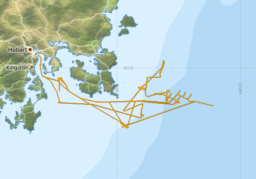
From: Hobart To: Hobart
Region: Derwent River; Tasmania coast; Southern Ocean
Ship: Investigator (RV) [details]
Description: Marine National Facility (MNF) post Port Period equipment calibration and commissioning, sea trials and personnel training. 1. Post port period calibration and trialling of underway and deployed equipment. 2. Commission the newly built deep towed camera 3. Underway sensor maintenance, calibration and training activities.
Project: Investigator - general vessel operations, gear trials, etc. [details] Primary
Underway data from NRUD - see this voyage
Voyage extents: 43° 29.2' S to 42° 53.2' S 147° 20.3' E to 148° 46.9' E Get voyage track shapefile Get CSV
Marlin Metadata:-
Cruise Summary Report at SeaDataNet:-
Participants - on ship:-
| Name | Role | Organisation | Project |
|---|---|---|---|
| Jason Fazey | Voyage Manager | Marine National Facility | Voyage Management on RV Investigator |
| John Hooper | Deputy Voyage Manager | Marine National Facility | Voyage Management on RV Investigator |
This list includes those that may have only been on part of the voyage. See voyage reports on 'Reports and Maps' tab for details.
Marine National Facility Reports - plans, summaries and data processing
- View Survey map
Publications, reports and datasets from this voyage.
Dataset
- Fazey, Jason; Nau, Amy; Berry, Chris; Vandenbossche, Phil; Navidad, Cisco; Heaney, Bernadette; Gifford, Davina (2023): IN2020_E01 Tasmanian Coast Bathymetry 10m - 210m Multi-resolution AusSeabed products. v1. CSIRO. Data Collection. 10.25919/17wm-dk49
- Nichol, S. (2009) Marine Sediments (MARS) Database - dataset name 'IN2020-E01' ENO 648440 Geoscience Australia, Canberra. External link to reference
- Tilbrook, Bronte; Neill, Craig; Akl, John (2022). Integrated Marine Observing System (IMOS) sea surface and atmospheric fCO2 measurements in the Southern Ocean, South Pacific, Indian Ocean onboard R/V Investigator in 2020 (NCEI Accession 0253534). [indicate subset used]. NOAA National Centers for Environmental Information. Dataset. 10.25921/ctqh-rn91
Search for publications, reports and datasets from this and other voyages
Data publishing
This is a list of online datasets hosted by CSIRO. Other processed datasets hosted by collaborating organisations may be found on the 'Metadata' or "Reports, Publications and Maps' tab.
Use the Get data link on the right to extract data using the NCMI Data Trawler.
| Data Stream | Data Summary | Get data | ||||||||||
|---|---|---|---|---|---|---|---|---|---|---|---|---|
| Gravity Measurements |
|
Get Data from Trawler Geophysical Survey and Mapping acquisition report |
||||||||||
| Multibeam echosounder |
|
Get Data from Trawler |
||||||||||
| pCO2 |
|
External link - download datafile at IMOS Data fields and units document (.pdf) |
||||||||||
| Sub-bottom profiler |
|
Get Data from Trawler |
||||||||||
| Singlebeam echosounder |
|
Get Data from Trawler Geophysical Survey and Mapping acquisition report |
| ID | When (UTC) | Lat | Long | Instrument | Identifier | Action | Log | Subject / Comment |
|---|
Deployments - None have been recorded in the Data Trawler.