Running News
May 2018 :
This month, 2 important satellites where launch to contribute to monitor sea level. The european union Copernicus program launched the Sentinel-3B satellite (https://www.esa.int/Our_Activities/Observing_the_Earth/Copernicus/Sentinel-3) a twin of the Sentinel-3A launched in 2016 which will complete (double) the higher spatial resolution higher accuracy sea
level capable altimetry mission. NASA launched another twin pair the Grace Follow-ON mission (https://www.nasa.gov/missions/grace-fo) which will take over the very successful GRACE satellite in monitoring the mass movement at the surface of the earth. The GFO is already detecting tiny variations of the gravity field (https://www.jpl.nasa.gov/news/news.php?feature=7156) See the paper in Nature Climate Change here and the associated journal article in The Conversation here.
~~~~~~~~~~~~~~~~~~~~~~~~~~~~~~~~~~~~~~~~~~~~~~~~~~~~~~~~~~~~~~~~~~~~~~~~~~~~~~~~~~~~~
June 2017 :
~~~~~~~~~~~~~~~~~~~~~~~~~~~~~~~~~~~~~~~~~~~~~~~~~~~~~~~~~~~~~~~~~~~~~~~~~~~~~~~~~~~~~
November 2016 :
~~~~~~~~~~~~~~~~~~~~~~~~~~~~~~~~~~~~~~~~~~~~~~~~~~~~~~~~~~~~~~~~~~~~~~~~~~~~~~~~~~~~~
September 2016 :
With the successful launch of Jason-3 and Sentinel-3A earlier this year and the upcoming Sentinel-3B, Sentinel-6 and SWOT in the next 5 years we developed a new Satellite altimetry Absolute Calibration srategy :
After many years of good operation in the Storm Bay, we removed our Jason moorings this month and are now expanding our mooring network in Bass Strait to be able to cope with all the sea level class satellites, already including Jason-3, Sentinel-3A and we just deployed a preliminary mooring for the Sentinel-3B crossover in the area.
Check out our cal/val activity or get the mooring data we produce with the support of IMOS there : http://imos.org.au/srscalval.html
~~~~~~~~~~~~~~~~~~~~~~~~~~~~~~~~~~~~~~~~~~~~~~~~~~~~~~~~~~~~~~~~~~~~~~~~~~~~~~~~~~~~~
February 2016 :
With the successful launch of the Sentinel-3 satellite today, February 17th in Australian time,
it's a new era starting for ocean satellite altimetry.
With its 27 day repeat cycle Sentinel-3 brings back a capability
occupied by the European ENVISAT until 2010 and bridged over by the Indian-French SARAL/Altika the last few years.
In effect this kind of orbit complements nicely the Jason series to deliver higher spatial coverage of the ocean dynamics.
But today was the launch of Sentinel-3A ahile Sentinel-3B to be launched in 2017 will probably go on an interleave orbit,
doubling the spatial coverage of the Sentinel-3 within the 27 day repeat cycle. This new era doesn't only bring more operational
and robust observations of the sea level, not only it adds higher spatial coverage of the ground tracks.
It's also the start of a new technological step with a systematic Synthetic Aperture Radar mode use over the oceans.
This means the along track sampling comes down from the typical 7km to the 1km mark and also it can operate with maintained
quality much closer to the coasts. We are looking forward to test and use these new systematic high quality data.
From now on, most planned altimetry missions will have this SAR mode capability (Sentinel-3, Sentinel-6/Jason-CS)
or even SAR interferometric (i.e. high resolution sea surface height mapping) capability (SWOT).
(See : Eumetsat-Sentinel3)
~~~~~~~~~~~~~~~~~~~~~~~~~~~~~~~~~~~~~~~~~~~~~~~~~~~~~~~~~~~~~~~~~~~~~~~~~~~~~~~~~~~~~
January 2016 :
Happy New Year. With the successful launch of the Jason-3 satellite today, January 18th in Australian time, the sea level record is promised to continue properly. We are looking forward to Sentinel-3A to launch in the coming weeks. (See : http://www.nesdis.noaa.gov/jason-3 , #Jason3)
~~~~~~~~~~~~~~~~~~~~~~~~~~~~~~~~~~~~~~~~~~~~~~~~~~~~~~~~~~~~~~~~~~~~~~~~~~~~~~~~~~~~~
December 2015 :
After being postponed earlier this year, the Jason-3 satellite is now planned to launch in January 2016.
See : http://www.nesdis.noaa.gov/jason-3/ Also, the European Copernicus programme is planning the first Sentinel-3 satellite (Sentinel-3A) which hosts a new generation of dual frequency altimeters capable of higher resolution on the ground and able to capture accurate sea level measurements. It has a 27 day repeat orbit, that is almost 3 times the Jason series.
It means that it will have roughly 3 times less temporal resolution and 3 times more spatial coverage.
With the sentinel-3B twin to be launched in 2017 the coverage should increase again meeting many more sea level applications requirements (closer to the coast and denser coverage in space). See details at : http://www.eumetsat.int/website/home/Satellites/CurrentSatellites/Sentinel3/index.html
~~~~~~~~~~~~~~~~~~~~~~~~~~~~~~~~~~~~~~~~~~~~~~~~~~~~~~~~~~~~~~~~~~~~~~~~~~~~~~~~~~~~~
September 2015 :
The World Meteorological Orgnaization releases its 5 year summary. see : http://www.wmo.int.
~~~~~~~~~~~~~~~~~~~~~~~~~~~~~~~~~~~~~~~~~~~~~~~~~~~~~~~~~~~~~~~~~~~~~~~~~~~~~~~~~~~~~
February 2016 :
With the successful launch of the Sentinel-3 satellite today, February 17th in Australian time,
it's a new era starting for ocean satellite altimetry.
With its 27 day repeat cycle Sentinel-3 brings back a capability
occupied by the European ENVISAT until 2010 and bridged over by the Indian-French SARAL/Altika the last few years.
In effect this kind of orbit complements nicely the Jason series to deliver higher spatial coverage of the ocean dynamics.
But today was the launch of Sentinel-3A ahile Sentinel-3B to be launched in 2017 will probably go on an interleave orbit,
doubling the spatial coverage of the Sentinel-3 within the 27 day repeat cycle. This new era doesn't only bring more operational
and robust observations of the sea level, not only it adds higher spatial coverage of the ground tracks.
It's also the start of a new technological step with a systematic Synthetic Aperture Radar mode use over the oceans.
This means the along track sampling comes down from the typical 7km to the 1km mark and also it can operate with maintained
quality much closer to the coasts. We are looking forward to test and use these new systematic high quality data.
From now on, most planned altimetry missions will have this SAR mode capability (Sentinel-3, Sentinel-6/Jason-CS)
or even SAR interferometric (i.e. high resolution sea surface height mapping) capability (SWOT).
(See : eumetsat-Sentinel3)
~~~~~~~~~~~~~~~~~~~~~~~~~~~~~~~~~~~~~~~~~~~~~~~~~~~~~~~~~~~~~~~~~~~~~~~~~~~~~~~~~~~~~
January 2016 :
Happy New Year. With the successful launch of the Jason-3 satellite today, January 18th in Australian time, the sea level record is promised to continue properly. We are looking forward to Sentinel-3A to launch in the coming weeks. (See : http://www.nesdis.noaa.gov/jason-3 , #Jason3)
~~~~~~~~~~~~~~~~~~~~~~~~~~~~~~~~~~~~~~~~~~~~~~~~~~~~~~~~~~~~~~~~~~~~~~~~~~~~~~~~~~~~~
December 2015 :
After being postponed earlier this year, the Jason-3 satellite is now planned to launch in January 2016.
See : http://www.nesdis.noaa.gov/jason-3/ Also, the European Copernicus programme is planning the first Sentinel-3 satellite (Sentinel-3A) which hosts a new generation of dual frequency altimeters capable of higher resolution on the ground and able to capture accurate sea level measurements. It has a 27 day repeat orbit, that is almost 3 times the Jason series.
It means that it will have roughly 3 times less temporal resolution and 3 times more spatial coverage.
With the sentinel-3B twin to be launched in 2017 the coverage should increase again meeting many more sea level applications requirements (closer to the coast and denser coverage in space). See details at : http://www.eumetsat.int/website/home/Satellites/FutureSatellites/CopernicusSatellites/Sentinel3/index.html
~~~~~~~~~~~~~~~~~~~~~~~~~~~~~~~~~~~~~~~~~~~~~~~~~~~~~~~~~~~~~~~~~~~~~~~~~~~~~~~~~~~~~
September 2015 :
The World Meteorological Orgnaization releases its 5 year summary. see : http://www.wmo.int.
~~~~~~~~~~~~~~~~~~~~~~~~~~~~~~~~~~~~~~~~~~~~~~~~~~~~~~~~~~~~~~~~~~~~~~~~~~~~~~~~~~~~~
June 2015 :
~~~~~~~~~~~~~~~~~~~~~~~~~~~~~~~~~~~~~~~~~~~~~~~~~~~~~~~~~~~~~~~~~~~~~~~~~~~~~~~~~~~~~
May 2015 :
~~~~~~~~~~~~~~~~~~~~~~~~~~~~~~~~~~~~~~~~~~~~~~~~~~~~~~~~~~~~~~~~~~~~~~~~~~~~~~~~~~~~~
April 2015 :
EUMETSAT, NOAA, CNES and NASA announce : JASON-3 satellite to be launched in 2015. It will ensure a continuity to the Reference Sea Level Missions Topex/Poseidon (1992-2002), JASON-1(2001-2009) and JASON-2 (2008-present). See : http://www.nesdis.noaa.gov/jason-3/
~~~~~~~~~~~~~~~~~~~~~~~~~~~~~~~~~~~~~~~~~~~~~~~~~~~~~~~~~~~~~~~~~~~~~~~~~~~~~~~~~~~~~
December 2014 :
2014, one of the hotest years on record , World Meteorological Organisation :
commented by CSIRO Oceans and Atmoshpere Flagship Science Director :
and also the State of the Climate 2014 :
~~~~~~~~~~~~~~~~~~~~~~~~~~~~~~~~~~~~~~~~~~~~~~~~~~~~~~~~~~~~~~~~~~~~~~~~~~~~~~~~~~~~~~~~~~~~~~~~~~~~~~~~~~~~~~~~~~~~~~~~~~~~~~~~~~~~~~~~~~~~~~~~~~~~~~~~~~~~~
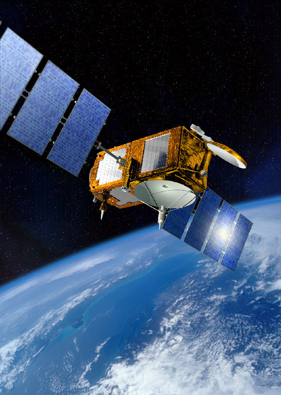 |
Jason-3 mission. This is the follow-on to the
extremely successful TOPEX/Poseidon, Jason-1 and Jason-2 missions.
It was successfully launched on 17th January 2016.
|
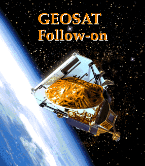 |
GFO mission comes to an end.
The GFO (GEOSAT Follow On) mission has now come to an end. On the 25th of
November, 2008 we were advised that an extra burn had been completed and that fuel was
fully depleted before completion of a maximum burn period. Altitude was reduced to below
that required to enable atmospheric re-entry within 25 years which is the de-orbit
requirement. Commands were sent to safe the satellite (deplete batteries, turn
off transmitters, etc.). GFO is now just a life-less mass in space.
It is expected that the US Navy will be launching a GFO follow on in the near future.
|
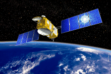 |
Jason-2 (the follow-on mission to Jason-1) was successfully launched on the 20th of June, 2008.
Click here for more information about the Jason-2 mission (external link)
|
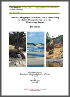 |
[August 2007] The Tasmanian State Government
released an updated report on Tasmanian
Coastal Vulnerability, 2nd edition, (the "Sharples" report). |
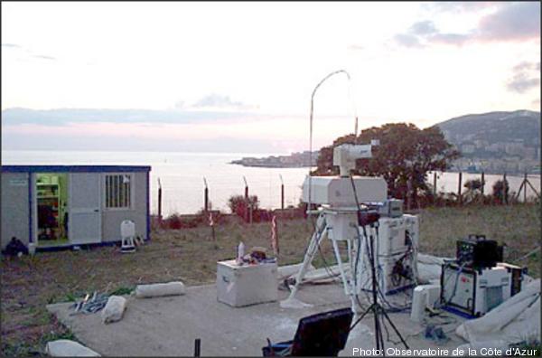 |
The French Transportable Laser Ranging System (FTLRS)
was deployed in Burnie from the 1st of December 2007 to the 18th
of April 2008. The data is currently being worked on. The picture shows the FTLRS
installed in Corsica (click image for larger view) |
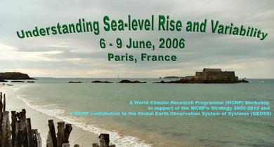 |
The World
Climate Research Programme held a workshop on Understanding sea level
Rise and Variability in Paris in 2006. See the conference statement for a brief summary. |
|