Voyage details and related metadata, reports, events and data.
ST 06/2007
(alternative identifier: ST200706)
- is a Marine National Facility ![]() voyage
voyage
Period: 2007-10-17 00:00 to 2007-10-22 00:00 UTC
Duration: 5.00 days
From: Mackay To: Newcastle
Region: Qld and NSW coast
Ship: Southern Surveyor [details]
Description:
Leader: R. Kloser (CMAR)
Project: Southern Surveyor - general vessel operations, gear trials, etc. [details]
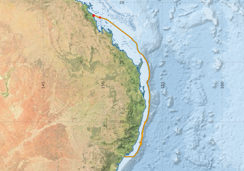
Voyage extents: 32° 56.6' S to 21° 06.3' S 149° 13.6' E to 153° 56.6' E
Marlin Metadata:-
Participants - on ship:-
| Name | Role | Organisation |
|---|---|---|
| Drew Mills | MNF Electronics | CSIRO Oceans & Atmosphere - Hobart |
| Gordon Keith | Swath mapping | CSIRO Oceans & Atmosphere - Hobart |
| John Walker | Consultant | |
| Leanne Pitt | P & O | |
| Lindsay Pender | MNF Computing support | CSIRO Oceans & Atmosphere - Hobart |
| Lisa Woodward | MNF | CSIRO Oceans & Atmosphere - Hobart |
| Rick Smith | Swath mapping | CSIRO Oceans & Atmosphere - Hobart |
| Rudy Kloser | Chief Investigator | CSIRO Oceans & Atmosphere - Hobart |
| Solomon Foster | Woods Hole Oceanographic Institution (USA) |
This list includes those that may have only been on part of the voyage. See voyage reports on 'Reports and Maps' tab for details.
Marine National Facility Reports - plans, summaries and data processing
-
ST200706 Voyage Summary
- includes preliminary results, voyage narrative, types of data collected with C77/ROSCOP codes.
-
ST200706 Voyage Plan
- includes objectives, investigator details, proposed data collection, voyage track and equipment to be used.
-
ST200706 Underway Data Processing Report
- details of data processing steps, calibration information, instruments used and any issues with the data.
-

Search for publications, reports and datasets from this and other voyages
Data publishing
This is a list of online datasets hosted by CSIRO. Other processed datasets hosted by collaborating organisations may be found on the 'Metadata' or "Reports, Publications and Maps' tab.
Use the Get data link on the right to extract data using the NCMI Data Trawler.
| Data Stream | Data Summary | Get data | ||||||||||||||
|---|---|---|---|---|---|---|---|---|---|---|---|---|---|---|---|---|
| ADCP Data |
|
Get Data from Trawler Download netCDF dataset st200706ADPnc.zip |
||||||||||||||
| Multibeam echosounder |
|
Get Data from Trawler |
||||||||||||||
| Underway |
|
Get Data from Trawler |
Deployments by start time:- Click on column header to sort. Use link on 'Deployment' to see full details. Use the CSV button at the bottom to export data (tab delimited).
Search for deployments from this voyage and others
| Deployment | Operation | Station | Cast | Gear | Project | Start and end times | Start Location | End Location | Depth range | Max Depth | Description | |||
|---|---|---|---|---|---|---|---|---|---|---|---|---|---|---|
| Multibeam echosounder [details] | EM300 Multibeam Echosounder | 2007-10-16 23:35 | 2007-10-21 21:58 | -21.1063 | 149.2262 | -32.9236 | 151.7629 | 1991.6 | ||||||
| Underway System [details] | Air Temperature Sensor-HMP233,Barometer,Fluorometer WS3S-443P,Gyro-Generic SS-NF,Humidity Sensor-HMP233,Licor-UWQ 3708,RM Young 05106 wind monitor-75621,RM Young 05106 wind monitor-75621,RM Young 05106 wind monitor-75621,RM Young Rain Gauge,Seapath 200,Seapath 200,Simrad EA500 Echosounder,ThermoSalinoGraph (TSG)-SS-SN 1777,ThermoSalinoGraph (TSG)-SS-SN 1777 | 1545 | 2007-10-16 23:55 | 2007-10-21 21:24 | -21.1062 | 149.2271 | -32.9242 | 151.7768 | ||||||
| ADCP Data [details] | RDI Ocean Surveyor Acoustic Doppler current profiler | 1545 | 2007-10-17 02:53 | 2007-10-21 20:59 | -21.2640 | 149.7614 | -32.9201 | 151.8386 | 631 | |||||