Survey details and related metadata, reports, events and data.
SS 01/2000 (alternative identifier: SS200001)
Period: 2000-04-03 00:00 to 2000-05-20 00:00 UTC
Duration: 47.00 days
From: Hobart To: Hobart
Region: Tasmanian, Victorian, South Australian and New South Wales coastal and offshore
Ship: Southern Surveyor [details]
Description:
The overall research goals for the voyage are to:
a) test and refine techniques for mapping and classifying marine benthic habitats and their biological communities using surrogate variables, and develop protocols for ground-truthing such assessments
b) map habitat and community substructure in key areas
c) sample previously unsurveyed marine habitats and communities to enable extension of the existing regionalisations in this region (principally on the lower continental slope, 1500 - 2000 m)
Leader: R. Kloser, A. Butler (CSIRO)
Project: Marine Biological Diversity Survey - South-East [details]
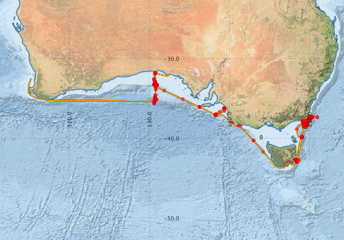
Voyage extents: 43° 42.4' S to 31° 49.0' S 114° 53.5' E to 150° 25.5' E Get voyage track shapefile Get CSV
Marlin Metadata:-
Metadata from OBIS Australia datasets:- biological data is published via the OBIS-AU IPT server and delivered to one or more of OBIS, ALA and GBIF
Download from OBIS Australia IPT View at - Ocean Biodiversity Information System (OBIS)
Download from OBIS Australia IPT View at - Ocean Biodiversity Information System (OBIS) Atlas of Living Australia (ALA) GBIF
Download from OBIS Australia IPT View at - Ocean Biodiversity Information System (OBIS) Atlas of Living Australia (ALA) GBIF
Download from OBIS Australia IPT View at - Ocean Biodiversity Information System (OBIS)
Participants - on ship:-
| Name | Role | Organisation |
|---|---|---|
| no docs found | CSIRO Oceans & Atmosphere - Hobart |
This list includes those that may have only been on part of the voyage. See voyage reports on 'Reports and Maps' tab for details.
Marine National Facility Reports - plans, summaries and data processing
-
SS200001 Voyage Plan
- includes objectives, investigator details, proposed data collection, voyage track and equipment to be used.
-

Publications, reports and datasets from this voyage.
Dataset
- Appleyard, Sharon; Ward, Robert; Pogonoski, John; Graham, Alastair; Last, Peter; Deagle, Bruce; & Holmes, Bronwyn (2024): Marine fishes (from Australia) COI barcode reference library. v2. CSIRO. Data Collection. 10.25919/8haz-aa91
- Lissette Victorero. (2023). Global benthic biogeographical regions and macroecological drivers for ophiuroids [Data set]. Zenodo. 10.5281/zenodo.7656699
IPT Resource
- The Cymonomid Crabs of of Australia (Crustacea: Brachyura: Cyclodorripoida) (Darwin Core Archive) External link to reference
- Australian National Fish Collection (ANFC) (Darwin Core Archive) External link to reference
- CSIRO, Cruise SS200001, Marine Biodiversity, South and Southeast Australia, 2001 (Darwin Core Archive) External link to reference
- Global benthic biogeographical regions and macroecological drivers for ophiuroids [Data set] (Darwin Core Archive) External link to reference
Journal Article
- Ahyong, S. T. (2019) Cyclodorripoida Records of the Australian Museum 71 10.3853/j.2201-4349.71.2019.1682
- Ahyong, S. T. and Poore, G. C. B. (2004) Deep-water Galatheidae (Crustacea : Decapoda : Anomura) from southern and eastern Australia. Zootaxa 1-76 10.11646/zootaxa.472.1.1
- Anderson, O. F. (2016) A review of New Zealand and southeast Australian echinothurioids (Echinodermata: Echinothurioida)-excluding the subfamily Echinothuriinae-with a description of a new species of Tromikosoma. Zootaxa 4092 451-488 10.11646/zootaxa.3609.6.1
- Chan, Tin-Yam, Cleva, Regis and Chu, Ka Hou (2016) On the genus Trachysalambria Burkenroad, 1934 (Crustacea, Decapoda, Penaeidae), with descriptions of three new species. Zootaxa 4150 201-254 10.11646/zootaxa.4150.3.1
- Holdgate, G. R.,Wallace, M. W.,Gallagher, S. J.,Smith, A. J.,Keene, J. B.,Moore, D.,Shafik, S. (2003) Plio‐Pleistocene tectonics and eustasy in the Gippsland Basin, southeast Australia: Evidence from magnetic imagery and marine geological data. Australian Journal of Earth Sciences 50 pp403-426. 10.1046/j.1440-0952.2003.01004.x
- Kloser, R.J.,Penrose, J.D.,Butler, A.J. (2010) Multi-beam backscatter measurements used to infer seabed habitats. Continental Shelf Research 30 pp1772-1782. 10.1016/j.csr.2010.08.004
- Komai, T. and Taylor, J. (2010) Three new species of the crangonid genus Metacrangon Zarenkov (Crustacea: Decapoda: Caridea) from Australia. Memoirs of Museum of Victoria 67 45-59 10.24199/j.mmv.2010.67.05
- Marshall, B A., Walton, K. (2018) A review of Ponder, 2010 and descriptions of new species and a new genus (Gastropoda: Neogastropoda: Buccinoidea: Buccinidae). Molluscan Research, 39, pp 70-81. 10.1080/13235818.2018.1468525
- Moore, K., Alderslade, P. and Miller, K. (2016) A taxonomic revision of the genus Primnoisis Studer & Wright , 1887 (Coelenterata: Octocorallia: Isididae) using morphological and molecular data. Zootaxa 4075 1-+ 10.11646/zootaxa.4075.1.1
- O’Hara, Timothy D.,Hugall, Andrew F.,Haines, Margaret L.,Weber, Alexandra A.-T.,Eichsteller, Angelina,Brogger, Martin I.,Eléaume, Marc,Fujita, Toshihiko,Kongsrud, Jon A.,Martinez Arbizu, Pedro,Mills, Sadie,Olbers, Jennifer M.,Paulay, Gustav,Ramil, Fran,Samadi, Sarah,Sands, Chester J.,Sellanes, Javier,Solis-Marin, Francisco A.,Moussalli, Adnan (2025) Spatiotemporal faunal connectivity across global sea floors. Nature pp-. 10.1038/s41586-025-09307-1
- Verhoeff TJ (2024). Flapjack octopods of Australia (Cephalopoda: Cirrata: Opisthoteuthidae), Part I Southern Australia. Australian Journal of Taxonomy 68: 1–44. 10.54102/ajt.wij3l
- Verhoeff, Tristan Joseph (2025) Dallithyris and Liothyrella from southeastern Australia with description of a new species of Liothyrella (Brachiopoda: Terebratulidae). Australian Journal of Taxonomy pp1-21. 10.54102/ajt.96zkl
- Verhoeff, Tristan Joseph,O’Shea, Steve (2022) New records and two new species of (Octopoda: Cirrata: Grimpoteuthididae) from southern Australia and New Zealand. Molluscan Research 42 pp4-30. 10.1080/13235818.2022.2035889
- Victorero, Lissette,Samadi, Sarah,O'Hara, Timothy D.,Mouchet, Maud,Delavenne, Juliette,Leprieur, Fabien,Leroy, Boris (2023) Global benthic biogeographical regions and macroecological drivers for ophiuroids. Ecography pp-. 10.1111/ecog.06627
- Watling, Les,Lapointe, Abby (2022) Global biogeography of the lower bathyal (700–3000 m) as determined from the distributions of cnidarian anthozoans. Deep Sea Research Part I: Oceanographic Research Papers 181 pp103703-. 10.1016/j.dsr.2022.103703
Report
- Harris, P.T., Radke, B.M., Smith, A., Glen, K., Rollet, N., Exon, N.F., Passlow, V. (2000) Marine Geological Data Collected during Southern Surveyor Voyage 01/00 : Eastern Bass Strait and Great Australian Bight : AGSO Research Cruise no. 224. Record 2000/043. Geoscience Australia, Canberra. External link to reference
Search for publications, reports and datasets from this and other voyages
Data publishing
This is a list of online datasets hosted by CSIRO. Other processed datasets hosted by collaborating organisations may be found on the 'Metadata' or "Reports, Publications and Maps' tab.
Use the Get data link on the right to extract data using the NCMI Data Trawler.
| Data Stream | Data Summary | Get data | ||||||||||||||
|---|---|---|---|---|---|---|---|---|---|---|---|---|---|---|---|---|
| ADCP Data |
|
Get Data from Trawler Download ADCP dataset ss0001ap.zip 2.2 / 0/4 Mb Processing report for this dataset |
||||||||||||||
| Marine biodiversity observations and/or samples |
|
Get Data from Trawler |
||||||||||||||
| Catch Details (deprecated - now bio) |
|
Get Data from Trawler Voyage Plan, updates and associated information Ship-based operations database (csv extracts) |
||||||||||||||
| CTD profile |
|
Get Data from Trawler Download CTD dataset ss0001cd.zip 2.2 / 0/4 Mb Processing report for this dataset |
||||||||||||||
| Hydrology |
|
Get Data from Trawler Download HYD dataset ss0001hd.zip 2.2 / 0/4 Mb Processing report for this dataset |
||||||||||||||
| Underway |
|
Get Data from Trawler Download dataset UWY dataset ss0001uy.zip 2.2 / 0/4 Mb Processing report for this dataset |
Deployments by start time:- Click on column header to sort. Use link on 'Deployment' to see full details. Use the CSV button at the bottom to export data (tab delimited).
Search for deployments from this voyage and others
| Deployment | Operation | Station | Cast | Gear | Project | Start and end times | Start Location | End Location | Depth range | Max Depth | Description | |||
|---|---|---|---|---|---|---|---|---|---|---|---|---|---|---|
| Underway System [details] | Doppler speed log,Licor-UWQ 3708,RM Young 05103 wind monitor,RM Young 05103 wind monitor,RM Young 05103 wind monitor,RM Young 05103 wind monitor,RM Young 05103 wind monitor,Simrad EK500 echosounder,Sperry gyrocompass,Temperature sensor-41342 | 1178 | 2000-04-03 23:15 | 2000-05-20 23:59 | -42.8865 | 147.3390 | -32.4843 | 115.2100 | ||||||
| CTD Cast / Hydrology [details] | Cast 3 | 1178 | 2000-04-04 08:30 | 2000-04-04 09:07 | -42.7952 | 148.3852 | -42.7947 | 148.3897 | 672.9 | |||||
| Catch [details] | 3 | 1178 | 2000-04-04 18:50 | 2000-04-04 21:50 | -42.7617 | 148.7267 | Area: Maria Island Transect name: test | |||||||
| ADCP Data [details] | RDI VM-150 Acoustic Doppler current profiler | 1178 | 2000-04-06 09:00 | 2000-05-20 17:00 | -38.3820 | 149.2980 | -32.5280 | 115.1990 | 344.8 | |||||
| CTD Cast / Hydrology [details] | Cast 4 | 1178 | 2000-04-06 09:55 | 2000-04-06 10:18 | -38.2598 | 149.3147 | -38.2577 | 149.3103 | 100.8 | |||||
| CTD Cast [details] | Cast 5 | 1178 | 2000-04-07 00:55 | 2000-04-07 01:09 | -38.0295 | 149.3378 | -38.0273 | 149.3418 | 100 | |||||
| Catch [details] | 9 | 1178 | 2000-04-07 01:42 | 2000-04-07 01:48 | -38.0466 | 149.3316 | Area: Seven Hour Bank Transect name: | |||||||
| Catch [details] | 10 | 1178 | 2000-04-07 01:53 | 2000-04-07 01:58 | -38.0453 | 149.3352 | Area: Seven Hour Bank Transect name: | |||||||
| Catch [details] | 11 | 1178 | 2000-04-07 02:24 | 2000-04-07 02:24 | -38.0710 | 149.3046 | Area: Seven Hour Bank Transect name: off | |||||||
| Catch [details] | 13 | 1178 | 2000-04-07 04:47 | 2000-04-07 04:47 | -38.1935 | 149.2754 | Area: Big Horseshoe (west) Transect name: west | |||||||
| Catch [details] | 14 | 1178 | 2000-04-07 05:04 | 2000-04-07 05:05 | -38.1914 | 149.2792 | Area: Big Horseshoe (west) Transect name: west | |||||||
| CTD Cast / Hydrology [details] | Cast 6 | 1178 | 2000-04-07 23:51 | 2000-04-07 00:13 | -38.2502 | 149.2937 | -38.2498 | 149.2873 | 367.8 | |||||
| Catch [details] | 17 | 1178 | 2000-04-08 01:01 | 2000-04-08 01:01 | -38.2455 | 149.2957 | Area: Big Horseshoe (west) Transect name: west | |||||||
| Catch [details] | 18 | 1178 | 2000-04-08 01:35 | 2000-04-08 01:36 | -38.2262 | 149.2862 | Area: Big Horseshoe (west) Transect name: SW | |||||||
| Catch [details] | 19 | 1178 | 2000-04-08 02:00 | 2000-04-08 02:00 | -38.2275 | 149.2857 | Area: Big Horseshoe (west) Transect name: west | |||||||
| Catch [details] | 21 | 1178 | 2000-04-08 06:00 | 2000-04-08 06:00 | -38.1993 | 149.3000 | Area: Big Horseshoe (west) Transect name: west | |||||||
| Catch [details] | 22 | 1178 | 2000-04-08 06:32 | 2000-04-08 06:32 | -38.1993 | 149.3000 | Area: Big Horseshoe (west) Transect name: SW | |||||||
| Catch [details] | 23 | 1178 | 2000-04-08 07:20 | 2000-04-08 07:20 | -38.1993 | 149.3000 | Area: Big Horseshoe (west) Transect name: SW | |||||||
| Catch [details] | 24 | 1178 | 2000-04-08 07:53 | 2000-04-08 07:53 | -38.1795 | 149.2624 | Area: Big Horseshoe (west) Transect name: SW | |||||||
| Catch [details] | 25 | 1178 | 2000-04-08 08:02 | 2000-04-08 08:02 | -38.1795 | 149.2624 | Area: Big Horseshoe (west) Transect name: SW | |||||||
| Catch [details] | 26 | 1178 | 2000-04-08 08:40 | 2000-04-08 08:40 | -38.1629 | 149.2300 | Area: Big Horseshoe (west) Transect name: SW | |||||||
| Catch [details] | 27 | 1178 | 2000-04-08 08:53 | 2000-04-08 08:53 | -38.1629 | 149.2300 | Area: Big Horseshoe (west) Transect name: SW | |||||||
| Video [details] | 1178 | 2000-04-08 13:33 | 2000-04-08 14:00 | -38.0460 | 149.3275 | -38.0483 | 149.3323 | |||||||
| Catch [details] | 29 | 1178 | 2000-04-08 13:40 | 2000-04-08 14:01 | -38.0460 | 149.3275 | -38.0483 | 149.3323 | 0 to 0 | 0 | Area: Big Horseshoe (west) Transect name: west | |||
| CTD Cast / Hydrology [details] | Cast 7 | 1178 | 2000-04-08 16:07 | 2000-04-08 16:23 | -37.9760 | 149.3032 | -37.9762 | 149.2985 | 98.3 | |||||
| Catch [details] | 32 | 1178 | 2000-04-09 01:59 | 2000-04-09 01:59 | -37.9455 | 149.2668 | Area: Broken Reef Transect name: | |||||||
| Catch [details] | 33 | 1178 | 2000-04-09 02:14 | 2000-04-09 02:14 | -37.9455 | 149.2668 | Area: Broken Reef Transect name: | |||||||
| Catch [details] | 34 | 1178 | 2000-04-09 02:34 | 2000-04-09 02:34 | -37.9445 | 149.2664 | Area: Broken Reef Transect name: | |||||||
| Catch [details] | 35 | 1178 | 2000-04-09 02:44 | 2000-04-09 02:44 | -37.9445 | 149.2665 | Area: Broken Reef Transect name: | |||||||
| Catch [details] | 36 | 1178 | 2000-04-09 03:24 | 2000-04-09 03:24 | -37.9457 | 149.2668 | Area: Broken Reef Transect name: | |||||||
| Catch [details] | 37 | 1178 | 2000-04-09 03:43 | 2000-04-09 03:43 | -37.9471 | 149.2673 | Area: Broken Reef Transect name: | |||||||
| Catch [details] | 38 | 1178 | 2000-04-09 04:00 | 2000-04-09 04:00 | -37.9557 | 149.2667 | Area: Broken Reef Transect name: | |||||||
| Catch [details] | 39 | 1178 | 2000-04-09 04:24 | 2000-04-09 04:24 | -37.9725 | 149.2668 | Area: Broken Reef Transect name: | |||||||
| Catch [details] | 40 | 1178 | 2000-04-09 04:41 | 2000-04-09 04:36 | -37.9725 | 149.2668 | Area: Broken Reef Transect name: | |||||||
| Catch [details] | 41 | 1178 | 2000-04-09 05:53 | 2000-04-09 05:53 | -38.0469 | 149.3396 | Area: Big Horseshoe (west) Transect name: west | |||||||
| Catch [details] | 42 | 1178 | 2000-04-09 06:07 | 2000-04-09 06:08 | -38.0460 | 149.3393 | Area: Big Horseshoe (west) Transect name: west | |||||||
| Catch [details] | 43 | 1178 | 2000-04-09 06:23 | 2000-04-09 06:23 | -38.0453 | 149.3391 | Area: Big Horseshoe (west) Transect name: west | |||||||
| Catch [details] | 44 | 1178 | 2000-04-09 06:47 | 2000-04-09 06:47 | -38.0310 | 149.3388 | Area: Big Horseshoe (west) Transect name: NW | |||||||
| Catch [details] | 45 | 1178 | 2000-04-09 07:25 | 2000-04-09 08:27 | -38.0367 | 149.3416 | -38.0472 | 149.3376 | 0 to 0 | 0 | Area: Big Horseshoe (west) Transect name: NW | |||
| Video [details] | 1178 | 2000-04-09 07:27 | 2000-04-09 08:26 | -38.0367 | 149.3416 | -38.0472 | 149.3376 | |||||||
| Catch [details] | 47 | 1178 | 2000-04-09 10:26 | 2000-04-09 10:26 | -37.8504 | 149.1838 | Area: Point Hicks Transect name: | |||||||
| Catch [details] | 49 | 1178 | 2000-04-09 13:57 | 2000-04-09 13:57 | -37.8190 | 149.1531 | Area: Point Hicks Transect name: | |||||||
| Catch [details] | 50 | 1178 | 2000-04-09 14:27 | 2000-04-09 15:15 | -37.8170 | 149.1516 | -37.8225 | 149.1565 | 38 to 48 | 48 | Area: Point Hicks Transect name: | |||
| Video [details] | 1178 | 2000-04-09 14:37 | 2000-04-09 15:14 | -37.8170 | 149.1516 | -37.8225 | 149.1565 | 48.6 | ||||||
| CTD Cast / Hydrology [details] | Cast 8 | 1178 | 2000-04-09 20:29 | 2000-04-09 20:40 | -37.7582 | 149.6045 | -37.7577 | 149.6035 | 70 | |||||
| Catch [details] | 55 | 1178 | 2000-04-09 20:51 | 2000-04-09 20:00 | -37.7567 | 149.6036 | Area: Sand Patch Point Transect name: | |||||||
| CTD Cast / Hydrology [details] | Cast 9 | 1178 | 2000-04-09 23:43 | 2000-04-09 23:55 | -37.7162 | 150.0712 | -37.7192 | 150.0722 | 119.1 | |||||
| Catch [details] | 58 | 1178 | 2000-04-10 00:04 | 2000-04-10 00:04 | -37.7205 | 150.0726 | Area: Gabo Reef Transect name: | |||||||
| Catch [details] | 60 | 1178 | 2000-04-10 06:20 | 2000-04-10 07:35 | -37.7174 | 150.0486 | -37.7347 | 150.0673 | 0 to 136 | 136 | Area: Gabo Reef Transect name: | |||
| Video [details] | 1178 | 2000-04-10 06:37 | 2000-04-10 07:35 | 0.0000 | 0.0000 | -37.7347 | 150.0673 | 136.9 | ||||||
| Catch [details] | 61 | 1178 | 2000-04-10 08:37 | 2000-04-10 08:37 | -37.7154 | 150.0451 | Area: Gabo Reef Transect name: | |||||||
| Catch [details] | 62 | 1178 | 2000-04-10 08:46 | 2000-04-10 08:46 | -37.7134 | 150.0457 | Area: Gabo Reef Transect name: | |||||||
| Catch [details] | 63 | 1178 | 2000-04-10 09:07 | 2000-04-10 09:07 | -37.7190 | 150.0489 | Area: Gabo Reef Transect name: | |||||||
| Catch [details] | 64 | 1178 | 2000-04-10 09:25 | 2000-04-10 09:25 | -37.7206 | 150.0511 | Area: Gabo Reef Transect name: | |||||||
| Catch [details] | 65 | 1178 | 2000-04-10 09:38 | 2000-04-10 09:38 | -37.7232 | 150.0530 | Area: Gabo Reef Transect name: | |||||||
| Catch [details] | 66 | 1178 | 2000-04-10 09:47 | 2000-04-10 10:03 | -37.7254 | 150.0564 | Area: Gabo Reef Transect name: | |||||||
| Catch [details] | 67 | 1178 | 2000-04-10 10:16 | 2000-04-10 10:16 | -37.7378 | 150.0730 | Area: Gabo Reef Transect name: | |||||||
| CTD Cast / Hydrology [details] | Cast 10 | 1178 | 2000-04-10 14:51 | 2000-04-10 15:03 | -37.3518 | 150.2697 | -37.3510 | 150.2663 | 118.6 | |||||
| Catch [details] | 70 | 1178 | 2000-04-10 15:13 | 2000-04-10 15:13 | -37.3515 | 150.2629 | Area: Howe Reef Transect name: | |||||||
| CTD Cast / Hydrology [details] | Cast 11 | 1178 | 2000-04-11 03:12 | 2000-04-11 03:20 | -37.3447 | 150.1790 | -37.3457 | 150.1767 | 93.3 | |||||
| Catch [details] | 74 | 1178 | 2000-04-11 03:26 | 2000-04-11 03:30 | -37.3463 | 150.1752 | Area: Howe Reef Transect name: | |||||||
| CTD Cast / Hydrology [details] | Cast 12 | 1178 | 2000-04-11 07:35 | 2000-04-11 07:44 | -37.2543 | 150.1687 | -37.2532 | 150.1667 | 88.5 | |||||
| Catch [details] | 77 | 1178 | 2000-04-11 07:49 | 2000-04-11 07:50 | -37.2529 | 150.1654 | Area: Howe Reef Transect name: | |||||||
| Catch [details] | 79 | 1178 | 2000-04-11 10:00 | 2000-04-11 11:23 | -37.3491 | 150.1897 | -37.3486 | 150.2367 | Area: Howe Reef Transect name: south | |||||
| Catch [details] | 80 | 1178 | 2000-04-11 11:43 | 2000-04-11 11:43 | -37.3500 | 150.2234 | Area: Howe Reef Transect name: | |||||||
| Catch [details] | 81 | 1178 | 2000-04-11 12:06 | 2000-04-11 12:06 | -37.3487 | 150.2058 | Area: Howe Reef Transect name: | |||||||
| Catch [details] | 82 | 1178 | 2000-04-11 12:25 | 2000-04-11 12:25 | -37.3482 | 150.1926 | Area: Howe Reef Transect name: | |||||||
| Catch [details] | 83 | 1178 | 2000-04-11 13:06 | 2000-04-11 13:06 | -37.3142 | 150.2351 | Area: Howe Reef Transect name: | |||||||
| Catch [details] | 84 | 1178 | 2000-04-11 13:32 | 2000-04-11 13:32 | -37.2887 | 150.2659 | Area: Howe Reef Transect name: | |||||||
| Catch [details] | 85 | 1178 | 2000-04-11 14:00 | 2000-04-11 14:03 | -37.2872 | 150.2602 | Area: Howe Reef Transect name: | |||||||
| Catch [details] | 86 | 1178 | 2000-04-11 14:49 | 2000-04-11 14:52 | -37.3152 | 150.2353 | -37.3186 | 150.2307 | Area: Howe Reef Transect name: | |||||
| Catch [details] | 87 | 1178 | 2000-04-11 15:27 | 2000-04-11 17:48 | -37.3449 | 150.2892 | -37.2343 | 150.1538 | Area: swath experiment Transect name: swath | |||||
| Catch [details] | 91 | 1178 | 2000-04-11 21:55 | 2000-04-11 21:55 | -37.3267 | 150.0756 | Area: Disaster Bay Transect name: | |||||||
| Catch [details] | 92 | 1178 | 2000-04-11 22:14 | 2000-04-11 22:14 | -37.3283 | 150.0707 | Area: Disaster Bay Transect name: | |||||||
| Catch [details] | 93 | 1178 | 2000-04-11 23:12 | 2000-04-11 23:19 | -37.3310 | 150.0813 | Area: Disaster Bay Transect name: | |||||||
| CTD Cast / Hydrology [details] | Cast 14 | 1178 | 2000-04-11 23:26 | 2000-04-11 23:36 | -37.3342 | 150.0798 | -37.3365 | 150.0790 | 73.1 | |||||
| Catch [details] | 96 | 1178 | 2000-04-12 06:33 | 2000-04-12 08:00 | -37.3257 | 150.0752 | -37.3794 | 150.0756 | 0 to 0 | 0 | Area: Disaster Bay Transect name: | |||
| Video [details] | 1178 | 2000-04-12 06:35 | 2000-04-12 08:02 | -37.3257 | 150.0752 | -37.3794 | 150.0756 | |||||||
| CTD Cast / Hydrology [details] | Cast 15 | 1178 | 2000-04-12 08:51 | 2000-04-12 09:00 | -37.3693 | 150.0878 | -37.3718 | 150.0855 | 79.2 | |||||
| Catch [details] | 98 | 1178 | 2000-04-12 09:10 | 2000-04-12 09:33 | -37.3650 | 150.0747 | Area: Disaster Bay Transect name: | |||||||
| Catch [details] | 99 | 1178 | 2000-04-12 09:57 | 2000-04-12 09:57 | -37.3657 | 150.0773 | Area: Disaster Bay Transect name: | |||||||
| Catch [details] | 100 | 1178 | 2000-04-12 10:20 | 2000-04-12 10:20 | -37.3482 | 150.1013 | Area: Disaster Bay Transect name: | |||||||
| Catch [details] | 101 | 1178 | 2000-04-12 10:41 | 2000-04-12 10:41 | -37.3474 | 150.0737 | Area: Disaster Bay Transect name: | |||||||
| Catch [details] | 102 | 1178 | 2000-04-12 10:50 | 2000-04-12 10:50 | -37.3503 | 150.0720 | Area: Disaster Bay Transect name: | |||||||
| Catch [details] | 103 | 1178 | 2000-04-12 11:31 | 2000-04-12 11:31 | -37.3460 | 149.9748 | Area: Disaster Bay Transect name: | |||||||
| Catch [details] | 104 | 1178 | 2000-04-12 11:44 | 2000-04-12 11:44 | -37.3461 | 149.9737 | Area: Disaster Bay Transect name: | |||||||
| Catch [details] | 105 | 1178 | 2000-04-12 12:07 | 2000-04-12 12:07 | -37.3492 | 150.0000 | Area: Disaster Bay Transect name: | |||||||
| Catch [details] | 106 | 1178 | 2000-04-12 13:16 | 2000-04-12 13:16 | -37.3487 | 150.0395 | Area: Disaster Bay Transect name: | |||||||
| Catch [details] | 107 | 1178 | 2000-04-12 14:22 | 2000-04-12 15:29 | -37.3482 | 150.1032 | -37.3480 | 150.0656 | 0 to 0 | 0 | Area: Disaster Bay Transect name: | |||
| Video [details] | 1178 | 2000-04-12 14:22 | 2000-04-12 15:22 | -37.3482 | 150.1032 | -37.3480 | 150.0656 | |||||||
| CTD Cast / Hydrology [details] | Cast 16 | 1178 | 2000-04-12 16:12 | 2000-04-12 16:19 | -37.3462 | 149.9733 | 19.2 | |||||||
| CTD Cast / Hydrology [details] | Cast 17 | 1178 | 2000-04-12 19:43 | 2000-04-12 19:54 | -37.3478 | 150.1352 | -37.3512 | 150.1342 | 88.7 | |||||
| Catch [details] | 111 | 1178 | 2000-04-12 20:29 | 2000-04-12 20:29 | -37.3536 | 150.1334 | Area: Howe Reef Transect name: | |||||||
| CTD Cast / Hydrology [details] | Cast 18 | 1178 | 2000-04-12 21:56 | 2000-04-12 22:06 | -37.3443 | 150.2892 | -37.3448 | 150.2900 | 75.5 | |||||
| Catch [details] | 114 | 1178 | 2000-04-12 22:24 | 2000-04-12 22:24 | -37.3529 | 150.2917 | Area: Howe Reef Transect name: deep | |||||||
| CTD Cast / Hydrology [details] | Cast 19 | 1178 | 2000-04-13 03:10 | 2000-04-13 03:46 | -37.3450 | 150.3757 | -37.3562 | 150.3718 | 399.5 | |||||
| Catch [details] | 117 | 1178 | 2000-04-13 04:37 | 2000-04-13 04:37 | -37.3487 | 150.3252 | Area: Howe Reef (off shelf) Transect name: off shelf | |||||||
| Catch [details] | 118 | 1178 | 2000-04-13 05:02 | 2000-04-13 05:02 | -37.3487 | 150.3252 | Area: Howe Reef (off shelf) Transect name: off shelf | |||||||
| Catch [details] | 119 | 1178 | 2000-04-13 05:46 | 2000-04-13 05:46 | -37.3481 | 150.3441 | Area: Howe Reef (off shelf) Transect name: off shelf - 350m | |||||||
| Catch [details] | 120 | 1178 | 2000-04-13 06:31 | 2000-04-13 06:31 | -37.3478 | 150.3556 | Area: Howe Reef Transect name: | |||||||
| Catch [details] | 121 | 1178 | 2000-04-13 06:50 | 2000-04-13 06:50 | -37.3478 | 150.3557 | Area: Howe Reef (off shelf) Transect name: off shelf | |||||||
| Catch [details] | 124 | 1178 | 2000-04-13 10:31 | 2000-04-13 11:55 | -37.3676 | 150.3271 | -37.3462 | 150.3589 | 285 to 466 | 466 | Area: Howe Reef (off shelf) Transect name: off shelf | |||
| Video [details] | 1178 | 2000-04-13 10:33 | 2000-04-13 12:11 | -37.3673 | 150.3273 | -37.3462 | 150.3589 | 466.9 | ||||||
| CTD Cast / Hydrology [details] | Cast 20 | 1178 | 2000-04-13 15:02 | 2000-04-13 15:10 | -37.3518 | 150.1167 | -37.3548 | 150.1153 | 88.5 | |||||
| CTD Cast / Hydrology [details] | Cast 21 | 1178 | 2000-04-13 23:18 | 2000-04-13 23:25 | -37.3430 | 150.0090 | -37.3442 | 150.0080 | 5 | |||||
| Catch [details] | 128 | 1178 | 2000-04-13 23:33 | 2000-04-13 23:33 | -37.3454 | 150.0070 | Area: Disaster Bay (west) Transect name: west | |||||||
| Catch [details] | 129 | 1178 | 2000-04-13 23:45 | 2000-04-13 23:45 | -37.3475 | 150.0059 | Area: Disaster Bay (west) Transect name: west | |||||||
| Catch [details] | 131 | 1178 | 2000-04-14 02:54 | 2000-04-14 02:54 | -37.3054 | 150.0107 | Area: Disaster Bay (west) Transect name: west | |||||||
| Catch [details] | 135 | 1178 | 2000-04-15 15:04 | 2000-04-15 15:14 | -37.3127 | 150.2341 | Area: Howe Reef Transect name: | |||||||
| Catch [details] | 138 | 1178 | 2000-04-15 18:44 | 2000-04-15 18:56 | -37.3018 | 150.2494 | Area: Howe Reef Transect name: | |||||||
| Catch [details] | 139 | 1178 | 2000-04-15 19:44 | 2000-04-15 19:56 | -37.2803 | 150.2381 | Area: Howe Reef Transect name: | |||||||
| Catch [details] | 140 | 1178 | 2000-04-15 22:13 | 2000-04-15 22:24 | -37.3546 | 150.3619 | Area: Howe Reef Transect name: | |||||||
| Catch [details] | 141 | 1178 | 2000-04-15 23:23 | 2000-04-15 23:36 | -37.3496 | 150.3265 | -37.3515 | 150.3393 | 260 to 325 | 325 | Area: Howe Reef (off shelf) Transect name: shallow | |||
| Catch [details] | 142 | 1178 | 2000-04-16 00:49 | 2000-04-16 00:55 | -37.3495 | 150.3465 | -37.3493 | 150.3650 | 370 to 640 | 640 | Area: Howe Reef (off shelf) Transect name: deep | |||
| Catch [details] | 143 | 1178 | 2000-04-16 04:13 | 2000-04-16 04:22 | -37.7118 | 150.0500 | Area: Gabo Reef Transect name: | |||||||
| Catch [details] | 144 | 1178 | 2000-04-16 05:23 | 2000-04-16 05:23 | -37.7311 | 150.0657 | Area: Gabo Reef Transect name: | |||||||
| Catch [details] | 145 | 1178 | 2000-04-16 05:58 | 2000-04-15 15:00 | -37.7654 | 150.0298 | Area: Gabo Reef Transect name: | |||||||
| CTD Cast / Hydrology [details] | Cast 22 | 1178 | 2000-04-16 09:28 | 2000-04-16 09:52 | -38.2402 | 149.7228 | -38.2385 | 149.7257 | 500.4 | |||||
| CTD Cast / Hydrology [details] | Cast 23 | 1178 | 2000-04-17 01:00 | 2000-04-17 01:23 | -38.1773 | 149.5660 | -38.1832 | 149.5732 | 286.7 | |||||
| Catch [details] | 150 | 1178 | 2000-04-17 02:07 | 2000-04-17 02:33 | -38.2149 | 149.6625 | -38.2028 | 149.6974 | 402 to 395 | 402 | Area: Big Horseshoe SE Transect name: S1 | |||
| Catch [details] | 151 | 1178 | 2000-04-17 05:30 | 2000-04-17 06:03 | -38.2128 | 149.6664 | -38.2027 | 149.7031 | 396 to 397 | 397 | Area: Big Horseshoe SE Transect name: S1 | |||
| Catch [details] | 152 | 1178 | 2000-04-17 09:28 | 2000-04-17 10:14 | -38.3376 | 149.6127 | -38.3365 | 149.6459 | 1000 to 993 | 1000 | Area: Big Horseshoe (deep) Transect name: S1000 | |||
| Catch [details] | 154 | 1178 | 2000-04-17 13:40 | 2000-04-17 13:56 | -38.4799 | 149.5529 | -38.4723 | 149.5428 | 1520 to 1527 | 1527 | Area: Big Horseshoe (deep) Transect name: S1500 | |||
| Catch [details] | 155 | 1178 | 2000-04-17 15:34 | 2000-04-17 15:34 | -38.4699 | 149.5300 | Area: Big Horseshoe (deep) Transect name: S1500 | |||||||
| Catch [details] | 156 | 1178 | 2000-04-17 17:20 | 2000-04-17 17:38 | -38.4571 | 149.5170 | -38.4506 | 149.5075 | 1512 to 1530 | 1530 | Area: Big Horseshoe (deep) Transect name: S1500 | |||
| Catch [details] | 157 | 1178 | 2000-04-17 19:35 | 2000-04-17 19:55 | -38.4510 | 149.5069 | -38.4574 | 149.5153 | 1533 to 1516 | 1533 | Area: Big Horseshoe (deep) Transect name: S1500 | |||
| Catch [details] | 158 | 1178 | 2000-04-17 21:58 | 2000-04-17 22:07 | -38.4784 | 149.5566 | -38.4781 | 149.5710 | 1426 to 1509 | 1509 | Area: Big Horseshoe (deep) Transect name: H1500 | |||
| Catch [details] | 159 | 1178 | 2000-04-18 01:44 | 2000-04-18 01:44 | -38.4774 | 149.5647 | Area: Big Horseshoe (deep) Transect name: H1500 | |||||||
| Catch [details] | 160 | 1178 | 2000-04-18 03:28 | 2000-04-18 03:28 | -38.4539 | 149.5113 | Area: Big Horseshoe (deep) Transect name: S1500 | |||||||
| Catch [details] | 161 | 1178 | 2000-04-18 04:08 | 2000-04-18 04:08 | -38.4541 | 149.5112 | Area: Big Horseshoe (deep) Transect name: S1500 | |||||||
| Catch [details] | 162 | 1178 | 2000-04-18 05:53 | 2000-04-18 06:21 | -38.4596 | 149.5282 | -38.4462 | 149.5054 | 1504 to 1426 | 1504 | Area: Big Horseshoe (deep) Transect name: S1500 | |||
| Video [details] | 1178 | 2000-04-18 11:02 | 2000-04-18 12:43 | -38.4751 | 149.5416 | -38.4784 | 149.5621 | 1516.7 | ||||||
| Catch [details] | 163 | 1178 | 2000-04-18 11:03 | 2000-04-18 12:42 | -38.4751 | 149.5416 | -38.4784 | 149.5621 | 1500 to 1516 | 1516 | Area: Big Horseshoe (deep) Transect name: 1500 S&H | |||
| Catch [details] | 164 | 1178 | 2000-04-18 15:41 | 2000-04-18 15:57 | -38.4467 | 149.5013 | -38.4371 | 149.4903 | 1526 to 1426 | 1526 | Area: Big Horseshoe (deep) Transect name: S1500 | |||
| Catch [details] | 165 | 1178 | 2000-04-18 17:41 | 2000-04-18 18:35 | -38.4296 | 149.5067 | -38.4321 | 149.4611 | 1426 to 1426 | 1426 | Area: Big Horseshoe (deep) Transect name: P1500 | |||
| Catch [details] | 166 | 1178 | 2000-04-18 21:10 | 2000-04-18 22:12 | -38.5675 | 149.4378 | -38.5913 | 149.5077 | 2011 to 1426 | 2011 | Area: Big Horseshoe (deep) Transect name: S2000 | |||
| Catch [details] | 167 | 1178 | 2000-04-19 00:39 | 2000-04-19 00:39 | -38.5747 | 149.4741 | Area: Big Horseshoe (deep) Transect name: S2000 | |||||||
| Catch [details] | 168 | 1178 | 2000-04-19 03:24 | 2000-04-19 04:33 | -38.5788 | 149.4721 | -38.5927 | 149.5056 | 1994 to 1970 | 1994 | Area: Big Horseshoe (deep) Transect name: S2000 | |||
| Catch [details] | 169 | 1178 | 2000-04-19 08:36 | 2000-04-19 10:23 | -38.5647 | 149.4412 | -38.5959 | 149.5186 | 1993 to 1963 | 1993 | Area: Big Horseshoe (deep) Transect name: S2000 | |||
| Catch [details] | 170 | 1178 | 2000-04-19 13:46 | 2000-04-19 15:20 | -38.5894 | 149.4895 | Area: Big Horseshoe (deep) Transect name: S2000 | |||||||
| Catch [details] | 171 | 1178 | 2000-04-19 17:40 | 2000-04-19 18:30 | -38.5985 | 149.5248 | -38.5905 | 149.5046 | 197 to 1975 | 1975 | Area: Big Horseshoe (deep) Transect name: S2000 | |||
| Catch [details] | 172 | 1178 | 2000-04-19 20:42 | 2000-04-19 21:38 | -38.5004 | 149.4180 | -38.5379 | 149.4061 | 1859 to 218 | 1859 | Area: Big Horseshoe (deep) Transect name: H2000 | |||
| Catch [details] | 173 | 1178 | 2000-04-20 00:00 | 2000-04-20 00:49 | -38.5112 | 149.3570 | Area: Big Horseshoe (deep) Transect name: H2000 | |||||||
| Catch [details] | 174 | 1178 | 2000-04-20 03:15 | 2000-04-20 03:15 | -38.5140 | 149.3520 | Area: Big Horseshoe (deep) Transect name: H2000 | |||||||
| Catch [details] | 175 | 1178 | 2000-04-20 04:57 | 2000-04-20 04:57 | -38.5413 | 149.4051 | Area: Big Horseshoe (deep) Transect name: P2000 | |||||||
| Catch [details] | 176 | 1178 | 2000-04-20 07:05 | 2000-04-20 08:15 | -38.5423 | 149.4328 | Area: Big Horseshoe (deep) Transect name: P2000 | |||||||
| Catch [details] | 177 | 1178 | 2000-04-20 11:20 | 2000-04-20 12:24 | -38.5138 | 149.3679 | -38.5202 | 149.3365 | 1970 to 2211 | 2211 | Area: Big Horseshoe (deep) Transect name: H2000 | |||
| Catch [details] | 178 | 1178 | 2000-04-20 15:39 | 2000-04-20 16:15 | -38.5031 | 149.4291 | -38.5089 | 149.3967 | 1803 to 1996 | 1996 | Area: Big Horseshoe (deep) Transect name: H2000 | |||
| CTD Cast / Hydrology [details] | Cast 24 | 1178 | 2000-04-20 17:39 | 2000-04-20 18:57 | -38.5562 | 149.4203 | -38.5595 | 149.4683 | 1933.5 | |||||
| Catch [details] | 180 | 1178 | 2000-04-20 21:03 | 2000-04-20 21:50 | -38.3365 | 149.6540 | -38.3378 | 149.6124 | 998 to 1000 | 1000 | Area: Big Horseshoe (deep) Transect name: S1000 | |||
| Catch [details] | 181 | 1178 | 2000-04-20 23:31 | 2000-04-21 00:30 | -38.3427 | 149.5793 | -38.3417 | 149.5351 | 1033 to 1088 | 1088 | Area: Big Horseshoe (deep) Transect name: H1000 | |||
| Catch [details] | 182 | 1178 | 2000-04-21 04:33 | 2000-04-21 05:35 | -38.4677 | 149.4408 | -38.4409 | 149.5654 | 1815 to 1420 | 1815 | Area: Big Horseshoe (deep) Transect name: S1500 | |||
| Catch [details] | 183 | 1178 | 2000-04-21 10:40 | 2000-04-21 11:15 | -38.2095 | 149.6063 | -38.2103 | 149.5757 | 382 to 435 | 435 | Area: Big Horseshoe SE Transect name: S2 | |||
| Catch [details] | 184 | 1178 | 2000-04-21 13:58 | 2000-04-21 14:37 | -38.2088 | 149.6074 | -38.2076 | 149.5764 | 382 to 430 | 430 | Area: Big Horseshoe SE Transect name: S2 | |||
| Catch [details] | 185 | 1178 | 2000-04-21 16:11 | 2000-04-21 16:45 | -38.2447 | 149.6851 | -38.2523 | 149.6664 | 546 to 567 | 567 | Area: Big Horseshoe SE Transect name: S3 | |||
| Catch [details] | 186 | 1178 | 2000-04-21 18:04 | 2000-04-21 18:42 | -38.2348 | 149.5775 | -38.2409 | 149.5630 | 520 to 570 | 570 | Area: Big Horseshoe SE Transect name: S4 | |||
| Catch [details] | 187 | 1178 | 2000-04-21 21:17 | 2000-04-21 21:41 | -38.2382 | 149.6574 | -38.2543 | 149.6355 | 500 to 563 | 563 | Area: Big Horseshoe SE Transect name: H2 | |||
| Catch [details] | 188 | 1178 | 2000-04-21 23:30 | 2000-04-21 23:44 | -38.2406 | 149.7001 | -38.2565 | 149.7021 | 503 to 581 | 581 | Area: Big Horseshoe SE Transect name: H1 | |||
| Catch [details] | 189 | 1178 | 2000-04-22 01:40 | 2000-04-22 01:40 | -38.2457 | 149.7078 | Area: Big Horseshoe SE Transect name: H1 | |||||||
| Catch [details] | 190 | 1178 | 2000-04-22 02:36 | 2000-04-22 02:40 | -38.2473 | 149.7042 | Area: Big Horseshoe SE Transect name: H1 | |||||||
| Catch [details] | 191 | 1178 | 2000-04-22 03:48 | 2000-04-22 03:49 | -38.2475 | 149.6901 | Area: Big Horseshoe SE Transect name: H2 | |||||||
| Catch [details] | 192 | 1178 | 2000-04-22 04:42 | 2000-04-22 04:43 | -38.2475 | 149.6901 | Area: Big Horseshoe SE Transect name: H2 | |||||||
| Catch [details] | 193 | 1178 | 2000-04-22 06:59 | 2000-04-22 07:30 | -38.2422 | 149.6510 | -38.2555 | 149.6322 | 511 to 577 | 577 | Area: Big Horseshoe SE Transect name: H2 | |||
| Catch [details] | 194 | 1178 | 2000-04-22 09:53 | 2000-04-22 10:28 | -38.2419 | 149.6909 | -38.2545 | 149.6611 | 510 to 573 | 573 | Area: Big Horseshoe SE Transect name: S3 | |||
| Catch [details] | 195 | 1178 | 2000-04-22 12:21 | 2000-04-22 12:46 | -38.2383 | 149.7000 | -38.2705 | 149.6334 | 499 to 644 | 644 | Area: Big Horseshoe SE Transect name: H1 | |||
| Catch [details] | 196 | 1178 | 2000-04-22 15:32 | 2000-04-22 15:53 | -38.2383 | 149.7353 | -38.2563 | 149.7376 | 522 to 608 | 608 | Area: Big Horseshoe SE Transect name: H4 | |||
| Catch [details] | 197 | 1178 | 2000-04-22 18:07 | 2000-04-22 18:28 | -38.2236 | 149.6241 | -38.2370 | 149.6061 | 435 to 485 | 485 | Area: Big Horseshoe SE Transect name: H3 | |||
| Catch [details] | 198 | 1178 | 2000-04-22 19:52 | 2000-04-22 20:27 | -38.1613 | 149.6503 | -38.1734 | 149.6209 | 224 to 280 | 280 | Area: Big Horseshoe SE Transect name: F1 | |||
| Catch [details] | 199 | 1178 | 2000-04-22 22:24 | 2000-04-22 22:36 | -38.1622 | 149.6987 | -38.1677 | 149.6852 | 260 to 265 | 265 | Area: Big Horseshoe SE Transect name: F2 | |||
| Catch [details] | 200 | 1178 | 2000-04-22 23:56 | 2000-04-22 23:56 | -38.1624 | 149.6956 | Area: Big Horseshoe SE Transect name: F2 | |||||||
| Catch [details] | 201 | 1178 | 2000-04-23 01:01 | 2000-04-23 01:02 | -38.1677 | 149.6343 | Area: Big Horseshoe SE Transect name: F1 | |||||||
| Catch [details] | 202 | 1178 | 2000-04-23 02:48 | 2000-04-23 03:18 | -38.1644 | 149.6448 | -38.1751 | 149.6157 | 215 to 285 | 285 | Area: Big Horseshoe SE Transect name: F1 | |||
| Catch [details] | 203 | 1178 | 2000-04-23 05:16 | 2000-04-23 05:47 | -38.1624 | 149.6980 | -38.1739 | 149.6676 | 260 to 274 | 274 | Area: Big Horseshoe SE Transect name: F2 | |||
| Catch [details] | 204 | 1178 | 2000-04-23 07:06 | 2000-04-23 07:40 | -38.2266 | 149.6198 | -38.2450 | 149.6026 | 443 to 520 | 520 | Area: Big Horseshoe SE Transect name: H3 | |||
| Catch [details] | 205 | 1178 | 2000-04-23 09:50 | 2000-04-23 10:26 | -38.2323 | 149.5820 | -38.2436 | 149.5586 | 500 to 590 | 590 | Area: Big Horseshoe SE Transect name: S4 | |||
| Catch [details] | 206 | 1178 | 2000-04-23 12:20 | 2000-04-23 12:53 | -38.2371 | 149.7337 | -38.2681 | 149.7354 | 515 to 608 | 608 | Area: Big Horseshoe SE Transect name: H4 | |||
| Catch [details] | 207 | 1178 | 2000-04-23 14:34 | 2000-04-23 14:34 | -38.2480 | 149.7406 | Area: Big Horseshoe SE Transect name: H4 | |||||||
| Catch [details] | 208 | 1178 | 2000-04-23 15:49 | 2000-04-23 15:49 | -38.2487 | 149.6710 | Area: Big Horseshoe SE Transect name: S3 | |||||||
| Catch [details] | 209 | 1178 | 2000-04-23 16:46 | 2000-04-23 16:46 | -38.2285 | 149.6181 | Area: Big Horseshoe SE Transect name: H3 | |||||||
| Catch [details] | 210 | 1178 | 2000-04-23 17:39 | 2000-04-23 17:39 | -38.2376 | 149.5715 | Area: Big Horseshoe SE Transect name: S4 | |||||||
| Catch [details] | 211 | 1178 | 2000-04-23 18:21 | 2000-04-23 18:21 | -38.2091 | 149.5935 | Area: Big Horseshoe SE Transect name: S2 | |||||||
| Catch [details] | 212 | 1178 | 2000-04-23 19:09 | 2000-04-23 19:09 | -38.2085 | 149.6849 | Area: Big Horseshoe SE Transect name: S1 | |||||||
| Catch [details] | 213 | 1178 | 2000-04-23 20:05 | 2000-04-23 20:22 | -38.2421 | 149.6503 | Area: Big Horseshoe SE Transect name: H2 | |||||||
| Catch [details] | 214 | 1178 | 2000-04-23 22:13 | 2000-04-23 22:37 | -38.2518 | 149.6640 | Area: Big Horseshoe SE Transect name: S3 | |||||||
| Catch [details] | 215 | 1178 | 2000-04-23 23:36 | 2000-04-24 00:07 | -38.2503 | 149.6731 | Area: Big Horseshoe SE Transect name: S3 | |||||||
| Catch [details] | 216 | 1178 | 2000-04-24 00:45 | 2000-04-24 01:11 | -38.2521 | 149.7008 | Area: Big Horseshoe SE Transect name: H1 | |||||||
| Catch [details] | 217 | 1178 | 2000-04-24 02:07 | 2000-04-24 02:46 | -38.2360 | 149.7342 | -38.2571 | 149.7380 | 517 to 689 | 689 | Area: Big Horseshoe SE Transect name: H4 | |||
| Catch [details] | 218 | 1178 | 2000-04-24 09:45 | 2000-04-24 09:56 | -37.9429 | 149.2623 | Area: Broken Reef Transect name: hard | |||||||
| Video [details] | 1178 | 2000-04-24 11:39 | 2000-04-24 13:18 | -37.9647 | 149.2854 | 116.4 | ||||||||
| Catch [details] | 219 | 1178 | 2000-04-24 11:40 | 2000-04-24 13:18 | -37.9379 | 149.2551 | -37.9647 | 149.2855 | 108 to 116 | 116 | Area: Broken Reef Transect name: | |||
| Video [details] | 1178 | 2000-04-24 16:02 | 2000-04-24 18:26 | -38.2054 | 149.3163 | 288.9 | ||||||||
| Catch [details] | 220 | 1178 | 2000-04-24 16:03 | 2000-04-24 18:24 | -38.1649 | 149.2322 | -38.2054 | 149.3163 | 152 to 288 | 288 | Area: Big Horseshoe (west) Transect name: 150m | |||
| Catch [details] | 221 | 1178 | 2000-04-24 19:49 | 2000-04-24 19:49 | -38.2017 | 149.3150 | Area: Big Horseshoe (west) Transect name: west | |||||||
| Catch [details] | 222 | 1178 | 2000-04-24 20:42 | 2000-04-24 20:43 | -38.1676 | 149.2399 | Area: Big Horseshoe (west) Transect name: west | |||||||
| CTD Cast / Hydrology [details] | Cast 25 | 1178 | 2000-04-24 22:45 | 2000-04-24 22:52 | -37.9437 | 149.2643 | -37.9443 | 149.2643 | 99.1 | |||||
| Catch [details] | 225 | 1178 | 2000-04-25 00:03 | 2000-04-25 00:03 | -37.9456 | 149.2431 | Area: Broken Reef Transect name: | |||||||
| Catch [details] | 226 | 1178 | 2000-04-25 00:29 | 2000-04-25 00:29 | -37.9469 | 149.2485 | Area: Broken Reef Transect name: | |||||||
| Catch [details] | 227 | 1178 | 2000-04-25 00:59 | 2000-04-25 00:59 | -37.9404 | 149.2720 | Area: Broken Reef Transect name: | |||||||
| Catch [details] | 228 | 1178 | 2000-04-25 01:25 | 2000-04-25 01:25 | -37.9599 | 149.2811 | Area: Broken Reef Transect name: | |||||||
| CTD Cast / Hydrology [details] | Cast 26 | 1178 | 2000-04-25 06:20 | 2000-04-25 06:42 | -38.1378 | 149.4382 | -38.1365 | 149.4400 | 472.6 | |||||
| Catch [details] | 232 | 1178 | 2000-04-25 13:11 | 2000-04-25 13:36 | -38.1654 | 149.6903 | -38.1749 | 149.6678 | 263 to 274 | 274 | Area: Big Horseshoe SE Transect name: F2 | |||
| Video [details] | 1178 | 2000-04-25 16:14 | 2000-04-25 18:46 | -38.2473 | 149.6466 | -38.2418 | 149.7427 | 551.9 | ||||||
| Catch [details] | 233 | 1178 | 2000-04-25 16:16 | 2000-04-25 18:46 | -38.2473 | 149.6465 | -38.2418 | 149.7428 | 528 to 551 | 551 | Area: Big Horseshoe SE Transect name: H2+ | |||
| Video [details] | 1178 | 2000-04-25 22:41 | 2000-04-26 01:37 | -38.2411 | 149.5594 | -38.2102 | 149.6820 | 585.8 | ||||||
| Catch [details] | 234 | 1178 | 2000-04-25 22:42 | 2000-04-26 01:38 | -38.2409 | 149.5593 | -38.2102 | 149.6820 | 394 to 585 | 585 | Area: Big Horseshoe SE Transect name: S4+ | |||
| Catch [details] | 235 | 1178 | 2000-04-26 04:30 | 2000-04-26 08:12 | -38.2417 | 149.7421 | -38.2476 | 149.6411 | 525 to 559 | 559 | Area: Big Horseshoe SE Transect name: H4 | |||
| Video [details] | 1178 | 2000-04-26 04:40 | 2000-04-26 08:11 | -38.2414 | 149.7421 | -38.2477 | 149.6411 | 559 | ||||||
| Catch [details] | 236 | 1178 | 2000-04-26 10:07 | 2000-04-26 12:30 | -38.1845 | 149.5628 | -38.2295 | 149.5088 | 318 to 899 | 899 | Area: Big Horseshoe SE Transect name: canyon | |||
| Video [details] | 1178 | 2000-04-26 10:07 | 2000-04-26 12:35 | -38.1845 | 149.5627 | -38.2299 | 149.5091 | 899.2 | ||||||
| Catch [details] | 237 | 1178 | 2000-04-26 15:35 | 2000-04-26 16:12 | -38.1850 | 149.5633 | -38.1974 | 149.5481 | 320 to 510 | 510 | Area: Big Horseshoe SE Transect name: steep | |||
| Catch [details] | 238 | 1178 | 2000-04-26 17:09 | 2000-04-26 17:09 | -38.2154 | 149.5269 | Area: Big Horseshoe SE Transect name: canyon | |||||||
| Catch [details] | 239 | 1178 | 2000-04-26 17:51 | 2000-04-26 17:51 | -38.2154 | 149.5256 | Area: Big Horseshoe SE Transect name: canyon | |||||||
| Catch [details] | 240 | 1178 | 2000-04-26 18:41 | 2000-04-26 18:41 | -38.1868 | 149.5578 | Area: Big Horseshoe SE Transect name: steep | |||||||
| Catch [details] | 241 | 1178 | 2000-04-26 19:53 | 2000-04-26 20:14 | -38.2424 | 149.6554 | -38.2534 | 149.6414 | 525 to 565 | 565 | Area: Big Horseshoe SE Transect name: H2 | |||
| Catch [details] | 242 | 1178 | 2000-04-26 21:51 | 2000-04-26 22:11 | -38.2339 | 149.6588 | -38.2490 | 149.6405 | 475 to 530 | 530 | Area: Big Horseshoe SE Transect name: H2 | |||
| Catch [details] | 243 | 1178 | 2000-04-27 00:54 | 2000-04-27 01:40 | -38.2110 | 149.6046 | -38.2105 | 149.5902 | 382 to 406 | 406 | Area: Big Horseshoe SE Transect name: S2 | |||
| Video [details] | 1178 | 2000-04-27 00:54 | 2000-04-27 01:36 | -38.2108 | 149.6045 | -38.2105 | 149.5902 | 407 | ||||||
| Video [details] | 1178 | 2000-04-27 02:32 | 2000-04-27 03:14 | -38.1923 | 149.5756 | -38.1879 | 149.5588 | 399.9 | ||||||
| Catch [details] | 244 | 1178 | 2000-04-27 02:34 | 2000-04-27 03:15 | -38.1924 | 149.5756 | -38.1878 | 149.5587 | 364 to 399 | 399 | Area: Big Horseshoe SE Transect name: steep | |||
| Catch [details] | 246 | 1178 | 2000-04-27 09:20 | 2000-04-27 09:20 | -38.3309 | 149.6572 | Area: Big Horseshoe (deep) Transect name: S1000 | |||||||
| Catch [details] | 247 | 1178 | 2000-04-27 11:13 | 2000-04-27 11:56 | -38.3371 | 149.6405 | -38.3385 | 149.6236 | 993 to 1001 | 1001 | Area: Big Horseshoe (deep) Transect name: S1000 | |||
| Video [details] | 1178 | 2000-04-27 11:13 | 2000-04-27 11:55 | -38.3368 | 149.6405 | -38.3386 | 149.6236 | 1001.6 | ||||||
| Video [details] | 1178 | 2000-04-27 13:35 | 2000-04-27 14:17 | -38.3409 | 149.5621 | -38.3415 | 149.5502 | 1095.3 | ||||||
| Catch [details] | 248 | 1178 | 2000-04-27 13:37 | 2000-04-27 14:17 | -38.3414 | 149.5622 | -38.3412 | 149.5490 | 1063 to 1095 | 1095 | Area: Big Horseshoe (deep) Transect name: H1000 | |||
| Catch [details] | 249 | 1178 | 2000-04-27 16:34 | 2000-04-27 16:34 | -38.3449 | 149.5578 | Area: Big Horseshoe (deep) Transect name: H1000 | |||||||
| Catch [details] | 250 | 1178 | 2000-04-27 18:33 | 2000-04-27 18:33 | -38.2182 | 149.5197 | Area: Big Horseshoe SE Transect name: canyon | |||||||
| CTD Cast [details] | Cast 27 | 1178 | 2000-04-27 21:35 | 2000-04-27 21:41 | -37.9427 | 149.2695 | 108 | |||||||
| CTD Cast / Hydrology [details] | Cast 28 | 1178 | 2000-04-28 07:21 | 2000-04-28 07:32 | -38.8555 | 148.4175 | -38.8568 | 148.4162 | 197.2 | |||||
| Catch [details] | 255 | 1178 | 2000-04-28 18:22 | 2000-04-28 18:46 | -39.8844 | 149.0268 | -39.8981 | 149.0548 | 1520 to 1539 | 1539 | Area: Flinders Transect name: 1500 m - soft | |||
| Catch [details] | 256 | 1178 | 2000-04-28 20:41 | 2000-04-28 21:15 | -39.9155 | 149.0884 | -39.9035 | 149.0681 | 1608 to 1557 | 1608 | Area: Flinders Transect name: 1500 m - hard | |||
| Catch [details] | 257 | 1178 | 2000-04-28 23:25 | 2000-04-28 23:25 | -39.8898 | 149.0370 | Area: Flinders Transect name: 1500 - soft | |||||||
| Catch [details] | 258 | 1178 | 2000-04-29 00:40 | 2000-04-29 00:40 | -39.9085 | 149.0775 | Area: Flinders Transect name: 1500 - hard | |||||||
| Catch [details] | 259 | 1178 | 2000-04-29 02:25 | 2000-04-29 03:18 | -39.8956 | 149.0506 | -39.8805 | 149.0189 | 1538 to 1501 | 1538 | Area: Flinders Transect name: 1500 m - soft | |||
| Catch [details] | 260 | 1178 | 2000-04-29 05:58 | 2000-04-29 06:49 | -39.9158 | 149.0736 | Area: Flinders Transect name: 1500 m - S1/H1 | |||||||
| Catch [details] | 261 | 1178 | 2000-04-29 10:17 | 2000-04-29 11:11 | -39.8364 | 149.1041 | -39.8017 | 149.0990 | 1923 to 1962 | 1962 | Area: Flinders Transect name: 1500 m - hard | |||
| Catch [details] | 262 | 1178 | 2000-04-29 13:28 | 2000-04-29 13:54 | -39.8047 | 149.0925 | -39.8203 | 149.0908 | 1933 to 1935 | 1935 | Area: Flinders Transect name: 2000 m - hard | |||
| Catch [details] | 263 | 1178 | 2000-04-29 16:51 | 2000-04-29 17:26 | -39.8222 | 149.0909 | Area: Flinders Transect name: 2000 m - H1 | |||||||
| Catch [details] | 265 | 1178 | 2000-04-29 22:25 | 2000-04-29 22:29 | -39.8105 | 149.1030 | Area: Flinders Transect name: 2000 - soft | |||||||
| Catch [details] | 267 | 1178 | 2000-04-30 16:59 | 2000-04-30 17:23 | -42.9716 | 148.4199 | -42.9527 | 148.4461 | 1467 to 1454 | 1467 | Area: Maria Island Transect name: 1500 m - soft | |||
| Catch [details] | 268 | 1178 | 2000-04-30 19:23 | 2000-04-30 19:23 | -42.9658 | 148.4382 | Area: Maria Island Transect name: 1500 - soft | |||||||
| Catch [details] | 270 | 1178 | 2000-04-30 23:30 | 2000-04-30 23:58 | -42.8009 | 148.3968 | -42.8015 | 148.4370 | 1283 to 1073 | 1283 | Area: Maria Island Transect name: Canyon | |||
| Catch [details] | 271 | 1178 | 2000-05-01 02:00 | 2000-05-01 05:30 | -42.8003 | 148.4006 | Area: Maria Island Transect name: Canyon | |||||||
| Catch [details] | 272 | 1178 | 2000-05-01 07:40 | 2000-05-01 08:33 | -42.7170 | 148.4090 | -42.6480 | 148.4355 | 400 to 400 | 400 | Area: Maria Island Transect name: Darcey's Patch | |||
| CTD Cast / Hydrology [details] | Cast 29 | 1178 | 2000-05-01 10:37 | 2000-05-01 10:44 | -42.6695 | 148.2663 | -42.6710 | 148.2673 | 84.9 | |||||
| Catch [details] | 275 | 1178 | 2000-05-01 13:20 | 2000-05-01 13:56 | -42.6762 | 148.2366 | -42.6689 | 148.2595 | Area: Maria Island Transect name: Training Site | |||||
| Catch [details] | 276 | 1178 | 2000-05-01 14:25 | 2000-05-01 14:25 | -42.6700 | 148.2540 | Area: Maria Island Transect name: Training Site | |||||||
| Catch [details] | 277 | 1178 | 2000-05-01 14:42 | 2000-05-01 14:42 | -42.6744 | 148.2417 | Area: Maria Island Transect name: Training Site | |||||||
| Catch [details] | 278 | 1178 | 2000-05-01 16:01 | 2000-05-01 16:01 | -42.6811 | 148.4071 | Area: Maria Island Transect name: 150 m | |||||||
| Catch [details] | 279 | 1178 | 2000-05-01 18:39 | 2000-05-01 19:16 | -42.9605 | 148.4386 | Area: Maria Island Transect name: 1500 m | |||||||
| Catch [details] | 280 | 1178 | 2000-05-04 00:32 | 2000-05-04 00:43 | -41.6944 | 144.2448 | Area: West Coast Tasmania Transect name: | |||||||
| Catch [details] | 281 | 1178 | 2000-05-04 10:01 | 2000-05-04 10:09 | -40.2739 | 143.0405 | Area: King Island Transect name: | |||||||
| CTD Cast / Hydrology [details] | Cast 30 | 1178 | 2000-05-04 10:20 | 2000-05-04 10:30 | -40.2767 | 143.0278 | -40.2755 | 143.0263 | 4.1 | |||||
| CTD Cast / Hydrology [details] | Cast 32 | 1178 | 2000-05-04 22:35 | 2000-05-04 22:44 | -38.4588 | 141.3253 | -38.4593 | 141.3265 | 78.7 | |||||
| Catch [details] | 286 | 1178 | 2000-05-05 00:44 | 2000-05-05 00:53 | -38.3630 | 141.1276 | Area: Portland Day Plankton Transect name: | |||||||
| Catch [details] | 287 | 1178 | 2000-05-05 10:12 | 2000-05-05 10:22 | -38.0343 | 140.3417 | Area: off Nene Valley Transect name: | |||||||
| Catch [details] | 288 | 1178 | 2000-05-06 00:43 | 2000-05-06 00:53 | -36.9829 | 138.3509 | Area: Lacepede Shelf Transect name: | |||||||
| Catch [details] | 289 | 1178 | 2000-05-06 01:29 | 2000-05-06 01:40 | -36.9881 | 138.3266 | -36.9846 | 138.3411 | 78 to 78 | 78 | Area: Lacepede shelf Transect name: ? m | |||
| CTD Cast / Hydrology [details] | Cast 33 | 1178 | 2000-05-06 08:22 | 2000-05-06 08:32 | -36.9803 | 138.3312 | -36.9798 | 138.3342 | 69.2 | |||||
| Catch [details] | 292 | 1178 | 2000-05-06 09:05 | 2000-05-06 09:19 | -36.9864 | 138.3300 | Area: Lacepede shelf Transect name: 120 m | |||||||
| Video [details] | 1178 | 2000-05-06 10:14 | 2000-05-06 11:06 | -36.9858 | 138.3328 | -36.9820 | 138.3590 | 77 | ||||||
| Catch [details] | 293 | 1178 | 2000-05-06 10:15 | 2000-05-06 11:07 | -36.9858 | 138.3328 | -36.9820 | 138.3590 | 0 to 77 | 77 | Area: Lacepede Shelf Transect name: 80 m | |||
| Catch [details] | 294 | 1178 | 2000-05-06 11:47 | 2000-05-06 11:48 | -36.9846 | 138.3412 | Area: Lacepede shelf Transect name: 80 m | |||||||
| Catch [details] | 297 | 1178 | 2000-05-06 20:20 | 2000-05-06 20:28 | -36.5411 | 139.4080 | Area: Lacepede shelf Transect name: 40 m | |||||||
| Catch [details] | 299 | 1178 | 2000-05-06 23:02 | 2000-05-06 23:14 | -36.2619 | 139.3580 | Area: Lacepede Shelf Transect name: 40 m | |||||||
| Catch [details] | 301 | 1178 | 2000-05-07 00:51 | 2000-05-07 00:55 | -36.2521 | 139.3609 | Area: Lacepede shelf Transect name: 40 m - site2 | |||||||
| CTD Cast / Hydrology [details] | Cast 34 | 1178 | 2000-05-07 02:22 | 2000-05-07 02:31 | -36.2415 | 139.3533 | 34.4 | |||||||
| Catch [details] | 303 | 1178 | 2000-05-07 02:46 | 2000-05-07 02:46 | -36.2416 | 139.3519 | Area: Lacepede shelf Transect name: 40 m | |||||||
| Catch [details] | 304 | 1178 | 2000-05-07 03:02 | 2000-05-07 03:30 | -36.2416 | 139.3519 | Area: Lacepede shelf Transect name: 40 m | |||||||
| Catch [details] | 305 | 1178 | 2000-05-07 03:48 | 2000-05-07 03:49 | -36.2409 | 139.3574 | Area: Lacepede shelf Transect name: 40 m | |||||||
| Catch [details] | 306 | 1178 | 2000-05-07 03:56 | 2000-05-07 03:57 | -36.2409 | 139.3574 | Area: Lacepede shelf Transect name: 40 m | |||||||
| Catch [details] | 307 | 1178 | 2000-05-07 04:17 | 2000-05-07 04:18 | -36.2412 | 139.3554 | Area: Lacepede shelf Transect name: 40 m - site2 | |||||||
| Catch [details] | 308 | 1178 | 2000-05-07 04:49 | 2000-05-07 04:49 | -36.2479 | 139.3628 | Area: Lacepede shelf Transect name: 40 m - site2 | |||||||
| Catch [details] | 309 | 1178 | 2000-05-07 04:55 | 2000-05-07 04:56 | -36.2480 | 139.3628 | Area: Lacepede shelf Transect name: 40 m - site2 | |||||||
| Catch [details] | 310 | 1178 | 2000-05-07 05:00 | 2000-05-07 05:45 | -36.2479 | 139.3628 | Area: Lacepede shelf Transect name: 40 m - site2 | |||||||
| Catch [details] | 311 | 1178 | 2000-05-07 05:56 | 2000-05-07 05:56 | -36.2488 | 139.3624 | Area: Lacepede shelf Transect name: 40 m - site2 | |||||||
| Catch [details] | 313 | 1178 | 2000-05-07 10:24 | 2000-05-07 10:33 | -36.6777 | 138.7806 | Area: Lacepede Shelf Transect name: | |||||||
| CTD Cast / Hydrology [details] | Cast 35 | 1178 | 2000-05-07 14:00 | 2000-05-07 00:00 | -37.0613 | 138.2503 | -37.0648 | 138.2465 | 122.2 | |||||
| Catch [details] | 316 | 1178 | 2000-05-07 17:38 | 2000-05-07 17:46 | -37.0584 | 138.2697 | Area: Lacepede shelf Transect name: 120 m | |||||||
| Catch [details] | 317 | 1178 | 2000-05-07 19:49 | 2000-05-07 20:25 | -37.0575 | 138.2815 | -37.0588 | 138.2678 | 0 to 0 | 0 | Area: Lacepede Shelf Transect name: 120 m | |||
| Video [details] | 1178 | 2000-05-07 19:49 | 2000-05-07 20:31 | -37.0575 | 138.2815 | -37.0588 | 138.2678 | |||||||
| Video [details] | 1178 | 2000-05-07 20:39 | 2000-05-07 20:50 | -37.0603 | 138.2658 | -37.0612 | 138.2622 | 129.8 | ||||||
| Catch [details] | 318 | 1178 | 2000-05-07 20:40 | 2000-05-07 20:50 | -37.0603 | 138.2657 | -37.0612 | 138.2622 | 125 to 129 | 129 | Area: Lacepede Shelf Transect name: 120 m | |||
| Catch [details] | 319 | 1178 | 2000-05-07 21:51 | 2000-05-07 21:51 | -37.0581 | 138.2833 | Area: Lacepede shelf Transect name: 120 m | |||||||
| Catch [details] | 320 | 1178 | 2000-05-07 22:31 | 2000-05-07 22:32 | -37.0572 | 138.2811 | Area: Lacepede shelf Transect name: 120 m | |||||||
| Catch [details] | 321 | 1178 | 2000-05-07 23:06 | 2000-05-07 23:06 | -37.0579 | 138.2761 | Area: Lacepede shelf Transect name: 120 m | |||||||
| Catch [details] | 322 | 1178 | 2000-05-07 23:31 | 2000-05-07 23:31 | -37.0610 | 138.2607 | Area: Lacepede shelf Transect name: 120 m | |||||||
| Catch [details] | 323 | 1178 | 2000-05-07 23:50 | 2000-05-08 00:02 | -37.0629 | 138.2528 | Area: Lacepede Shelf Transect name: | |||||||
| Catch [details] | 325 | 1178 | 2000-05-08 10:42 | 2000-05-08 10:42 | -36.0673 | 136.2894 | Area: transit to GAB Transect name: | |||||||
| Catch [details] | 326 | 1178 | 2000-05-08 10:49 | 2000-05-08 10:59 | -36.0683 | 136.2891 | Area: on transit to GAB Transect name: | |||||||
| Catch [details] | 327 | 1178 | 2000-05-08 11:16 | 2000-05-08 11:16 | -36.0701 | 136.2776 | Area: transit to GAB Transect name: | |||||||
| Catch [details] | 328 | 1178 | 2000-05-08 22:05 | 2000-05-08 22:15 | -35.0783 | 134.1831 | Area: Port Lincoln off shore Transect name: | |||||||
| Catch [details] | 329 | 1178 | 2000-05-09 10:04 | 2000-05-09 10:14 | -34.0154 | 131.8619 | Area: SW of Cape Adieu Transect name: | |||||||
| CTD Cast / Hydrology [details] | Cast 36 | 1178 | 2000-05-09 16:24 | 2000-05-09 16:57 | -33.4867 | 130.7497 | -33.4958 | 130.7498 | 544.8 | |||||
| CTD Cast / Hydrology [details] | Cast 37 | 1178 | 2000-05-09 18:55 | 2000-05-09 19:06 | -33.2630 | 130.7485 | -33.2660 | 130.7487 | 117.2 | |||||
| Catch [details] | 334 | 1178 | 2000-05-09 23:34 | 2000-05-09 23:45 | -33.2471 | 130.6376 | -33.2552 | 130.6159 | 139 to 141 | 141 | Area: GAB BPZ Transect name: 140 m | |||
| Catch [details] | 335 | 1178 | 2000-05-10 00:54 | 2000-05-10 01:26 | -33.2592 | 130.6520 | -33.2719 | 130.5966 | 141 to 148 | 148 | Area: GAB BPZ Transect name: 140 m - high | |||
| Catch [details] | 336 | 1178 | 2000-05-10 03:25 | 2000-05-10 03:55 | -33.2481 | 130.6371 | -33.2756 | 130.5787 | 143 to 150 | 150 | Area: GAB BPZ Transect name: 140 m - high | |||
| Catch [details] | 338 | 1178 | 2000-05-10 05:52 | 2000-05-10 06:35 | -33.2727 | 130.7267 | -33.2642 | 130.7389 | 135 to 143 | 143 | Area: GAB BPZ Transect name: 140 m - low | |||
| Video [details] | 1178 | 2000-05-10 05:52 | 2000-05-10 06:32 | -33.2724 | 130.7258 | -33.2642 | 130.7388 | 143.2 | ||||||
| Catch [details] | 339 | 1178 | 2000-05-10 07:11 | 2000-05-10 07:41 | -33.2618 | 130.7510 | -33.2780 | 130.7104 | 135 to 142 | 142 | Area: GAB BPZ Transect name: 140 m - low | |||
| Catch [details] | 340 | 1178 | 2000-05-10 08:44 | 2000-05-10 08:44 | -33.2724 | 130.7280 | Area: GAB BPZ Transect name: 140 m - low | |||||||
| Catch [details] | 341 | 1178 | 2000-05-10 09:17 | 2000-05-10 09:17 | -33.2669 | 130.7328 | Area: GAB BPZ Transect name: 140 m - low | |||||||
| Catch [details] | 342 | 1178 | 2000-05-10 09:43 | 2000-05-10 09:43 | -33.2634 | 130.7383 | Area: GAB BPZ Transect name: 140 m - low | |||||||
| Catch [details] | 343 | 1178 | 2000-05-10 10:41 | 2000-05-10 12:00 | -33.2665 | 130.6687 | -33.2651 | 130.6721 | 140 to 145 | 145 | Area: GAB BPZ Transect name: 140 m - centre | |||
| Video [details] | 1178 | 2000-05-10 10:43 | 2000-05-10 12:02 | -33.2662 | 130.6681 | -33.2651 | 130.6722 | 145.5 | ||||||
| Catch [details] | 344 | 1178 | 2000-05-10 12:30 | 2000-05-10 12:30 | -33.2627 | 130.6723 | Area: GAB BPZ Transect name: 140 m - centre | |||||||
| Catch [details] | 345 | 1178 | 2000-05-10 12:51 | 2000-05-10 12:51 | -33.2637 | 130.6709 | Area: GAB BPZ Transect name: 140 m - centre | |||||||
| Catch [details] | 346 | 1178 | 2000-05-10 15:18 | 2000-05-10 17:46 | -33.2682 | 130.6180 | -33.2634 | 130.6155 | 140 to 149 | 149 | Area: GAB BPZ Transect name: 140 m - high | |||
| Video [details] | 1178 | 2000-05-10 15:18 | 2000-05-10 17:44 | -33.2634 | 130.6155 | 149.5 | ||||||||
| Catch [details] | 347 | 1178 | 2000-05-10 18:24 | 2000-05-10 18:24 | -33.2665 | 130.6263 | Area: GAB BPZ Transect name: ? M - high | |||||||
| Catch [details] | 348 | 1178 | 2000-05-10 18:52 | 2000-05-10 18:52 | -33.2664 | 130.6184 | Area: GAB BPZ Transect name: 140 m - high | |||||||
| Catch [details] | 349 | 1178 | 2000-05-10 19:09 | 2000-05-10 19:09 | -33.2669 | 130.6104 | Area: GAB BPZ Transect name: 140 m - high | |||||||
| Catch [details] | 350 | 1178 | 2000-05-10 20:10 | 2000-05-10 20:34 | -33.2546 | 130.6000 | -33.2545 | 130.6313 | 143 to 140 | 143 | Area: GAB BPZ Transect name: 140 m - high | |||
| Catch [details] | 351 | 1178 | 2000-05-10 21:34 | 2000-05-10 22:22 | -33.2545 | 130.7058 | -33.2644 | 130.8080 | 134 to 130 | 134 | Area: GAB BPZ Transect name: 140 m - low | |||
| CTD Cast / Hydrology [details] | Cast 38 | 1178 | 2000-05-10 23:00 | 2000-05-10 23:12 | -33.2853 | 130.9218 | -33.2865 | 130.9233 | 117.5 | |||||
| Catch [details] | 355 | 1178 | 2000-05-11 04:18 | 2000-05-11 04:50 | -33.3229 | 130.9739 | 141 to 145 | 145 | Area: GAB outside BPZ Transect name: 140 m | |||||
| Catch [details] | 356 | 1178 | 2000-05-11 05:33 | 2000-05-11 05:46 | -33.3057 | 130.9194 | -33.3103 | 130.9623 | 136 to 137 | 137 | Area: GAB outside BPZ Transect name: 140 m | |||
| Catch [details] | 357 | 1178 | 2000-05-11 06:10 | 2000-05-11 06:25 | -33.3276 | 130.9699 | Area: GAB outside BPZ Transect name: 140 m | |||||||
| Catch [details] | 358 | 1178 | 2000-05-11 07:02 | 2000-05-11 09:54 | -33.3226 | 130.9635 | -33.3288 | 130.9488 | 136 to 146 | 146 | Area: GAB outside BPZ Transect name: 140 m - 1 | |||
| Video [details] | 1178 | 2000-05-11 07:07 | 2000-05-11 09:51 | -33.3227 | 130.9627 | -33.3274 | 130.9496 | 146.3 | ||||||
| Catch [details] | 359 | 1178 | 2000-05-11 10:37 | 2000-05-11 10:37 | -33.3238 | 130.9509 | Area: GAB outside BPZ Transect name: 140 m | |||||||
| Catch [details] | 360 | 1178 | 2000-05-11 10:59 | 2000-05-11 10:59 | -33.3103 | 130.9488 | Area: GAB outside BPZ Transect name: 120 m | |||||||
| Catch [details] | 361 | 1178 | 2000-05-11 11:08 | 2000-05-11 11:18 | -33.3141 | 130.9476 | Area: GAB outside BPZ Transect name: 140 m | |||||||
| CTD Cast / Hydrology [details] | Cast 39 | 1178 | 2000-05-11 16:13 | 2000-05-11 16:24 | -32.9267 | 130.7578 | -32.9308 | 130.7603 | 82.8 | |||||
| Catch [details] | 365 | 1178 | 2000-05-11 19:47 | 2000-05-11 20:23 | -32.9223 | 130.7285 | -32.9217 | 130.7170 | 91 to 96 | 96 | Area: GAB BPZ Transect name: 90 m | |||
| Video [details] | 1178 | 2000-05-11 19:47 | 2000-05-11 20:22 | -32.9225 | 130.7280 | -32.9217 | 130.7170 | 96.7 | ||||||
| Catch [details] | 366 | 1178 | 2000-05-11 21:20 | 2000-05-11 21:50 | -32.9230 | 130.6927 | -32.9235 | 130.6900 | 91 to 95 | 95 | Area: GAB BPZ Transect name: 90 m | |||
| Video [details] | 1178 | 2000-05-11 21:21 | 2000-05-11 21:48 | -32.9232 | 130.6923 | -32.9236 | 130.6896 | 95.9 | ||||||
| Catch [details] | 367 | 1178 | 2000-05-11 23:03 | 2000-05-11 23:25 | -32.9233 | 130.7027 | 96 to 95 | 96 | Area: GAB BPZ Transect name: 90 m | |||||
| Catch [details] | 372 | 1178 | 2000-05-13 09:10 | 2000-05-13 09:10 | -31.8303 | 130.7513 | Area: GAB BPZ Transect name: 55 m | |||||||
| Catch [details] | 373 | 1178 | 2000-05-13 09:30 | 2000-05-13 09:40 | -31.8238 | 130.7548 | Area: GAB BPZ Transect name: 55 m | |||||||
| Catch [details] | 375 | 1178 | 2000-05-13 13:24 | 2000-05-13 13:25 | -31.8357 | 130.7539 | Area: GAB BPZ Transect name: 55 m | |||||||
| Catch [details] | 376 | 1178 | 2000-05-13 13:39 | 2000-05-13 13:39 | -31.8360 | 130.7530 | Area: GAB BPZ Transect name: 55 m | |||||||
| Catch [details] | 377 | 1178 | 2000-05-13 13:57 | 2000-05-13 13:58 | -31.8315 | 130.7542 | Area: GAB BPZ Transect name: 55 m | |||||||
| Catch [details] | 378 | 1178 | 2000-05-13 14:33 | 2000-05-13 14:46 | -31.8320 | 130.7757 | -31.8388 | 130.7517 | Area: GAB BPZ Transect name: 55 m | |||||
| Catch [details] | 379 | 1178 | 2000-05-13 18:04 | 2000-05-13 18:04 | -31.8303 | 130.7600 | -31.8240 | 130.7551 | Area: GAB BPZ Transect name: 55 m | |||||
| Catch [details] | 380 | 1178 | 2000-05-13 18:24 | 2000-05-13 18:44 | -31.8171 | 130.7583 | -31.8448 | 130.7546 | Area: GAB BPZ Transect name: 55 m | |||||
| Catch [details] | 382 | 1178 | 2000-05-14 14:42 | 2000-05-14 16:01 | -31.8249 | 130.7620 | -31.8327 | 130.7700 | Area: GAB BPZ Transect name: 55 m | |||||
| Catch [details] | 383 | 1178 | 2000-05-14 17:11 | 2000-05-14 17:21 | -31.8317 | 130.6983 | -31.8316 | 130.6880 | Area: GAB BPZ Transect name: 55 m | |||||
| Catch [details] | 386 | 1178 | 2000-05-15 01:36 | 2000-05-15 01:36 | -32.9238 | 130.7441 | Area: GAB BPZ Transect name: 90 m | |||||||
| Catch [details] | 387 | 1178 | 2000-05-15 01:59 | 2000-05-15 02:32 | -38.2486 | 149.6445 | -38.2724 | 149.6143 | Area: GAB BPZ Transect name: 90 m | |||||
| Catch [details] | 388 | 1178 | 2000-05-15 03:27 | 2000-05-15 03:27 | -32.6090 | 130.5831 | Area: GAB BPZ Transect name: 90 m | |||||||
| Catch [details] | 392 | 1178 | 2000-05-15 12:10 | 2000-05-15 12:11 | -33.4659 | 130.8132 | Area: GAB MPZ Transect name: 1 | |||||||
| Catch [details] | 393 | 1178 | 2000-05-15 12:41 | 2000-05-15 12:41 | -33.4655 | 130.8147 | Area: GAB MPZ Transect name: | |||||||
| Catch [details] | 394 | 1178 | 2000-05-15 15:57 | 2000-05-15 15:59 | -33.8522 | 130.8108 | Area: GAB MPZ Transect name: 2 | |||||||
| Catch [details] | 395 | 1178 | 2000-05-15 20:47 | 2000-05-15 20:49 | -34.5845 | 130.7630 | Area: GAB MPZ Transect name: 3 | |||||||
| Catch [details] | 396 | 1178 | 2000-05-15 23:12 | 2000-05-15 23:13 | -34.8567 | 130.7212 | Area: GAB MPZ Transect name: 4 | |||||||
| Catch [details] | 397 | 1178 | 2000-05-16 01:17 | 2000-05-16 01:19 | -35.0298 | 130.6680 | Area: GAB MPZ Transect name: 5 | |||||||
| Catch [details] | 398 | 1178 | 2000-05-16 03:05 | 2000-05-16 03:05 | -35.0705 | 130.8375 | Area: GAB MPZ Transect name: 6 | |||||||
| Catch [details] | 399 | 1178 | 2000-05-16 03:53 | 2000-05-16 03:56 | -35.0733 | 130.8388 | Area: GAB MPZ Transect name: 6 | |||||||
| Catch [details] | 400 | 1178 | 2000-05-16 06:12 | 2000-05-16 06:14 | -35.1689 | 130.8168 | Area: GAB MPZ Transect name: 7 | |||||||
| Catch [details] | 401 | 1178 | 2000-05-16 08:22 | 2000-05-16 10:06 | -35.1592 | 130.8158 | Area: GAB MPZ Transect name: 7 | |||||||
| Catch [details] | 402 | 1178 | 2000-05-16 14:32 | 2000-05-16 16:53 | -35.3340 | 130.5966 | Area: GAB MPZ Transect name: 8 | |||||||
| Catch [details] | 403 | 1178 | 2000-05-16 19:39 | 2000-05-16 19:39 | -35.4056 | 130.6638 | Area: GAB MPZ Transect name: 8 | |||||||
| Catch [details] | 404 | 1178 | 2000-05-16 23:52 | 2000-05-16 23:54 | -35.5983 | 130.6172 | Area: GAB MPZ Transect name: 9 | |||||||
| Catch [details] | 405 | 1178 | 2000-05-17 02:42 | 2000-05-17 04:02 | -35.5998 | 130.6174 | Area: GAB MPZ Transect name: 9 | |||||||
| Catch [details] | 406 | 1178 | 2000-05-17 07:05 | 2000-05-17 07:05 | -35.4060 | 130.6599 | Area: GAB MPZ Transect name: 9 | |||||||
| Sediment Sampling [details] | 224/SM79 | 1178 | -42.6742 | 148.2418 | ||||||||||
| Sediment Sampling [details] | 224/SM80 | 1178 | -42.6811 | 148.4071 | ||||||||||
| Sediment Sampling [details] | 224/SM33 | 1178 | -37.3142 | 150.2351 | ||||||||||
| Sediment Sampling [details] | 224/SM34 | 1178 | -37.2887 | 150.2659 | ||||||||||
| Sediment Sampling [details] | 224/SM340 | 1178 | -33.2752 | 130.7282 | ||||||||||
| Sediment Sampling [details] | 224/SM341 | 1178 | -33.2678 | 130.7330 | ||||||||||
| Sediment Sampling [details] | 224/SM342 | 1178 | -33.2646 | 130.7386 | ||||||||||
| Sediment Sampling [details] | 224/SM344 | 1178 | -33.2637 | 130.6730 | ||||||||||
| Sediment Sampling [details] | 224/SM345 | 1178 | -33.2646 | 130.6715 | ||||||||||
| Sediment Sampling [details] | 224/SM347 | 1178 | -33.2672 | 130.6262 | ||||||||||
| Sediment Sampling [details] | 224/SM348 | 1178 | -33.2666 | 130.6183 | ||||||||||
| Sediment Sampling [details] | 224/SM349 | 1178 | -33.2646 | 130.6120 | ||||||||||
| Sediment Sampling [details] | 224/SM35 | 1178 | -37.3267 | 150.0756 | ||||||||||
| Sediment Sampling [details] | 224/SM359 | 1178 | -33.3245 | 130.9512 | ||||||||||
| Sediment Sampling [details] | 224/SM36 | 1178 | -37.3651 | 150.0747 | ||||||||||
| Sediment Sampling [details] | 224/SM360 | 1178 | -33.3122 | 130.9490 | ||||||||||
| Sediment Sampling [details] | 224/SM37 | 1178 | -37.3482 | 150.1013 | ||||||||||
| Sediment Sampling [details] | 224/SM372 | 1178 | -31.8305 | 130.7512 | ||||||||||
| Sediment Sampling [details] | 224/SM375 | 1178 | -31.8356 | 130.7536 | ||||||||||
| Sediment Sampling [details] | 224/SM376 | 1178 | -31.8360 | 130.7527 | ||||||||||
| Sediment Sampling [details] | 224/SM377 | 1178 | -31.8319 | 130.7541 | ||||||||||
| Sediment Sampling [details] | 224/SM38 | 1178 | -37.3474 | 150.0737 | ||||||||||
| Sediment Sampling [details] | 224/SM386 | 1178 | -32.6090 | 130.5831 | ||||||||||
| Sediment Sampling [details] | 224/SM388 | 1178 | -32.6090 | 130.5831 | ||||||||||
| Sediment Sampling [details] | 224/SM39 | 1178 | -37.3461 | 150.9748 | ||||||||||
| Sediment Sampling [details] | 224/SM40 | 1178 | -37.3492 | 151.0000 | ||||||||||
| Sediment Sampling [details] | 224/SM41 | 1178 | -37.3536 | 150.1334 | ||||||||||
| Sediment Sampling [details] | 224/SM42 | 1178 | -37.3529 | 150.2917 | ||||||||||
| Sediment Sampling [details] | 224/SM43 | 1178 | -37.3487 | 150.3252 | ||||||||||
| Sediment Sampling [details] | 224/SM44 | 1178 | -37.3481 | 150.3441 | ||||||||||
| Sediment Sampling [details] | 224/SM45B | 1178 | -37.3478 | 150.3557 | ||||||||||
| Sediment Sampling [details] | 224/SM46 | 1178 | -37.3454 | 150.0070 | ||||||||||
| Sediment Sampling [details] | 224/SM47 | 1178 | -37.3054 | 150.0107 | ||||||||||
| Sediment Sampling [details] | 224/SM48 | 1178 | -37.3547 | 150.3619 | ||||||||||
| Sediment Sampling [details] | 224/SM48B | 1178 | -37.7311 | 150.0657 | ||||||||||
| Sediment Sampling [details] | 224/SM49 | 1178 | -37.7654 | 150.0298 | ||||||||||
| Sediment Sampling [details] | 224/SM51 | 1178 | -38.4774 | 149.5641 | ||||||||||
| Sediment Sampling [details] | 224/SM52 | 1178 | -38.4541 | 149.5112 | ||||||||||
| Sediment Sampling [details] | 224/SM53 | 1178 | -38.5747 | 149.4741 | ||||||||||
| Sediment Sampling [details] | 224/SM54 | 1178 | -38.5140 | 149.3520 | ||||||||||
| Sediment Sampling [details] | 224/SM55 | 1178 | -38.5414 | 149.4051 | ||||||||||
| Sediment Sampling [details] | 224/SM55A | 1178 | -37.7567 | 149.6036 | ||||||||||
| Sediment Sampling [details] | 224/SM56 | 1178 | -38.2473 | 149.7042 | ||||||||||
| Sediment Sampling [details] | 224/SM56A | 1178 | -38.2475 | 149.6901 | ||||||||||
| Sediment Sampling [details] | 224/SM57 | 1178 | -38.2475 | 149.6901 | ||||||||||
| Sediment Sampling [details] | 224/SM58 | 1178 | -38.1625 | 149.6956 | ||||||||||
| Sediment Sampling [details] | 224/SM59 | 1178 | -38.1677 | 149.6343 | ||||||||||
| Sediment Sampling [details] | 224/SM60 | 1178 | -38.2480 | 149.7406 | ||||||||||
| Sediment Sampling [details] | 224/SM61 | 1178 | -38.2487 | 149.6710 | ||||||||||
| Sediment Sampling [details] | 224/SM62 | 1178 | -38.2285 | 149.6181 | ||||||||||
| Sediment Sampling [details] | 224/SM63 | 1178 | -38.2376 | 149.5715 | ||||||||||
| Sediment Sampling [details] | 224/SM64 | 1178 | -38.2091 | 149.5935 | ||||||||||
| Sediment Sampling [details] | 224/SM65 | 1178 | -38.2085 | 149.6849 | ||||||||||
| Sediment Sampling [details] | 224/SM66 | 1178 | -38.2017 | 149.3150 | ||||||||||
| Sediment Sampling [details] | 224/SM67 | 1178 | -38.1676 | 149.2399 | ||||||||||
| Sediment Sampling [details] | 224/SM68 | 1178 | -37.9456 | 149.2431 | ||||||||||
| Sediment Sampling [details] | 224/SM69 | 1178 | -37.9469 | 149.2485 | ||||||||||
| Sediment Sampling [details] | 224/SM70 | 1178 | -37.9404 | 149.2720 | ||||||||||
| Sediment Sampling [details] | 224/SM71 | 1178 | -37.9600 | 149.2811 | ||||||||||
| Sediment Sampling [details] | 224/SM72 | 1178 | -38.2154 | 149.5269 | ||||||||||
| Sediment Sampling [details] | 224/SM73 | 1178 | -38.2155 | 149.5256 | ||||||||||
| Sediment Sampling [details] | 224/SM74 | 1178 | -38.1868 | 149.5578 | ||||||||||
| Sediment Sampling [details] | 224/SM75 | 1178 | -38.3309 | 149.6572 | ||||||||||
| Sediment Sampling [details] | 224/SM76 | 1178 | -39.8898 | 149.0380 | ||||||||||
| Sediment Sampling [details] | 224/SM77 | 1178 | -42.9658 | 148.4382 | ||||||||||
| Sediment Sampling [details] | 224/SM78 | 1178 | -42.6700 | 148.2540 | ||||||||||
| Sediment Sampling [details] | 224/DR01 | 1178 | -35.1338 | 130.8045 | ||||||||||
| Sediment Sampling [details] | 224/DR02 | 1178 | -35.3340 | 130.5966 | ||||||||||
| Sediment Sampling [details] | 224/DR03 | 1178 | -35.5998 | 130.6174 | ||||||||||
| Sediment Sampling [details] | 224/GC07 | 1178 | -35.1689 | 130.8168 | ||||||||||
| Sediment Sampling [details] | 224/GC06 | 1178 | -35.0734 | 130.8393 | ||||||||||
| Sediment Sampling [details] | 224/GC08 | 1178 | -35.5983 | 130.6172 | ||||||||||
| Sediment Sampling [details] | 224/GC03 | 1178 | -34.5845 | 130.7633 | ||||||||||
| Sediment Sampling [details] | 224/GC02 | 1178 | -33.8522 | 130.8108 | ||||||||||
| Sediment Sampling [details] | 224/GC05 | 1178 | -35.0298 | 130.6680 | ||||||||||
| Sediment Sampling [details] | 224/GC04 | 1178 | -34.8567 | 130.7213 | ||||||||||
| Sediment Sampling [details] | 224/GC01 | 1178 | -33.4659 | 130.8132 | ||||||||||
| Sediment Sampling [details] | 224/BC05 | 1178 | -38.2263 | 149.2862 | ||||||||||
| Sediment Sampling [details] | 224/BC06 | 1178 | -38.1795 | 149.2624 | ||||||||||
| Sediment Sampling [details] | 224/BC07 | 1178 | -38.1629 | 149.2300 | ||||||||||
| Sediment Sampling [details] | 224/BC09 | 1178 | -37.9445 | 149.2665 | ||||||||||
| Sediment Sampling [details] | 224/BC11 | 1178 | -37.7206 | 150.0726 | ||||||||||
| Sediment Sampling [details] | 224/BC14 | 1178 | -37.3283 | 150.0707 | ||||||||||
| Sediment Sampling [details] | 224/BC15 | 1178 | -37.3310 | 150.0813 | ||||||||||
| Sediment Sampling [details] | 224/BC17 | 1178 | -37.3503 | 150.0720 | ||||||||||
| Sediment Sampling [details] | 224/BC19 | 1178 | -37.3487 | 150.0395 | ||||||||||
| Sediment Sampling [details] | 224/BC21 | 1178 | -37.3476 | 150.0059 | ||||||||||
| Sediment Sampling [details] | 224/SM01 | 1178 | -38.1914 | 149.2792 | ||||||||||
| Sediment Sampling [details] | 224/SM03 | 1178 | -38.2252 | 149.2847 | ||||||||||
| Sediment Sampling [details] | 224/SM04 | 1178 | -38.1993 | 149.3000 | ||||||||||
| Sediment Sampling [details] | 224/SM05 | 1178 | -38.1867 | 149.2757 | ||||||||||
| Sediment Sampling [details] | 224/SM06 | 1178 | -38.1880 | 149.2829 | ||||||||||
| Sediment Sampling [details] | 224/SM07 | 1178 | -38.1795 | 149.2624 | ||||||||||
| Sediment Sampling [details] | 224/SM09 | 1178 | -37.9456 | 149.2668 | ||||||||||
| Sediment Sampling [details] | 224/SM10 | 1178 | -37.9445 | 149.2664 | ||||||||||
| Sediment Sampling [details] | 224/SM11 | 1178 | -37.9457 | 149.2668 | ||||||||||
| Sediment Sampling [details] | 224/SM12 | 1178 | -37.9471 | 149.2673 | ||||||||||
| Sediment Sampling [details] | 224/SM13 | 1178 | -37.9557 | 149.2667 | ||||||||||
| Sediment Sampling [details] | 224/SM14 | 1178 | -37.9725 | 149.2668 | ||||||||||
| Sediment Sampling [details] | 224/SM16 | 1178 | -38.0460 | 149.3393 | ||||||||||
| Sediment Sampling [details] | 224/SM17 | 1178 | -38.0453 | 149.3391 | ||||||||||
| Sediment Sampling [details] | 224/SM18 | 1178 | -38.0310 | 149.3388 | ||||||||||
| Sediment Sampling [details] | 224/SM19 | 1178 | -37.8504 | 149.1838 | ||||||||||
| Sediment Sampling [details] | 224/SM20 | 1178 | -37.8190 | 149.1531 | ||||||||||
| Sediment Sampling [details] | 224/SM21 | 1178 | -37.7206 | 150.0726 | ||||||||||
| Sediment Sampling [details] | 224/SM22 | 1178 | -37.7154 | 150.0451 | ||||||||||
| Sediment Sampling [details] | 224/SM23 | 1178 | -37.7190 | 150.0489 | ||||||||||
| Sediment Sampling [details] | 224/SM24 | 1178 | -37.7207 | 150.0511 | ||||||||||
| Sediment Sampling [details] | 224/SM25 | 1178 | -37.7232 | 150.0530 | ||||||||||
| Sediment Sampling [details] | 224/SM26 | 1178 | -37.7378 | 150.0730 | ||||||||||
| Sediment Sampling [details] | 224/SM27 | 1178 | -37.3515 | 150.2629 | ||||||||||
| Sediment Sampling [details] | 224/SM28 | 1178 | -37.3463 | 150.1752 | ||||||||||
| Sediment Sampling [details] | 224/SM29 | 1178 | -37.2529 | 150.1654 | ||||||||||
| Sediment Sampling [details] | 224/SM294 | 1178 | -36.9838 | 138.3412 | ||||||||||
| Sediment Sampling [details] | 224/SM30 | 1178 | -37.4500 | 150.2234 | ||||||||||
| Sediment Sampling [details] | 224/SM303 | 1178 | -36.2416 | 139.3519 | ||||||||||
| Sediment Sampling [details] | 224/SM305 | 1178 | -36.2409 | 139.3575 | ||||||||||
| Sediment Sampling [details] | 224/SM306 | 1178 | -36.2409 | 139.3574 | ||||||||||
| Sediment Sampling [details] | 224/SM307 | 1178 | -36.2412 | 139.3556 | ||||||||||
| Sediment Sampling [details] | 224/SM308 | 1178 | -36.2480 | 139.3628 | ||||||||||
| Sediment Sampling [details] | 224/SM309 | 1178 | -36.2480 | 139.3628 | ||||||||||
| Sediment Sampling [details] | 224/SM31 | 1178 | -37.3487 | 150.2058 | ||||||||||
| Sediment Sampling [details] | 224/SM311 | 1178 | -36.2488 | 139.3623 | ||||||||||
| Sediment Sampling [details] | 224/SM316 | 1178 | -37.0587 | 138.2665 | ||||||||||
| Sediment Sampling [details] | 224/SM319 | 1178 | -37.0581 | 138.2806 | ||||||||||
| Sediment Sampling [details] | 224/SM32 | 1178 | -37.3482 | 150.1926 | ||||||||||
| Sediment Sampling [details] | 224/SM320 | 1178 | -37.0582 | 138.2821 | ||||||||||
| Sediment Sampling [details] | 224/SM321 | 1178 | -37.0590 | 138.2765 | ||||||||||
| Sediment Sampling [details] | 224/SM322 | 1178 | -37.0628 | 138.2606 | ||||||||||
| Sediment Sampling [details] | 224/SM325 | 1178 | -36.0672 | 136.2876 | ||||||||||