Voyage details and related metadata, reports, events and data.
SS2011_C01
- is a Marine National Facility ![]() voyage
voyage
Title: Tsunami Detection Buoy Maintenance for Australian Tsunami Warning System (ATWS)
Period: 2011-04-05 06:00 to 2011-04-14 04:00 UTC
Duration: 8.92 days
From: Sydney To: Hobart
Region: Tasman Sea
Ship: Southern Surveyor [details]
Description: Southern Surveyor research voyage charter ss2011_c02.Tsunami Detection Buoy Maintenance for Australian Tsunami Warning System (ATWS). Scientific Objectives: The Australian Tsunami Warning System (ATWS) is a national effort involving the Australian Bureau of Meteorology (Bureau), Geoscience Australia (GA) and Emergency Management Australia (EMA) to provide a comprehensive tsunami warning system capable of delivering timely and effective tsunami warnings to the Australian population by 2009. The project also supports international efforts to establish an Indian Ocean tsunami warning system, and contributes to the facilitation of tsunami warnings for the South West Pacific. Due to the complexity and uncertainty as to whether an undersea earthquake has the potential to generate a tsunami, the observation of sea levels is a critical factor in verifying whether a tsunami has actually been generated. The use of actual sea level observations, as compared with reliance on seismic observations alone, therefore helps to significantly reduce the risk of false tsunami warnings being issued. All Australian-owned buoys, as well as deep-ocean buoys operated by other countries in the Australian region, provide critical data to Australia's tsunami warning system.
Leader: A Thomas (BOM)
Project: Southern Surveyor : BoM Charter [details]
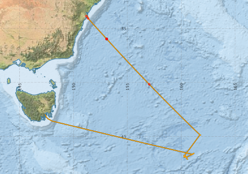
Voyage extents: 47° 08.8' S to 33° 49.7' S 147° 22.5' E to 161° 50.9' E Get voyage track shapefile Get CSV
Marlin Metadata:-
Participants - on ship:-
| Name | Role | Organisation |
|---|---|---|
| Bill Gauci | Deployment Mooring Engineer | Bureau of Meteorology |
| Hugh Barker | MNF Computing Support | CSIRO Oceans & Atmosphere - Hobart |
| Pamela Brodie | MNF Voyage Manager | CSIRO Oceans & Atmosphere - Hobart |
| Peter Dunn | MNF Electronics Support | CSIRO Oceans & Atmosphere - Hobart |
| Rod Palmer | MNF Electronics Support | CSIRO Oceans & Atmosphere - Hobart |
| Tara Martin | MNF Swath Mapping support | CSIRO Oceans & Atmosphere - Hobart |
| Thomas Alan | Chief Investigator | Bureau of Meteorology |
This list includes those that may have only been on part of the voyage. See voyage reports on 'Reports and Maps' tab for details.
Marine National Facility Reports - plans, summaries and data processing
-
SS2011_C01 Voyage Plan
- includes objectives, investigator details, proposed data collection, voyage track and equipment to be used.
-
SS2011_C01 Underway Data Processing Report
- details of data processing steps, calibration information, instruments used and any issues with the data.
-
SS2011_C01 Voyage Summary
- includes preliminary results, voyage narrative, types of data collected with C77/ROSCOP codes.
-
SS2011_C01 Scientific Highlight
- report of the key outputs
-

Publications, reports and datasets from this voyage.
Dataset
- Bakker, Dorothee C E; Pfeil, Benjamin; Smith, Karl; Hankin, Steven; Olsen, Are; Alin, Simone R; Cosca, Catherine E; Harasawa, Sumiko; Kozyr, Alexander; Nojiri, Yukihiro; O'Brien, Kevin M; Schuster, Ute; Telszewski, Maciej; Tilbrook, Bronte; Wada, Chisato; Akl, John; Barbero, Leticia; Bates, Nicolas R; Boutin, Jacqueline; Bozec, Yann; Cai, Wei-Jun; Castle, Robert D; Chavez, Francisco P; Chen, Lei; Chierici, Melissa; Currie, Kim I; de Baar, Hein J W; Evans, Wiley; Feely, Richard A; Fransson, Agneta; Gao, Zhongyong; Hales, Burke; Hardman-Mountford, Nicolas J; Hoppema, Mario; Huang, Wei-Jen; Hunt, Christopher W; Huss, Betty; Ichikawa, Tadafumi; Johannessen, Truls; Jones, Elizabeth M; Jones, Steve D; Jutterstrøm, Sara; Kitidis, Vassilis; Körtzinger, Arne; Landschützer, Peter; Lauvset, Siv K; Lefèvre, Nathalie; Manke, Ansley; Mathis, Jeremy T; Merlivat, Liliane; Metzl, Nicolas; Murata, Akihiko; Newberger, Timothy; Omar, Abdirahman M; Ono, Tsuneo; Park, Geun-Ha; Paterson, Kristina; Pierrot, Denis; Ríos, Aida F; Sabine, Christopher L; Saito, Shu; Salisbury, Joe; Sarma, Vedula V S S; Schlitzer, Reiner; Sieger, Rainer; Skjelvan, Ingunn; Steinhoff, Tobias; Sullivan, Kevin; Sun, Heng; Sutton, Adrienne; Suzuki, Toru; Sweeney, Colm; Takahashi, Taro; Tjiputra, Jerry; Tsurushima, Nobuo; van Heuven, Steven; Vandemark, Doug; Vlahos, Penny; Wallace, Douglas WR; Wanninkhof, Rik; Watson, Andrew J (2014): Surface Ocean CO2 Atlas (SOCAT) V2. PANGAEA, 10.1594/PANGAEA.811776
- Smith, S. R.,Lopez, N.,Bourassa, M. A. (2016) SAMOS air‐sea fluxes: 2005–2014. Geoscience Data Journal 3 pp9-19. 10.1002/gdj3.34
Search for publications, reports and datasets from this and other voyages
Data publishing
This is a list of online datasets hosted by CSIRO. Other processed datasets hosted by collaborating organisations may be found on the 'Metadata' or "Reports, Publications and Maps' tab.
Use the Get data link on the right to extract data using the NCMI Data Trawler.
| Data Stream | Data Summary | Get data | ||||||||||||||
|---|---|---|---|---|---|---|---|---|---|---|---|---|---|---|---|---|
| ADCP Data |
|
Get Data from Trawler Download NetCDF ss2011_c01_ADCP_nc.zip Overview ADCP Dataset HTML Download Processing Report ss2011_c01ADCP.pdf |
||||||||||||||
| Multibeam echosounder |
|
Get Data from Trawler |
||||||||||||||
| pCO2 |
|
External link - download datafile at IMOS |
||||||||||||||
| SOOP Bio-acoustics |
|
External link
Transect 2 - datafile at IMOS NetCDF Data Format: Manual Download |
||||||||||||||
| Underway |
|
Get Data from Trawler Download 5 sec NetCDF dataset ss2011_c01UWYnc.zip |
||||||||||||||
| XBT Profile |
|
Get Data from Trawler Download xbt_ascii_ma_2007_2012.zip (MEDS ASCII format ) Download xbt_nc_ss2007_2012.zip (NetCDF format) |
Deployments by start time:- Click on column header to sort. Use link on 'Deployment' to see full details. Use the CSV button at the bottom to export data (tab delimited).
Search for deployments from this voyage and others
| Deployment | Operation | Station | Cast | Gear | Project | Start and end times | Start Location | End Location | Depth range | Max Depth | Description | |||
|---|---|---|---|---|---|---|---|---|---|---|---|---|---|---|
| Underway System [details] | Air Temperature Sensor-HMT333,Barometer,Doppler speed log,Fluorometer WS3S-1203,Gill Ultrasonic Wind Sensor,Gill Ultrasonic Wind Sensor,Humidity Sensor-HMT333,IMOS Port Pyranometer-SN 35122F3,IMOS Port Radiometer-SN 35111F3,IMOS Stbd Pyranometer-SN 35123F3,IMOS Stbd Radiometer-SN 35093F3,IMOS rain gauge,IMOS rain gauge,Licor-UWQ 3708,RM Young 05106 wind monitor-75621,RM Young 05106 wind monitor-75621,RM Young 05106 wind monitor-75621,RM Young Rain Gauge,Remote Temperature (T)-SN 2621,Seapath 200,Seapath 200,Seapath 200,Simrad EK60 echosounder,ThermoSalinoGraph (TSG)-SS-SN 1777 | 2378 | 2011-04-05 06:06 | 2011-04-14 21:12 | -33.8633 | 151.1827 | -42.9413 | 147.3766 | ||||||
| ADCP Data [details] | RDI Ocean Surveyor Acoustic Doppler current profiler | 2378 | 2011-04-05 07:31 | 2011-04-10 12:07 | -34.0636 | 151.3475 | -46.9685 | 160.4859 | 781 | |||||
| XBT Cast [details] | Sippican Deep Blue | 2391 | 2011-04-05 22:18 | -35.9650 | 153.0682 | 1100.3 | ||||||||
| Multibeam echosounder [details] | EM300 Multibeam Echosounder | 2011-04-05 22:33 | 2011-04-14 12:04 | -35.9823 | 153.0840 | -43.2156 | 147.4978 | 5971 | ||||||
| XBT Cast [details] | Sippican Deep Blue | 2391 | 2011-04-05 22:35 | -35.9737 | 153.0762 | 1100.3 | ||||||||
| XBT Cast [details] | Sippican Deep Blue | 2391 | 2011-04-07 06:22 | -40.1682 | 157.0204 | 1100.3 | ||||||||