Survey details and related metadata, reports, events and data.
SS 05/95 (alternative identifier: SS199505)
Period: 1995-06-16 00:00 to 1995-06-23 00:00 UTC
Duration: 7.00 days
From: Weipa To: Weipa
Region: Gulf of Carpentaria
Ship: Southern Surveyor [details]
Description: Southern Surveyor cruise SS 05/95 was carried out in the area of the Northern Prawn Fishery in the Gulf of Carpentaria. Cruise objectives achieved included the investigation of the distribution and abundance of grooved tiger prawns, Penaeus semisulcatus using Florida Flyer prawn nets; comparison of an AusTED by catch reduction device and a standard codend; samples of P. semisulcatus were collected for genetic and isotope analyses; collected sediment samples with the Smith-MacIntyre grab; collected water samples for analysis and primary productivity experiments; data entry from the fish laboratory was streamlined and de-bugged and Leiognathids samples were collected to complete a PhD study (Jonathan Staunton Smith).
Leader: J. Salini (CSIRO)
Project: Tropical Prawn Ecology 1992-1995 [details]
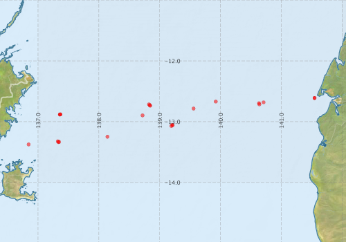
Voyage extents: 13° 20.2' S to 12° 41.7' S 137° 19.5' E to 140° 38.3' E
Marlin Metadata:-
Metadata from OBIS Australia datasets:- biological data is published via the OBIS-AU IPT server and delivered to one or more of OBIS, ALA and GBIF
Download from OBIS Australia IPT View at - Ocean Biodiversity Information System (OBIS) Atlas of Living Australia (ALA) GBIF
Participants - on ship:-
| Name | Role | Organisation |
|---|---|---|
| Don Heales | Prawns | CSIRO Fisheries |
| Jason McGilvray | Gear | Queensland Department of Primary Industries |
| John McCartie | Gear | Northern Territory Department of Primary Industry, Fisheries and Mines |
| John Salini | Cruise leader | CSIRO Fisheries |
| John Wallace | Fish | CSIRO Fisheries |
| Jonathan Staunton Smith | Fish | CSIRO Fisheries |
| Matt Sherlock | Electronics | CSIRO Fisheries |
| Michele Burford | Primary productivity | CSIRO Fisheries |
| Mick Haywood | Prawns | CSIRO Fisheries |
| Miroslaw Ryba | Computing | CSIRO Fisheries |
| Peter Rothlisberg | Primary productivity | CSIRO Fisheries |
| Ron Plaschke | Primary productivity | CSIRO Fisheries |
This list includes those that may have only been on part of the voyage. See voyage reports on 'Reports and Maps' tab for details.
Marine National Facility Reports - plans, summaries and data processing
-
SS199505 Voyage Summary
- includes preliminary results, voyage narrative, types of data collected with C77/ROSCOP codes.
-
SS199505 Voyage Plan
- includes objectives, investigator details, proposed data collection, voyage track and equipment to be used.
-

Publications, reports and datasets from this voyage.
IPT Resource
- Southern Surveyor Voyage SS 05/95 prawn survey in the Gulf of Carpentaria, Australia (Jun 1995) (Darwin Core Archive) External link to reference
Search for publications, reports and datasets from this and other voyages
Data publishing
This is a list of online datasets hosted by CSIRO. Other processed datasets hosted by collaborating organisations may be found on the 'Metadata' or "Reports, Publications and Maps' tab.
Use the Get data link on the right to extract data using the NCMI Data Trawler.
| Data Stream | Data Summary | Get data | ||||||||||
|---|---|---|---|---|---|---|---|---|---|---|---|---|
| Marine biodiversity observations and/or samples |
|
Get Data from Trawler Ship-based operations database (csv extracts) |
||||||||||
| CTD profile |
|
Get Data from Trawler Download dataset Processing report for this dataset |
||||||||||
| Hydrology |
|
Get Data from Trawler Download dataset |
Deployments by start time:- Click on column header to sort. Use link on 'Deployment' to see full details. Use the CSV button at the bottom to export data (tab delimited).
Search for deployments from this voyage and others
| Deployment | Operation | Station | Cast | Gear | Project | Start and end times | Start Location | End Location | Depth range | Max Depth | Description | |||
|---|---|---|---|---|---|---|---|---|---|---|---|---|---|---|
| Hydrology Cast [details] | 1 | 79 | 1995-06-16 22:57 | 1995-06-16 00:00 | -12.6113 | 141.5458 | 7 | |||||||
| Hydrology Cast [details] | 1 | 79 | 1995-06-16 23:55 | 1995-06-16 00:00 | -12.6113 | 141.5458 | 5 | |||||||
| CTD Cast / Hydrology [details] | 1 | Cast 3 | 79 | 1995-06-17 23:30 | 1995-06-17 23:36 | -12.6958 | 140.6330 | -12.7060 | 140.6367 | 0 | ||||
| Catch [details] | 4 | 1995-06-18 00:00 | -12.6450 | 140.9617 | 49 | |||||||||
| Catch [details] | 5 | 1995-06-18 00:00 | -12.6500 | 140.8667 | 55 | |||||||||
| Catch [details] | 6 | 1995-06-18 00:00 | -12.6500 | 140.7167 | 60 | |||||||||
| Catch [details] | 11 | 1995-06-18 00:00 | -12.7417 | 139.5417 | 57 | |||||||||
| Catch [details] | 12 | 1995-06-18 00:00 | -12.7433 | 139.4550 | 58 | |||||||||
| Catch [details] | 13 | 1995-06-18 00:00 | -12.7300 | 139.3317 | 56 | |||||||||
| Catch [details] | 14 | 1995-06-18 00:00 | -12.7467 | 139.2500 | 57 | |||||||||
| CTD Cast / Hydrology [details] | 1 | Cast 4 | 79 | 1995-06-18 00:03 | 1995-06-18 00:22 | -12.7150 | 140.6385 | -12.7252 | 140.6413 | 0 | ||||
| CTD Cast / Hydrology [details] | 1 | Cast 5 | 79 | 1995-06-18 23:08 | 1995-06-18 23:24 | -12.7293 | 138.8368 | -12.7242 | 138.8325 | 0 | ||||
| CTD Cast / Hydrology [details] | 1 | Cast 6 | 79 | 1995-06-18 23:58 | 1995-06-19 00:23 | -12.7155 | 138.8242 | -12.7088 | 138.8177 | 0 | ||||
| Catch [details] | 15 | 1995-06-19 00:00 | -12.7600 | 139.1483 | 55 | |||||||||
| Catch [details] | 16 | 1995-06-19 00:00 | -12.7600 | 139.0500 | 56 | |||||||||
| Catch [details] | 17 | 1995-06-19 00:00 | -12.7550 | 138.9500 | 54 | |||||||||
| Catch [details] | 18 | 1995-06-19 00:00 | -12.7583 | 138.8500 | 54 | |||||||||
| Catch [details] | 23 | 1995-06-19 00:00 | -12.8883 | 138.0700 | 49 | |||||||||
| Catch [details] | 24 | 1995-06-19 00:00 | -12.8750 | 137.9533 | 49 | |||||||||
| Hydrology Cast [details] | 1 | 79 | 1995-06-19 23:08 | 1995-06-19 00:00 | -12.8825 | 137.3590 | -99 | |||||||
| CTD Cast / Hydrology [details] | 1 | Cast 8 | 79 | 1995-06-19 23:44 | 1995-06-19 23:58 | -12.8792 | 137.3692 | -12.8780 | 137.3733 | 0 | ||||
| Catch [details] | 25 | 1995-06-20 00:00 | -12.8600 | 137.8500 | 48 | |||||||||
| Catch [details] | 27 | 1995-06-20 00:00 | -12.8517 | 137.6517 | 48 | |||||||||
| Catch [details] | 28 | 1995-06-20 00:00 | -12.8433 | 137.5583 | 48 | |||||||||
| Catch [details] | 29 | 1995-06-20 00:00 | -12.8467 | 137.4617 | 46 | |||||||||
| Catch [details] | 30 | 1995-06-20 00:00 | -12.8500 | 137.3500 | 46 | |||||||||
| Catch [details] | 35 | 1995-06-20 00:00 | -13.3400 | 136.8367 | 31 | |||||||||
| Catch [details] | 36 | 1995-06-20 00:00 | -13.3450 | 136.9383 | 38 | |||||||||
| CTD Cast / Hydrology [details] | 1 | Cast 9 | 79 | 1995-06-20 23:03 | 1995-06-20 23:14 | -13.3360 | 137.3352 | -13.3333 | 137.3333 | 0 | ||||
| CTD Cast / Hydrology [details] | 1 | Cast 10 | 79 | 1995-06-20 23:48 | 1995-06-20 23:59 | -13.3242 | 137.3255 | -13.3215 | 137.3222 | 0 | ||||
| Catch [details] | 26 | 1995-06-21 00:00 | -12.8800 | 137.7483 | 48 | |||||||||
| Catch [details] | 37 | 1995-06-21 00:00 | -13.3533 | 137.0567 | 43 | |||||||||
| Catch [details] | 38 | 1995-06-21 00:00 | -13.3567 | 137.1600 | 45 | |||||||||
| Catch [details] | 39 | 1995-06-21 00:00 | -13.3633 | 137.2633 | 46 | |||||||||
| Catch [details] | 40 | 1995-06-21 00:00 | -13.3450 | 137.2983 | 45 | |||||||||
| Catch [details] | 45 | 1995-06-21 00:00 | -13.2483 | 138.1417 | 51 | |||||||||
| Catch [details] | 46 | 1995-06-21 00:00 | -13.2517 | 138.2517 | 52 | |||||||||
| Catch [details] | 47 | 1995-06-21 00:00 | -13.2533 | 138.3533 | 52 | |||||||||
| Catch [details] | 48 | 1995-06-21 00:00 | -13.2467 | 138.4483 | 52 | |||||||||
| CTD Cast / Hydrology [details] | 1 | Cast 11 | 79 | 1995-06-21 23:34 | 1995-06-21 23:46 | -13.0597 | 139.2138 | -13.0580 | 139.2125 | 0 | ||||
| Catch [details] | 49 | 1995-06-22 00:00 | -13.2500 | 138.5433 | 54 | |||||||||
| Catch [details] | 50 | 1995-06-22 00:00 | -13.2550 | 138.6467 | 53 | |||||||||
| Catch [details] | 51 | 1995-06-22 00:00 | -13.2533 | 138.7433 | 54 | |||||||||
| Catch [details] | 52 | 1995-06-22 00:00 | -13.2550 | 139.8433 | 55 | |||||||||
| Catch [details] | 57 | 1995-06-22 00:00 | -12.6250 | 139.9400 | 60 | |||||||||
| Catch [details] | 58 | 1995-06-22 00:00 | -12.6433 | 59 | ||||||||||
| Catch [details] | 59 | 1995-06-22 00:00 | -12.6467 | 140.0833 | 60 | |||||||||
| CTD Cast / Hydrology [details] | 1 | Cast 12 | 79 | 1995-06-22 00:16 | 1995-06-22 00:30 | -13.0533 | 139.2068 | -13.0513 | 139.2038 | 0 | ||||
| Catch [details] | 60 | 1995-06-23 00:00 | -12.6517 | 140.1650 | 60 | |||||||||
| Catch [details] | 61 | 1995-06-23 00:00 | -12.6650 | 140.2750 | 61 | |||||||||
| Catch [details] | 62 | 1995-06-23 00:00 | -12.6550 | 140.3683 | 61 | |||||||||
| Sediment Sampling [details] | 7 | 79 | -12.6817 | 140.7083 | ||||||||||
| Sediment Sampling [details] | 10 | 79 | -12.7850 | 139.5567 | ||||||||||
| Sediment Sampling [details] | 19 | 79 | -12.7383 | 138.8433 | ||||||||||
| Sediment Sampling [details] | 22 | 79 | -12.8967 | 138.7183 | ||||||||||
| Sediment Sampling [details] | 31 | 79 | -12.8817 | 137.3600 | ||||||||||
| Sediment Sampling [details] | 34 | 79 | -13.3750 | 136.8450 | ||||||||||
| Sediment Sampling [details] | 41 | 79 | -13.3333 | 137.3467 | ||||||||||
| Sediment Sampling [details] | 44 | 79 | -13.2483 | 138.1417 | ||||||||||
| Sediment Sampling [details] | 53 | 79 | -13.0717 | 139.1917 | ||||||||||
| Sediment Sampling [details] | 56 | 79 | -12.6700 | 139.9217 | ||||||||||