Survey details and related metadata, reports, events and data.
SO 5/87 (alternative identifier: SO198705)
Period: 1987-07-09 00:00 to 1987-07-22 00:00 Local
Duration: 13.00 days
Region: Tasmania (E and W)
Ship: Soela [details]
Description: Soela cruise SO 5/87 was undertaken to carry out an acoustic and demersal trawl survey for orange roughy in waters off eastern and western Tasmania, with particular reference to the St Patrick's Head and Sandy Cape orange roughy grounds. Cruise aims included to estimate, by acoustic survey, the volume of orange roughy schools found on the fishing grounds (no acoustic "marks" which could be positively attributed to orange roughy were detected on either ground); to determine, by target trawling, the density of orange roughy biomass in those schools (target trawling failed to verify the presence of fish associated with the "marks"); to investigate by pelagic trawling, the distribution of juvenile orange roughy and their relationship to adult schools (no juveniles were caught); to collect biological information on the roughy caught; to sample for orange roughy eggs and larvae if adults caught are in spawning or spent condition (adult roughy off St Patrick's head were nearing spawning condition but not close enough to attempt any sampling for eggs or larvae); to collect environmental data when appropriate, particularly salinity samples between Storm Bay and Sandy Cape; to collect bathymetric data to improve existing charts (no improvements were made to existing charts) and to sample for blue grenadier larvae.
Leader: N. Elliott (CSIRO)
Project: Abundance, distribution, movements and population dynamics of orange roughy in southeast Australian waters (FIRTA project no. 87/129) 1987-1990 [details]
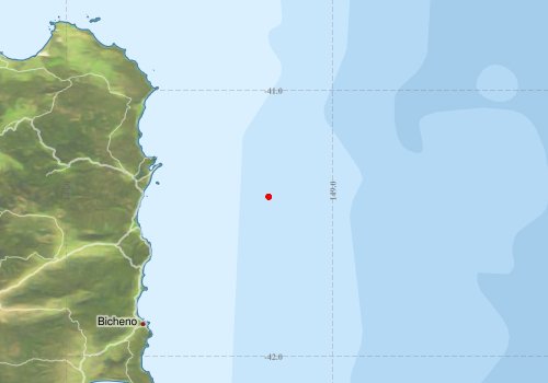
Voyage extents: 41° 24.0' S to 41° 24.0' S 148° 45.6' E to 148° 45.6' E
Marlin Metadata:-
Metadata from OBIS Australia datasets:- biological data is published via the OBIS-AU IPT server and delivered to one or more of OBIS, ALA and GBIF
Download from OBIS Australia IPT View at - Ocean Biodiversity Information System (OBIS) Atlas of Living Australia (ALA) GBIF
Download from OBIS Australia IPT View at - Ocean Biodiversity Information System (OBIS) Atlas of Living Australia (ALA) GBIF
Participants:- no records
Marine National Facility Reports - plans, summaries and data processing
- View the Survey plan - includes objectives, investigator details, proposed data collection, voyage track and equipment to be used.
- View the Survey Summary report - includes preliminary results, voyage narrative, types of data collected with C77/ROSCOP codes.
- There is no map for this survey.
Publications, reports and datasets from this voyage.
Journal Article
- Ahyong, S. T. and Poore, G. C. B. (2004) Deep-water Galatheidae (Crustacea : Decapoda : Anomura) from southern and eastern Australia. Zootaxa 1-76 10.11646/zootaxa.472.1.1
- Ahyong, S. T. and Poore, G. C. B. (2004) The Chirostylidae of southern Australia (Crustacea : Decapoda : Anomura). Zootaxa 1-88 10.11646/zootaxa.436.1.1
Search for publications, reports and datasets from this and other voyages
Data publishing
This is a list of online datasets hosted by CSIRO. Other processed datasets hosted by collaborating organisations may be found on the 'Metadata' or "Reports, Publications and Maps' tab.
Use the Get data link on the right to extract data using the NCMI Data Trawler.
| Data Stream | Data Summary | Get data | ||||||
|---|---|---|---|---|---|---|---|---|
| Marine biodiversity observations and/or samples |
|
Get Data from Trawler |
Deployments by start time:- Click on column header to sort. Use link on 'Deployment' to see full details. Use the CSV button at the bottom to export data (tab delimited).
Search for deployments from this voyage and others
| Deployment | Operation | Station | Cast | Gear | Project | Start and end times | Start Location | End Location | Depth range | Max Depth | Description | |||
|---|---|---|---|---|---|---|---|---|---|---|---|---|---|---|
| Trawl [details] | 4 | Engel demersal high lift | 533 | 1987-07-10 12:00 | -41.4000 | 148.7600 | Orange roughy demersal trawl | |||||||
| Trawl [details] | 5 | Engel demersal high lift | 533 | 1987-07-10 12:00 | -41.4000 | 148.7600 | Orange roughy demersal trawl | |||||||
| Trawl [details] | 6 | Engel demersal high lift | 533 | 1987-07-11 12:00 | -41.4000 | 148.7600 | Orange roughy demersal trawl | |||||||
| Trawl [details] | 7 | Engel demersal high lift | 533 | 1987-07-12 12:00 | -41.4000 | 148.7600 | Orange roughy demersal trawl | |||||||
| Trawl [details] | 8 | Engel demersal high lift | 533 | 1987-07-12 12:00 | -41.4000 | 148.7600 | Orange roughy demersal trawl | |||||||
| Trawl [details] | 9 | Engel demersal high lift | 533 | 1987-07-12 12:00 | -41.4000 | 148.7600 | Orange roughy demersal trawl | |||||||
| Trawl [details] | 10 | Engel demersal high lift | 533 | 1987-07-16 12:00 | -41.4000 | 148.7600 | Orange roughy demersal trawl | |||||||
| Trawl [details] | 11 | Engel demersal high lift | 533 | 1987-07-16 12:00 | -41.4000 | 148.7600 | Orange roughy demersal trawl | |||||||
| Trawl [details] | 12 | Engel demersal high lift | 533 | 1987-07-17 12:00 | -41.4000 | 148.7600 | Orange roughy demersal trawl | |||||||
| Trawl [details] | 13 | Engel demersal high lift | 533 | 1987-07-17 12:00 | -41.4000 | 148.7600 | Orange roughy demersal trawl | |||||||
| Trawl [details] | 14 | Engel demersal high lift | 533 | 1987-07-17 12:00 | -41.4000 | 148.7600 | Orange roughy demersal trawl | |||||||
| Trawl [details] | 15 | Engel demersal high lift | 533 | 1987-07-17 12:00 | -41.4000 | 148.7600 | Orange roughy demersal trawl | |||||||