Survey details and related metadata, reports, events and data.
SO 2/87 (alternative identifier: SO198702)
Period: 1987-04-01 00:00 to 1987-04-14 00:00 Local
Duration: 13.00 days
Region: W and NE Tasmania
Ship: Soela [details]
Description: Soela cruise SO 2/87 was undertaken for an orange roughy survey in the west and northeast Tasmanian waters, with particular reference to the Sandy Cape orange roughy gound centred on the position 41 degrees 13'S, 144 degrees E. Cruise aims were to locate and estimate the weight of orange roughy (using echo surveys and demersal trawl hauls) and to carry out a bathymetric survey of the Sandy Cape grounds. To collect biological information on the orange roughy caught and to carry out tagging trials with the trawl caught roughy. Also to collect environmental data when appropriate.
Leader: F. Harden Jones (CSIRO)
Project: Abundance, distribution, movements and population dynamics of orange roughy in southeast Australian waters (FIRTA project no. 87/129) 1987-1990 [details]
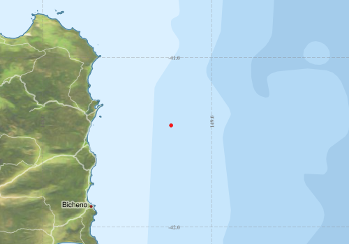
Voyage extents: 41° 24.0' S to 41° 24.0' S 148° 45.6' E to 148° 45.6' E
Marlin Metadata:-
Metadata from OBIS Australia datasets:- biological data is published via the OBIS-AU IPT server and delivered to one or more of OBIS, ALA and GBIF
Download from OBIS Australia IPT View at - Ocean Biodiversity Information System (OBIS) Atlas of Living Australia (ALA) GBIF
Download from OBIS Australia IPT View at - Ocean Biodiversity Information System (OBIS) Atlas of Living Australia (ALA) GBIF
Participants:- no records
Marine National Facility Reports - plans, summaries and data processing
- View the Survey plan - includes objectives, investigator details, proposed data collection, voyage track and equipment to be used.
- View the Survey Summary report - includes preliminary results, voyage narrative, types of data collected with C77/ROSCOP codes.
-

Search for publications, reports and datasets from this and other voyages
Data publishing
This is a list of online datasets hosted by CSIRO. Other processed datasets hosted by collaborating organisations may be found on the 'Metadata' or "Reports, Publications and Maps' tab.
Use the Get data link on the right to extract data using the NCMI Data Trawler.
| Data Stream | Data Summary | Get data | ||||||
|---|---|---|---|---|---|---|---|---|
| Marine biodiversity observations and/or samples |
|
Get Data from Trawler |
Deployments by start time:- Click on column header to sort. Use link on 'Deployment' to see full details. Use the CSV button at the bottom to export data (tab delimited).
Search for deployments from this voyage and others
| Deployment | Operation | Station | Cast | Gear | Project | Start and end times | Start Location | End Location | Depth range | Max Depth | Description | |||
|---|---|---|---|---|---|---|---|---|---|---|---|---|---|---|
| Trawl [details] | 15 | Engel demersal high lift | 533 | 1987-04-13 12:00 | -41.4000 | 148.7600 | Orange roughy demersal trawl | |||||||
| Trawl [details] | 16 | Engel demersal high lift | 533 | 1987-04-13 12:00 | -41.4000 | 148.7600 | Orange roughy demersal trawl | |||||||
| Trawl [details] | 17 | Engel demersal high lift | 533 | 1987-04-13 12:00 | -41.4000 | 148.7600 | Orange roughy demersal trawl | |||||||