Survey details and related metadata, reports, events and data.
SO 4/85 (alternative identifier: SO198504)
Period: 1985-07-18 00:00 to 1985-08-28 00:00 Local
Duration: 41.00 days
Region: Tasmanian waters, E Bass Strait, E Great Australian Bight, southern NSW
Ship: Soela [details]
Description: Soela cruise SO 4/85 was undertaken for a demersal fish survey including blue grenadier and ichthyoplankton sampling in Tasmanian, eastern Bass Strait, eastern Great Australian Bight and southern NSW waters. Leg 1 cruise objectives were to test and calibrate the radio direction finder. To sample ichthyoplankton along standard transects around Tasmania. To deploy and track for 48 hours a buoyed drogue (including 24 hour sampling of larvae around the drogue) and to deploy surface drifter cards in the blue grenadier spawning area on the west coast of Tasmania. Also to conduct hydrological sampling in the area. Leg 2 cruise objectives were to carry out ichthyoplankton sampling on the continental shelf break between Eden and the eastern Great Australian Bight. Demersal fish sampling for MSL as part of an ongoing biological programme. Adult blue grenadier sampling from SA trawl grounds. Neuston sampling from Bass Strait and to collect ovarian tissue samples from commercial fishes for analysis by CSIRO Division of Food Research.
Leader: R. Thresher & J. Gunn (CSIRO)
Project: "Soela" fish surveys, 1980s [details]
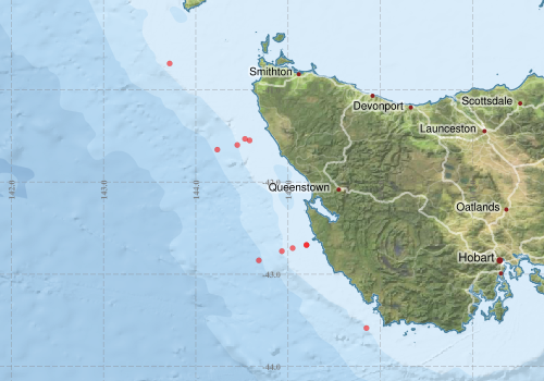
Voyage extents: 43° 35.0' S to 40° 43.0' S 143° 43.0' E to 145° 51.0' E
Marlin Metadata:-
Metadata from OBIS Australia datasets:- biological data is published via the OBIS-AU IPT server and delivered to one or more of OBIS, ALA and GBIF
Download from OBIS Australia IPT View at - Ocean Biodiversity Information System (OBIS) Atlas of Living Australia (ALA) GBIF
Participants:- no records
Marine National Facility Reports - plans, summaries and data processing
- View the Survey plan - includes objectives, investigator details, proposed data collection, voyage track and equipment to be used.
- There is no map for this survey.
Search for publications, reports and datasets from this and other voyages
Data publishing
This is a list of online datasets hosted by CSIRO. Other processed datasets hosted by collaborating organisations may be found on the 'Metadata' or "Reports, Publications and Maps' tab.
Use the Get data link on the right to extract data using the NCMI Data Trawler.
| Data Stream | Data Summary | Get data | ||||||||||||
|---|---|---|---|---|---|---|---|---|---|---|---|---|---|---|
| Marine biodiversity observations and/or samples |
|
Get Data from Trawler |
||||||||||||
| Hydrology |
|
Get Data from Trawler |
Deployments by start time:- Click on column header to sort. Use link on 'Deployment' to see full details. Use the CSV button at the bottom to export data (tab delimited).
Search for deployments from this voyage and others
| Deployment | Operation | Station | Cast | Gear | Project | Start and end times | Start Location | End Location | Depth range | Max Depth | Description | |||
|---|---|---|---|---|---|---|---|---|---|---|---|---|---|---|
| Hydrology Cast [details] | 1 | 35 | 1985-07-20 18:40 | 1985-07-20 19:15 | -43.5833 | 145.8500 | 146 | |||||||
| Hydrology Cast [details] | 1 | 35 | 1985-07-21 13:36 | 1985-07-21 13:49 | -42.6833 | 145.2000 | 71 | |||||||
| Hydrology Cast [details] | 1 | 35 | 1985-07-22 10:00 | 1985-07-22 10:16 | -41.5333 | 144.5333 | 64 | |||||||
| Hydrology Cast [details] | 1 | 35 | 1985-07-22 11:57 | 1985-07-22 12:08 | -41.5500 | 144.5833 | 75 | |||||||
| Hydrology Cast [details] | 1 | 35 | 1985-07-22 15:40 | 1985-07-22 15:55 | -41.6000 | 144.4500 | 125 | |||||||
| Hydrology Cast [details] | 1 | 35 | 1985-07-22 18:30 | 1985-07-22 19:30 | -41.6500 | 144.2333 | 1389 | |||||||
| Hydrology Cast [details] | 1 | 35 | 1985-07-23 06:37 | 1985-07-23 06:55 | -40.7167 | 143.7167 | 145 | |||||||
| Hydrology Cast [details] | 1 | 35 | 1985-07-24 06:00 | 1985-07-24 06:14 | -42.6833 | 145.2000 | 77 | |||||||
| Hydrology Cast [details] | 1 | 35 | 1985-07-24 08:00 | 1985-07-24 08:16 | -42.7167 | 145.0500 | 74 | |||||||
| Hydrology Cast [details] | 1 | 35 | 1985-07-24 10:03 | 1985-07-24 10:21 | -42.7500 | 144.9333 | 142 | |||||||
| Hydrology Cast [details] | 1 | 35 | 1985-07-24 13:12 | 1985-07-24 15:02 | -42.8500 | 144.6833 | 1327 | |||||||