Survey details and related metadata, reports, events and data.
SO 1/85 (alternative identifier: SO198501)
Period: 1985-01-23 00:00 to 1985-02-22 00:00 Local
Duration: 30.00 days
Region: W and NW Tasmania, E Bass Strait and E Tasmania
Ship: Soela [details]
Description: Soela cruise SO 1/85 was undertaken for fish and hydrological sampling in Tasmanian waters and east Bass Strait. Leg 1 cruise objectives were to conduct sampling for blue grenadier from off the south, west and north west coasts of Tasmania and from the eastern Bass Strait. To sample ichthyoplankton on the transects around Tasmania and to conduct routine hydrology and phytoplankton studies on those transects. To sample bottom fish in the eastern Bass Strait and to conduct seabird observations during the cruise. Leg 2 cruise objectives were to conduct demersal, pelagic and larval fish sampling in the core study area, 11.7 nm east off Mistaken Cape on the east coast of Tasmania. Also to conduct hydrology transects, zooplankton sampling, collect lanternfish for heavy metal analysis, and to photograph demersal and midwater fish.
Leader: T. Kenchington & J. Young (CSIRO)
Project: "Soela" fish surveys, 1980s [details]
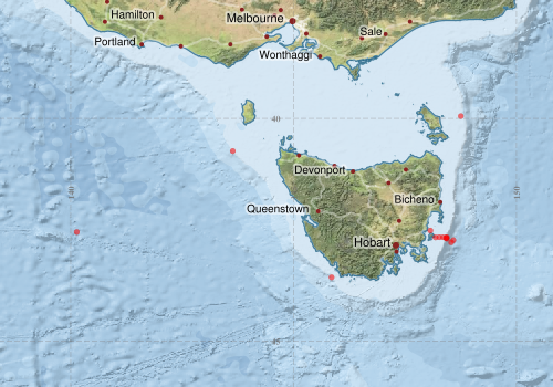
Voyage extents: 43° 34.0' S to 39° 57.0' S 140° 08.0' E to 148° 45.0' E
Marlin Metadata:-
Metadata from OBIS Australia datasets:- biological data is published via the OBIS-AU IPT server and delivered to one or more of OBIS, ALA and GBIF
Download from OBIS Australia IPT View at - Ocean Biodiversity Information System (OBIS) Atlas of Living Australia (ALA) GBIF
Participants:- no records
Marine National Facility Reports - plans, summaries and data processing
- View the Survey plan - includes objectives, investigator details, proposed data collection, voyage track and equipment to be used.
- There is no map for this survey.
Search for publications, reports and datasets from this and other voyages
Data publishing
This is a list of online datasets hosted by CSIRO. Other processed datasets hosted by collaborating organisations may be found on the 'Metadata' or "Reports, Publications and Maps' tab.
Use the Get data link on the right to extract data using the NCMI Data Trawler.
| Data Stream | Data Summary | Get data | ||||||||||||
|---|---|---|---|---|---|---|---|---|---|---|---|---|---|---|
| Marine biodiversity observations and/or samples |
|
Get Data from Trawler |
||||||||||||
| Hydrology |
|
Get Data from Trawler |
Deployments by start time:- Click on column header to sort. Use link on 'Deployment' to see full details. Use the CSV button at the bottom to export data (tab delimited).
Search for deployments from this voyage and others
| Deployment | Operation | Station | Cast | Gear | Project | Start and end times | Start Location | End Location | Depth range | Max Depth | Description | |||
|---|---|---|---|---|---|---|---|---|---|---|---|---|---|---|
| Hydrology Cast [details] | 1 | 35 | 1985-01-24 11:32 | 1985-01-24 12:01 | -43.5667 | 145.8500 | 165 | |||||||
| Hydrology Cast [details] | 1 | 35 | 1985-01-27 19:20 | 1985-01-27 19:58 | -40.7333 | 143.6333 | 136 | |||||||
| Hydrology Cast [details] | 1 | 35 | 1985-02-02 01:57 | 1985-02-02 01:57 | -39.9500 | 148.7500 | 100 | |||||||
| Hydrology Cast [details] | 1 | 35 | 1985-02-12 13:45 | 1985-02-12 14:15 | -42.6700 | 148.1817 | 78 | |||||||
| Hydrology Cast [details] | 1 | 35 | 1985-02-12 15:25 | 1985-02-12 15:55 | -42.6667 | 148.2667 | 93 | |||||||
| Hydrology Cast [details] | 1 | 35 | 1985-02-12 16:50 | 1985-02-12 16:55 | -42.6667 | 148.3500 | 100 | |||||||
| Hydrology Cast [details] | 1 | 35 | 1985-02-12 18:30 | 1985-02-12 18:43 | -42.6833 | 148.4167 | 267 | |||||||
| Hydrology Cast [details] | 1 | 35 | 1985-02-12 21:05 | 1985-02-12 22:45 | -42.7833 | 148.5333 | 801 | |||||||
| Hydrology Cast [details] | 1 | 35 | 1985-02-13 00:15 | 1985-02-13 00:45 | -42.7333 | 148.5833 | 775 | |||||||
| Hydrology Cast [details] | 1 | 35 | 1985-02-17 09:30 | 1985-02-17 09:55 | -42.5500 | 140.1333 | 51 | |||||||
| Hydrology Cast [details] | 1 | 35 | 1985-02-17 10:23 | 1985-02-17 10:40 | -42.5167 | 148.0667 | 40 | |||||||
| Hydrology Cast [details] | 1 | 35 | 1985-02-17 21:10 | 1985-02-17 22:45 | -42.6667 | 148.4333 | 386 | |||||||
| Hydrology Cast [details] | 1 | 35 | 1985-02-17 22:50 | 1985-02-17 00:05 | -42.7000 | 148.4333 | 394 | |||||||
| Hydrology Cast [details] | 1 | 35 | 1985-02-21 10:10 | 1985-02-21 11:40 | -42.6833 | 148.4250 | 369 | |||||||