Voyage details and related metadata, reports, events and data.
IN2022_V02
- is a Marine National Facility ![]() voyage
voyage
Title: Sedimentation at its extreme: how powerful are submarine caldera-forming eruptions (Kermadec arc)?
Period: 2022-03-18 22:00 to 2022-04-19 02:00 UTC
Duration: 31.17 days
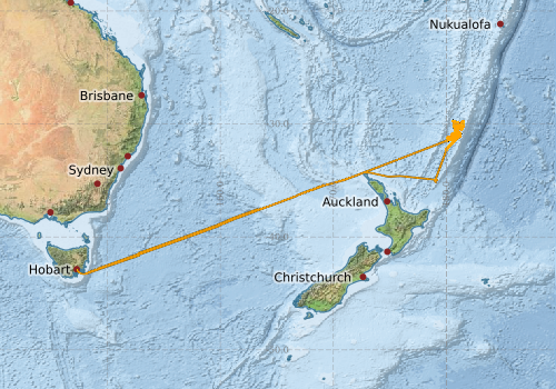
From: Hobart To: Hobart
Region: Derwent Estuary; Tasmania coast; Tasman Sea; New Zealand coast; Southwest Pacific Ocean
Ship: Investigator (RV) [details]
Description: The aim of this project is to link the behaviour of deep submarine eruptions with the morphology of their deposits. Modelling calculations of sediment mass fluxes will permit the first-ever hazard mapping scheme for submarine volcanoes globally (tsunami and sediment flows), and provide new ore vectoring strategies for exploration in Australia. For operational reasons the publication of the voyage plan has been postponed.
Leader: Dr Jutzeler (UTAS)
Projects:
-
Sedimentation at its extreme: how powerful are submarine caldera-forming eruptions (Kermadec arc)?
[details] Primary
-
BGC and Standard Argo float deployments [details] Piggy-back
-
Natural iron fertilisation of oceans around Australia: Linking terrestrial dust and bushfires to marine biogeochemistry [details] Piggy-back
Underway data from NRUD - see this voyage
Voyage extents: 43° 17.1' S to 29° 44.0' S 147° 20.3' E to 178° 29.7' W Get voyage track shapefile Get CSV
Marlin Metadata:-
Cruise Summary Report at SeaDataNet:-
Participants - on ship:-
| Name | Role | Organisation | Project |
|---|---|---|---|
| Martin Jutzeler | Chief Scientist | University of Tasmania | Sedimentation at its extreme: how powerful are submarine caldera-forming eruptions (Kermadec arc)? |
| Steffen Kutterolf | Alt. Chief Scientist (sediment) | GEOMAR - Helmholtz Centre for Ocean Research Kiel (DE) | Sedimentation at its extreme: how powerful are submarine caldera-forming eruptions (Kermadec arc)? |
Participants - shore based:-
| Name | Role | Organisation | Project |
|---|---|---|---|
| Adam Soule | PI | University of Rhode Island (URI, USA) | Sedimentation at its extreme: how powerful are submarine caldera-forming eruptions (Kermadec arc)? |
| Andrew Bowie | PI - piggyback | University of Tasmania - Hobart | Natural iron fertilisation of oceans around Australia: Linking terrestrial dust and bushfires to marine biogeochemistry |
| Craig Hanstein | PI - piggyback | CSIRO Oceans & Atmosphere - Hobart | BGC and Standard Argo float deployments |
| Geoffroy Lamarche | PI | Office of the Parliamentary Commissioner for the Environment (NZ) | Sedimentation at its extreme: how powerful are submarine caldera-forming eruptions (Kermadec arc)? |
| Joanne Whittaker | PI | University of Tasmania - Institute of Marine and Antarctic Studies | Sedimentation at its extreme: how powerful are submarine caldera-forming eruptions (Kermadec arc)? |
| Michael Manga | PI | University of California at Berkeley (USA) | Sedimentation at its extreme: how powerful are submarine caldera-forming eruptions (Kermadec arc)? |
| Peter Strutton | PI - piggyback | University of Tasmania | BGC and Standard Argo float deployments |
| Rebecca Carey | PI | University of Tasmania | Sedimentation at its extreme: how powerful are submarine caldera-forming eruptions (Kermadec arc)? |
| Richard Wysoczanski | PI | Sedimentation at its extreme: how powerful are submarine caldera-forming eruptions (Kermadec arc)? | |
| Scott Meyerink | PI - piggyback | University of Tasmania - Hobart | Natural iron fertilisation of oceans around Australia: Linking terrestrial dust and bushfires to marine biogeochemistry |
This list includes those that may have only been on part of the voyage. See voyage reports on 'Reports and Maps' tab for details.
Marine National Facility Reports - plans, summaries and data processing
-
IN2022_V02 ADCP Data Processing Report
- details of data processing steps, calibration information, instruments used and any issues with the data.
-
IN2022_V02 Underway Data Processing Report
- details of data processing steps, calibration information, instruments used and any issues with the data.
-
IN2022_V02 Voyage Plan
- includes objectives, investigator details, proposed data collection, voyage track and equipment to be used.
-
IN2022_V02 Scientific Highlights
- report of the key outputs
-
IN2022_V02 Voyage Summary
- includes preliminary results, voyage narrative, types of data collected with C77/ROSCOP codes.
- View Survey map
Publications, reports and datasets from this voyage.
Dataset
- Jutzeler, Martin; Nau, Amy; Boyd, Matt; Navidad, Cisco (2024): IN2022_V02 Kermadec Volcanic Arc Bathymetry 10m - 210m Multi-resolution AusSeabed products. v1. CSIRO. Data Collection. 10.25919/9re0-rc76
- Tilbrook, Bronte; Neill, Craig; Akl, John (2022). Integrated Marine Observing System (IMOS) sea surface and atmospheric fCO2 measurements in the Southern Ocean, South Pacific, Indian Ocean onboard R/V Investigator in 2022 (NCEI Accession 0276052). [indicate subset used]. NOAA National Centers for Environmental Information. Dataset. https://doi.org/10.25921/q8dm-8763. 10.25921/q8dm-8763
Journal Article
- Frey, S. E., Jutzeler, M., Cartigny, M., & Carey, R. J. (2026). Large-scale submarine sediment waves at Macauley caldera volcano: In situ evidence of high-flux, syn-eruptive submarine transport. Geochemistry, Geophysics, Geosystems, 27, e2025GC012492 10.1029/2025gc012492
- Frey, Shannon E.,Jutzeler, Martin,Carey, Rebecca J.,Harris, Peter T. (2025) In-situ sedimentary evidence of complex bottom currents at a modern deepwater seamount. Communications Earth & Environment 6 pp-. 10.1038/s43247-025-02690-7
- Lucieer, Vanessa,Flukes, Emma,Monk, Jacquomo,Walsh, Peter (2024) Geomorphometric maps of Australia’s Marine Park estate and their role in improving the integrated monitoring and management of marine ecosystems. Frontiers in Marine Science 10 pp-. 10.3389/fmars.2023.1302108
- Verhoeff, Tristan Joseph,O'Shea, Steve (2025) A new southern hemisphere species of Cirroteuthis (Octopoda: Cirrata: Cirroteuthidae), and re-evaluation of the taxonomic status of Cirroteuthis hoylei Robson, 1932. Folia Malacologica 33 pp-. 10.12657/folmal.033.003
Search for publications, reports and datasets from this and other voyages
Data publishing
This is a list of online datasets hosted by CSIRO. Other processed datasets hosted by collaborating organisations may be found on the 'Metadata' or "Reports, Publications and Maps' tab.
Use the Get data link on the right to extract data using the NCMI Data Trawler.
| Data Stream | Data Summary | Get data | ||||||||||||
|---|---|---|---|---|---|---|---|---|---|---|---|---|---|---|
| ADCP Data |
|
Get Data from Trawler Download overview plots of collected OS75nb ADCP data Download the 5 minute ADCP os150nb Data (NetCDF format) Download the 5 minute ADCP os75nb Data (NetCDF format) Download overview plots of collected OS150nb ADCP data |
||||||||||||
| Multibeam echosounder |
|
Get Data from Trawler |
||||||||||||
| pCO2 |
|
External link - download datafile at IMOS Data fields and units document (.pdf) |
||||||||||||
| Sub-bottom profiler |
|
Get Data from Trawler |
||||||||||||
| SOOP Bio-acoustics |
|
External link
Transect 2 - datafile at IMOS NetCDF Data Format: Manual Download |
||||||||||||
| Underway |
|
Get Data from Trawler Download the 5 minute Underway data (CSV format) Download the 1 minute Underway data (CSV format) Download the 5 second Underway data (netCDF format) Download the 5 second Underway data (CSV format) Download the 10-second Underway data (CSV format) Download the TSG Calibration Data (CSV format) |
| ID | When (UTC) | Lat | Long | Instrument | Identifier | Action | Log | Subject / Comment |
|---|
Deployments by start time:- Click on column header to sort. Use link on 'Deployment' to see full details. Use the CSV button at the bottom to export data (tab delimited).
Search for deployments from this voyage and others
| Deployment | Operation | Station | Cast | Gear | Project | Start and end times | Start Location | End Location | Depth range | Max Depth | Description | |||
|---|---|---|---|---|---|---|---|---|---|---|---|---|---|---|
| Underway System [details] | Air Sampling Inlet Mode,Air Temperature Sensor - ROTRONIC T&RH HC2A-S3,Air Temperature Sensor - ROTRONIC T&RH HC2A-S3,Air Temperature Sensor - ROTRONIC T&RH HC2A-S3,Air Temperature Sensor - ROTRONIC T&RH HC2A-S3,Burket Flow meter,Burket Flow meter,CSIRO Hobart pCO2,CSIRO Hobart pCO2,CSIRO Hobart pCO2,CSIRO Hobart pCO2,CSIRO Hobart pCO2,CSIRO Hobart pCO2,CSIRO Hobart pCO2,CSIRO Hobart pCO2,CSIRO Hobart pCO2,CSIRO Hobart pCO2,CSIRO air sampling inlet,CSIRO air sampling inlet,Depth: TECHSAS-DERIVED. For more information contact the Data Acquisition and Processing group.,Fluorometer Concentration,Fluorometer WSCHL-1441,Gyrocompass,IMOS Port Pyranometer-SN 35122F3,IMOS Port Radiometer-SN 35093F3,IMOS Stbd Pyranometer-SN 29125F3,IMOS Stbd Radiometer-SN 29140F3,IMOS wind monitor,IMOS wind monitor,IMOS wind monitor,IMOS wind monitor,ISAR SST,Kobold MIK-C Flow meter,Kobold MIK-C Fluorometer Flow Meter,Kongsberg Maritime Skipper DL850 doppler log,Kongsberg Maritime Skipper DL850 doppler log,Kongsberg Maritime Skipper DL850 doppler log,Kongsberg Maritime Skipper DL850 doppler log,Kongsberg Maritime Skipper DL850 doppler log,Kongsberg Maritime Skipper DL850 doppler log,LI-COR LI-190 Quantum Sensor,LI-COR LI-190 Quantum Sensor,MAAP Status,Multiangle Absorption Photometer (MAAP),Multiangle Absorption Photometer (MAAP),Optode Dissolved Oxygen Concentration,Optode Dissolved Oxygen Saturation,Optode Water Temperature,Ozone Monitor RVT1,Ozone Monitor RVT1,Ozone Monitor RVT2,Ozone Monitor RVT2,Picarro Greenhouse Gas Spectrometer CO2,CH4,H2o,Picarro Greenhouse Gas Spectrometer CO2,CH4,H2o,Picarro Greenhouse Gas Spectrometer CO2,CH4,H2o,Port Rain Gauge,Port drop keel sensor,RM Young 05106 wind monitor,RM Young 05106 wind monitor,RM Young Wind Sensor Type 05106,RM Young Wind Sensor Type 05106,RM Young Wind Sensor Type 05106,RM Young Wind Sensor Type 05106,RM Young Wind Sensor Type 05106,RM Young Wind Sensor Type 05106,RM Young Wind Sensor Type 05106,Remote Temperature (T) - SN 1061,Seapath 330+,Seapath 330+,Seapath 330+,Seapath 330+,Starboard Rain Gauge,Starboard drop keel sensor,ThermoSalinoGraph (TSG)-SN 3439,ThermoSalinoGraph (TSG)-SN 3439,Vaisala Ship's Barometer PTB330 | 2022-03-18 22:45 | 2022-04-19 00:38 | -42.8864 | 147.3388 | |||||||||
| ADCP Data [details] | Teledyne RDI ADCP 75 kHz | 2549 | 2022-03-19 00:27 | 2022-04-18 22:16 | -43.1091 | 147.4713 | -43.1020 | 147.4598 | 798 | |||||