Voyage details and related metadata, reports, events and data.
ST 03/2007
(alternative identifier: ST200703)
- is a Marine National Facility ![]() voyage
voyage
Period: 2007-04-30 00:00 to 2007-05-09 00:00 UTC
Duration: 9.00 days
From: Hobart To: Fremantle
Region: Great Australian Bight
Ship: Southern Surveyor [details]
Description: Transit from Hobart to Fremantle. During a scheduled transit from Hobart to Fremantle three Apex Profiler floats were deployed, a short section of ocean floor was sub-bottom profiled, a new CMAR PCO2 system was calibrated and a standard underway dataset was collected
Project: Southern Surveyor - general vessel operations, gear trials, etc. [details]
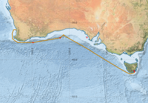
Voyage extents: 43° 49.9' S to 31° 55.6' S 114° 37.6' E to 147° 29.8' E
Metadata - No Marlin metadata records found or has not been linked to this survey or potentially the metadata catalogue is offline.
Participants - on ship:-
| Name | Role | Organisation |
|---|---|---|
| no docs found | CSIRO Oceans & Atmosphere - Hobart |
This list includes those that may have only been on part of the voyage. See voyage reports on 'Reports and Maps' tab for details.
Marine National Facility Reports - plans, summaries and data processing
-
ST200703 Underway Data Processing Report
- details of data processing steps, calibration information, instruments used and any issues with the data.
-

Publications, reports and datasets from this voyage.
Journal Article
- Power, H. E.,Clarke, S. L. (2019) 3D seismic-derived bathymetry: a quantitative comparison with multibeam data. Geo-Marine Letters 39 pp447-467. 10.1007/s00367-019-00596-w
Search for publications, reports and datasets from this and other voyages
Data publishing
This is a list of online datasets hosted by CSIRO. Other processed datasets hosted by collaborating organisations may be found on the 'Metadata' or "Reports, Publications and Maps' tab.
Use the Get data link on the right to extract data using the NCMI Data Trawler.
| Data Stream | Data Summary | Get data | ||||||||||||
|---|---|---|---|---|---|---|---|---|---|---|---|---|---|---|
| Multibeam echosounder |
|
Get Data from Trawler |
||||||||||||
| Underway |
|
Get Data from Trawler |
| ID | When (UTC) | Lat | Long | Instrument | Identifier | Action | Log | Subject / Comment |
|---|
Deployments by start time:- Click on column header to sort. Use link on 'Deployment' to see full details. Use the CSV button at the bottom to export data (tab delimited).
Search for deployments from this voyage and others
| Deployment | Operation | Station | Cast | Gear | Project | Start and end times | Start Location | End Location | Depth range | Max Depth | Description | |||
|---|---|---|---|---|---|---|---|---|---|---|---|---|---|---|
| Multibeam echosounder [details] | EM300 Multibeam Echosounder | 2007-04-30 12:01 | 2007-05-09 02:45 | -43.0020 | 147.3765 | -32.0186 | 115.6852 | 6042 | ||||||
| Underway System [details] | Air Temperature Sensor-HMP233,Barometer,Fluorometer WS3S-443P,Gyro-Generic SS-NF,Humidity Sensor-HMP233,Licor-UWQ 3708,RM Young 05106 wind monitor-75621,RM Young 05106 wind monitor-75621,RM Young 05106 wind monitor-75621,RM Young Rain Gauge,Seapath 200,Seapath 200,Simrad EA500 Echosounder,ThermoSalinoGraph (TSG)-SS-SN 1777,ThermoSalinoGraph (TSG)-SS-SN 1777 | 1545 | 2007-04-30 13:21 | 2007-05-09 05:00 | -43.2460 | 147.4947 | -32.0495 | 115.7452 | ||||||
| ARGO float [details] | 66015 | 2394 | 2007-05-03 21:37 | -34.0200 | 134.7100 | Owner: BOM CTD Type: SBE-41 Serial number: 2927 | ||||||||
| ARGO float [details] | 66014 | 2394 | 2007-05-05 19:38 | -34.1400 | 127.4900 | Owner: BOM CTD Type: SBE-41 Serial number: 2925 | ||||||||
| ARGO float [details] | 66013 | 2394 | 2007-05-07 06:02 | -35.3900 | 120.2200 | Owner: BOM CTD Type: SBE-41 Serial number: 2924 | ||||||||