Voyage details and related metadata, reports, events and data.
SS2011_E02
- is a Marine National Facility ![]() voyage
voyage
Period: 2011-04-26 00:00 to 2011-04-27 00:00 UTC
Duration: 1.00 days
From: Hobart To: Hobart
Region: Storm Bay
Ship: Southern Surveyor [details]
Description: Sea trials and acoustic calibrations
Leader: D McKenzie
Project: Southern Surveyor - general vessel operations, gear trials, etc. [details]
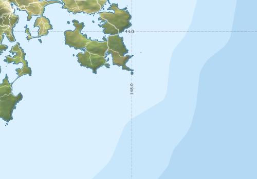
Voyage extents: 43° 24.0' S to 42° 30.0' S 147° 12.0' E to 148° 24.0' E
Marlin Metadata:-
Participants - on ship:-
| Name | Role | Organisation |
|---|---|---|
| Ian Hawkes | DAP | CSIRO Oceans & Atmosphere - Hobart |
This list includes those that may have only been on part of the voyage. See voyage reports on 'Reports and Maps' tab for details.
Marine National Facility Reports - plans, summaries and data processing
- There is no map for this survey. Create a map from underway data.
Publications, reports and datasets from this voyage.
Dataset
- Smith, S. R.,Lopez, N.,Bourassa, M. A. (2016) SAMOS air‐sea fluxes: 2005–2014. Geoscience Data Journal 3 pp9-19. 10.1002/gdj3.34
Search for publications, reports and datasets from this and other voyages
Data publishing
This is a list of online datasets hosted by CSIRO. Other processed datasets hosted by collaborating organisations may be found on the 'Metadata' or "Reports, Publications and Maps' tab.
Use the Get data link on the right to extract data using the NCMI Data Trawler.
| Data Stream | Data Summary | Get data |
|---|---|---|
| Underway | No data |
Deployments - None have been recorded in the Data Trawler.