Voyage details and related metadata, reports, events and data.
SS2010_E01
- is a Marine National Facility ![]() voyage
voyage
Period: 2010-03-13 00:00 to 2010-03-14 00:00 UTC
Duration: 1.00 days
From: Hobart To: Hobart
Region: Storm Bay
Ship: Southern Surveyor [details]
Description: Southern Surveyor SS2010_E01 gear trial. Voyage Objectives 1. Complete electrical load-sharing, CPP and vessel station-keeping tests. 2. Calibrate / commission the recently-installed Skipper Doppler log. 3. Deploy and operate the EZ Net. Provide training in instrument operations to other MNF support staff 4. Deploy and operate new MNF Tow-Yow system. Develop operational handling and data acquisition procedures 5. Operate EM300 Multibeam system. Acquire data for verification of recent system modifications. Develop operational procedures for new SiS software package 6. Operate underway data acquisition systems
Leader: Drew Mills (CMAR)
Project: Southern Surveyor - general vessel operations, gear trials, etc. [details]
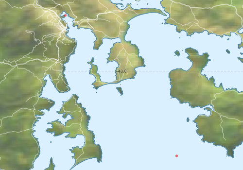
Voyage extents: 43° 12.0' S to 42° 48.0' S 147° 18.0' E to 147° 36.0' E
Marlin Metadata:-
Participants - on ship:-
| Name | Role | Organisation |
|---|---|---|
| Andreas Marouchos | Towed CTD testing | CSIRO Oceans & Atmosphere - Hobart |
| Bernadette Heaney | EM300 | CSIRO Oceans & Atmosphere - Hobart |
| Drew Mills | Towed CTD testing and Doppler Calibration, Voyage Manager | CSIRO Oceans & Atmosphere - Hobart |
| Graham Stacey | Observer | CSIRO Oceans & Atmosphere - Hobart |
| Karl Forcey | Towed CTD testing, Doppler Calibration and operational support. | CSIRO Oceans & Atmosphere - Hobart |
| Lindsay MacDonald | EZ Net testing | CSIRO Oceans & Atmosphere - Hobart |
| Pamela Brodie | DAP system | CSIRO Oceans & Atmosphere - Hobart |
| Peter Dunn | EZ Net testing/familiarisation | CSIRO Oceans & Atmosphere - Hobart |
| Stephen McCullum | Operational support | CSIRO Oceans & Atmosphere - Hobart |
| Tony Veness | EM300 | CSIRO Oceans & Atmosphere - Hobart |
| Trevor Goodwin | assist with EZ deployment and gain experience on Surveyor | CSIRO Oceans & Atmosphere - Hobart |
This list includes those that may have only been on part of the voyage. See voyage reports on 'Reports and Maps' tab for details.
Marine National Facility Reports - plans, summaries and data processing
-
SS2010_E01 Voyage Plan
- includes objectives, investigator details, proposed data collection, voyage track and equipment to be used.
- There is no map for this survey.
Publications, reports and datasets from this voyage.
Dataset
- Smith, S. R.,Lopez, N.,Bourassa, M. A. (2016) SAMOS air‐sea fluxes: 2005–2014. Geoscience Data Journal 3 pp9-19. 10.1002/gdj3.34
Search for publications, reports and datasets from this and other voyages
Data publishing
This is a list of online datasets hosted by CSIRO. Other processed datasets hosted by collaborating organisations may be found on the 'Metadata' or "Reports, Publications and Maps' tab.
Use the Get data link on the right to extract data using the NCMI Data Trawler.
| Data Stream | Data Summary | Get data | ||||||||||
|---|---|---|---|---|---|---|---|---|---|---|---|---|
| Multibeam echosounder |
|
Get Data from Trawler |
||||||||||
| XBT Profile |
|
Get Data from Trawler Download xbt_ascii_ma_2007_2012.zip (MEDS ASCII format ) Download xbt_nc_ss2007_2012.zip (NetCDF format) |
Deployments by start time:- Click on column header to sort. Use link on 'Deployment' to see full details. Use the CSV button at the bottom to export data (tab delimited).
Search for deployments from this voyage and others
| Deployment | Operation | Station | Cast | Gear | Project | Start and end times | Start Location | End Location | Depth range | Max Depth | Description | |||
|---|---|---|---|---|---|---|---|---|---|---|---|---|---|---|
| Multibeam echosounder [details] | EM300 Multibeam Echosounder | 2010-02-11 02:00 | 2010-03-14 03:56 | -42.8448 | 147.3305 | -42.8863 | 147.3385 | 190.4 | ||||||
| XBT Cast [details] | Sippican Deep Blue | 2391 | 2010-03-13 10:16 | -43.2364 | 147.6410 | 846.5 | ||||||||