Voyage details and related metadata, reports, events and data.
SS 12/2008
(alternative identifier: SS200812)
- is a Marine National Facility ![]() voyage
voyage
Period: 2008-11-05 00:00 to 2008-11-21 00:00 UTC
Duration: 16.00 days
From: Newcastle To: Sydney
Region: Continental Slope off New South Wales
Ship: Southern Surveyor [details]
Description:
Title: "Submarine Landslides and Sedimentation Model for the SE Australian Margin".
This voyage will investigate the potential for Submarine Landslides and inform a Sedimentation Model for the SE Australian Margin between Byron Bay and Noosa Heads.
Equipment used will include EM300 multibeam (MBES) and Topas high resolution seismic (HRS), XBTs, CTD, Smith Macintyre Grab, GA rock dredge and the GA Thomas coring system.
See the Voyage Plan for details.
Leader: Associate Professor Ron Boyd (University of Newcastle)
Project: National Facility External Users: R. Boyd (University of Newcastle) [details]
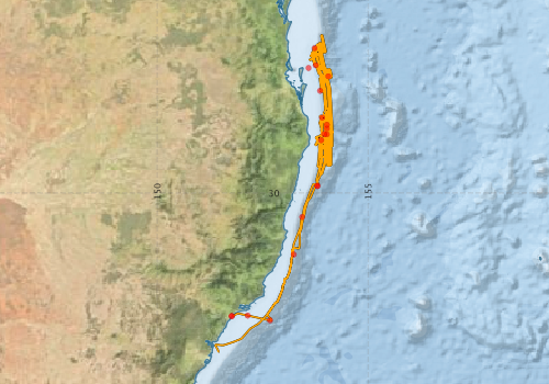
Voyage extents: 33° 46.8' S to 26° 14.9' S 151° 22.4' E to 154° 09.6' E Get voyage track shapefile Get CSV
Marlin Metadata:-
Participants - on ship:-
| Name | Role | Organisation |
|---|---|---|
| Asrar Talukder | Topas Seismic acquisition, processing and interp. | CSIRO Perth |
| Bernadette Heaney | MNF Swath Support | CSIRO Oceans & Atmosphere - Hobart |
| David Mitchell | Coring, Grab Sampling, Dredging, Topas Seismic, T-shirts | University of Sydney |
| Hiski Kippo | MNF Computing Support | CSIRO Oceans & Atmosphere - Hobart |
| Janice Felzenberg | Navigation, XBT, MB and Topas Processing, and Fledermaus Display | CCOM/UNH |
| Jim Gardner | Navigation, XBT, MB and Topas Processing, and Fledermaus Display, Data Synthesis | CCOM/UNH |
| Jock Keene | Senior Second Scientist, Voyage Report, Sampling and MidN to Noon Sediments (Dredge, Grab and Core) plus Data Synthesis | University of Sydney |
| Kevin Ruming | Navigation, MB Processing, Fledermaus Display, Computing and Data Base Management, Voyage Report | NSW DPI |
| Michael Kinsela | MB Acquisition and Processing | University of Sydney |
| Neville Exon | Sampling and Sediments (Dredge, Grab and Core) plus MB/Topas Operation, Data Synthesis | ANU/IODP |
| Peter Dunn | MNF Voyage Manager and Electronics Support | CSIRO Oceans & Atmosphere - Hobart |
| Ron Boyd | Chief Scientist, Voyage Report, Voyage Noon-MidN Planning and Conduct, Data Synthesis | University of Newcastle - Depart. of Geology |
| Samantha Clarke | Topas Seismic Acquisition and Processing | University of Sydney |
| Tom Hubble | Topas Seismic acquisition, processing and interp. | University of Sydney |
| Tony Veness | MNF Swath Support | CSIRO Oceans & Atmosphere - Hobart |
This list includes those that may have only been on part of the voyage. See voyage reports on 'Reports and Maps' tab for details.
Marine National Facility Reports - plans, summaries and data processing
-
SS200812 Scientific Highlight
- report of the key outputs
-
SS200812 Voyage Summary
- includes preliminary results, voyage narrative, types of data collected with C77/ROSCOP codes.
-
SS200812 Voyage Plan
- includes objectives, investigator details, proposed data collection, voyage track and equipment to be used.
-

Publications, reports and datasets from this voyage.
Book Chapter
- Clarke, S., Hubble, T., Airey, D., Yu, P., Boyd, R., Keene, J., Exon, N., Gardner, J. & Ward, S. (2014), Morphology of Australia’s Eastern Continental Slope and Related Tsunami Hazard. Submarine Mass Movements and Their Consequences: 6th International Symposium. Cham: Springer International Publishing.
External link to reference
Conference Poster
- Clarke, S., Hubble, T., Airey, D. & Ward, S. (2015), Eastern Australia's submarine landslides: implications for tsunami hazard between Jervis Bay and Fraser Island, Landslides.
External link to reference
- Clarke, S., Hubble, T., Airey, D., Yu, P., Boyd, R., Keene, J., Exon, N., Gardner, J., Ward, S. & Party SS, S. (2014), Morphology of Australia’s Eastern Continental Slope and Related Tsunami Hazard. Springer International Publishing Switzerland, Editors: S. Krastel et al.
External link to reference
Conference Proceedings
- Hubble, T., Yu, P., Airey, D., Clarke, S., Boyd, R., Keene, J., Exon, N. & Gardner, J. (2012), Physical Properties and Age of Continental Slope Sediments Dredged from the Eastern Australian Continental Margin – Implications for Timing of Slope Failure. In: Submarine Mass Movements and Their Consequences. (2012), Dordrecht. Springer Netherlands, pp. 43-54. 10.1007/978-3-319-00972-8_47
Conference paper
- Clarke, S., Airey, D.W., Yu, P., Hubble, T. (2011), Submarine Landslides on the South-Eastern Australian Margin. Australian Geomechanics Society Sydney Chapter Symposium October 2011. Sydney, Australia, Australian Geomechanics Society: 27-38.
External link to reference
- Clarke, S., Hubble, T., Airey, D., Yu, P., Boyd, R., Keene, J., Exon, N., Gardner, J. (2012), Submarine Landslides on the Upper Southeast Australian Passive Continental Margin – Preliminary Findings. In: Yamada Y. et al. (eds) Submarine Mass Movements and Their Consequences. Advances in Natural and Technological Hazards Research, vol 31. Springer, Dordrecht. 10.1007/978-94-007-2162-3_5
- Hubble, T., Yu, P., Airey, D., Clarke, S., Boyd, R., Keene, J., Exon, N., Gardner, J. (2012), Physical Properties and Age of Continental Slope Sediments Dredged from the Eastern Australian Continental Margin – Implications for Timing of Slope Failure. In: Yamada Y. et al. (eds) Submarine Mass Movements and Their Consequences. Advances in Natural and Technological Hazards Research, vol 31. Springer, Dordrecht.
Dataset
- Smith, S. R.,Lopez, N.,Bourassa, M. A. (2016) SAMOS air‐sea fluxes: 2005–2014. Geoscience Data Journal 3 pp9-19. 10.1002/gdj3.34
Journal Article
- Clarke, S.,Hubble, T.,Webster, J.,Airey, D.,De Carli, E.,Ferraz, C.,Reimer, P.,Boyd, R.,Keene, J. (2016) Sedimentology, structure and age estimate of five continental slope submarine landslides, eastern Australia. Australian Journal of Earth Sciences 63 pp631-652. 10.1080/08120099.2016.1225600
- Clarke, Samantha L.,Hubble, Thomas C. T.,Miao, G.,Airey, D. W.,Ward, S. N. (2019) Eastern Australia’s submarine landslides: implications for tsunami hazard between Jervis Bay and Fraser Island. Landslides 16 pp2059-2085. 10.1007/s10346-019-01223-6
- Hubble T, Yu P, Clarke S, Airey D, Boyd R, Keene J, Exon N, and Gardner J, 2012: Physical properties and age of continental slope sediments dredged from the Eastern Australian Continental Margin: implications for timing of slope failure. Vol 31. 42-54. Advances in Natural and Technological Hazards Research. Springer Netherlands 10.1007/978-94-007-2162-3_4
- Hubble, Thomas,Yeung, Serena,Clarke, Samantha,Baxter, Alan,De Blasio, Fabio (2018) Submarine landslides offshore Yamba, NSW, Australia: an analysis of their timing, downslope motion and possible causes. Geological Society, London, Special Publications ppSP477.11-. 10.1144/SP477.11
Thesis
- Clarke, S. (2014) Submarine landslides of the eastern Australian upper continental margin. PhD. Thesis, The University of Sydney, 217 pp.
External link to reference
Search for publications, reports and datasets from this and other voyages
Data publishing
This is a list of online datasets hosted by CSIRO. Other processed datasets hosted by collaborating organisations may be found on the 'Metadata' or "Reports, Publications and Maps' tab.
Use the Get data link on the right to extract data using the NCMI Data Trawler.
| Data Stream | Data Summary | Get data | ||||||||||||||
|---|---|---|---|---|---|---|---|---|---|---|---|---|---|---|---|---|
| ADCP Data |
|
Get Data from Trawler Download netCDF dataset ss200812_ADCP_nc.zip SS200812_UWY_ADCP_Report.pdf |
||||||||||||||
| Multibeam echosounder |
|
Get Data from Trawler |
||||||||||||||
| Underway |
|
Get Data from Trawler Download NetCDF dataset ss200812UWYnc.zip |
||||||||||||||
| XBT Profile |
|
Get Data from Trawler Download xbt_ascii_ma_2007_2012.zip (MEDS ASCII format ) Download xbt_nc_ss2007_2012.zip (NetCDF format) |
Deployments by start time:- Click on column header to sort. Use link on 'Deployment' to see full details. Use the CSV button at the bottom to export data (tab delimited).
Search for deployments from this voyage and others
| Deployment | Operation | Station | Cast | Gear | Project | Start and end times | Start Location | End Location | Depth range | Max Depth | Description | |||
|---|---|---|---|---|---|---|---|---|---|---|---|---|---|---|
| Underway System [details] | Air Temperature Sensor-HMP233,Barometer,Fluorometer WS3S-443P,Gyro-Generic SS-NF,Humidity Sensor-HMP233,IMOS Port Pyranometer-SN 35122F3,IMOS Port Radiometer-SN 35111F3,IMOS Stbd Pyranometer-SN 35123F3,IMOS Stbd Radiometer-SN 35093F3,IMOS rain gauge,IMOS rain gauge,IMOS wind monitor,IMOS wind monitor,IMOS wind monitor,IMOS wind monitor,Licor-UWQ 3708,RM Young 05106 wind monitor-75621,RM Young 05106 wind monitor-75621,RM Young 05106 wind monitor-75621,RM Young Rain Gauge,Remote Temperature (T)-SN 2621,Seapath 200,Seapath 200,Simrad EA500 Echosounder,ThermoSalinoGraph (TSG)-SS-SN 1777 | 134 | 2008-11-04 21:56 | 2008-11-20 17:46 | -32.9222 | 151.7653 | -33.7813 | 151.4453 | ||||||
| Multibeam echosounder [details] | EM300 Multibeam Echosounder | 2008-11-04 22:57 | 2008-11-20 06:19 | -32.9222 | 151.7653 | -32.2974 | 152.9598 | 5101.6 | ||||||
| XBT Cast [details] | Sippican Deep Blue | 2391 | 2008-11-05 02:24 | -32.9092 | 152.1457 | 578.9 | ||||||||
| XBT Cast [details] | Sippican Deep Blue | 2391 | 2008-11-05 05:18 | -33.0242 | 152.6735 | 1100.3 | ||||||||
| XBT Cast [details] | Sippican Deep Blue | 2391 | 2008-11-05 23:07 | -30.5690 | 153.4362 | 1100.3 | ||||||||
| XBT Cast [details] | Sippican Deep Blue | 2391 | 2008-11-06 07:28 | -29.8371 | 153.7971 | 1095.5 | ||||||||
| XBT Cast [details] | Sippican Deep Blue | 2391 | 2008-11-06 07:33 | -29.8275 | 153.8005 | 1100.3 | ||||||||
| XBT Cast [details] | Sippican Deep Blue | 2391 | 2008-11-06 15:48 | -28.6024 | 153.9622 | 1100.3 | ||||||||
| ADCP Data [details] | RDI Ocean Surveyor Acoustic Doppler current profiler | 134 | 2008-11-06 21:58 | 2008-11-20 16:05 | -28.3817 | 154.0199 | -33.6070 | 151.4730 | 830 | |||||
| XBT Cast [details] | Sippican Deep Blue | 2391 | 2008-11-07 06:48 | -27.0341 | 153.5890 | 1100.3 | ||||||||
| XBT Cast [details] | Sippican Deep Blue | 2391 | 2008-11-08 17:07 | -26.5627 | 153.7300 | 1100.3 | ||||||||
| XBT Cast [details] | Sippican Deep Blue | 2391 | 2008-11-09 22:28 | -28.4711 | 154.0217 | 0.7 | ||||||||
| XBT Cast [details] | Sippican Deep Blue | 2391 | 2008-11-09 22:33 | -28.6082 | 154.0217 | 1100.3 | ||||||||
| XBT Cast [details] | Sippican Deep Blue | 2391 | 2008-11-11 16:28 | -26.9686 | 153.7566 | 1100.3 | ||||||||
| XBT Cast [details] | Sippican Deep Blue | 2391 | 2008-11-13 15:31 | -27.2308 | 154.0550 | 1100.3 | ||||||||
| XBT Cast [details] | Sippican Deep Blue | 2391 | 2008-11-14 17:18 | -27.5757 | 153.8615 | 1100.3 | ||||||||
| XBT Cast [details] | Sippican Deep Blue | 2391 | 2008-11-15 17:13 | -28.2117 | 153.9102 | 1100.3 | ||||||||
| XBT Cast [details] | Sippican Deep Blue | 2391 | 2008-11-16 16:28 | -28.7469 | 153.8871 | 1100.3 | ||||||||
| XBT Cast [details] | Sippican Deep Blue | 2391 | 2008-11-20 02:58 | -31.4603 | 153.2357 | 1100.3 | ||||||||