Survey details and related metadata, reports, events and data.
SS 10/95 (alternative identifier: SS199510)
Period: 1995-10-10 00:00 to 1995-11-05 00:00 UTC
Duration: 26.00 days
From: Weipa To: Weipa
Region: Gulf of Carpentaria
Ship: Southern Surveyor [details]
Description:
Southern Surveyor cruise SS 10/95 was undertaken to test devices for the Bycatch Reduction in Prawn Trawls project in the area of the tiger prawn fishery west of Weipa, Gulf of Carpentaria. Aims of the cruise were to conduct prawn and fish bycatch reduction/video comparison trawls; EFN (environmentally friendly net) trawls, shark longlining, and to collect samples for the Hobart genetics group.
The night time prawn trawling was carried out 5 nm west of Duyfken Point and day time trawling in waters further west. Five bycatch reduction devices (BRDs) and a control or standard prawn net codend were tested and four of these BRDs were compared intensively. Daytime fish trawling with the EFN were carried out in waters 25 nm west of Duyfken Point. Video images were obtained of fish behaviour in the BRD codends of the prawn net and the EFN, and of the performance of the EFN over benthic structure. Samples collected included bycatch species for reference specimens and saurids for the Hobart genetics group. Longlining was successfully used to demonstrate its effectiveness at obtaining large numbers of sharks over short time intervals including dyed bait experiments.
Leader: J. Salini (CSIRO)
Project: The effects of trawl design on bycatch and benthos in prawn and finfish fisheries (FRDC project no. 93/179)1993-1998 [details]
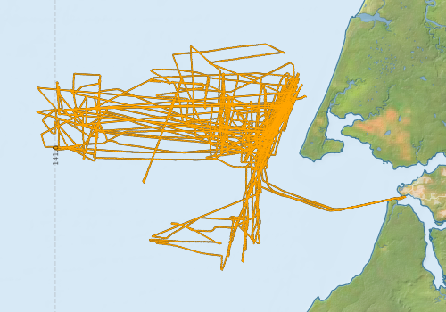
Voyage extents: 12° 50.7' S to 12° 17.9' S 140° 57.3' E to 141° 50.9' E Get voyage track shapefile Get CSV
Marlin Metadata:-
Metadata from OBIS Australia datasets:- biological data is published via the OBIS-AU IPT server and delivered to one or more of OBIS, ALA and GBIF
Download from OBIS Australia IPT View at - Ocean Biodiversity Information System (OBIS) Atlas of Living Australia (ALA) GBIF
Download from OBIS Australia IPT View at - Ocean Biodiversity Information System (OBIS) Atlas of Living Australia (ALA) GBIF
Participants - on ship:-
| Name | Leg | Role | Organisation |
|---|---|---|---|
| Anders Cormie | 1 2 | University of Tasmania, Australian Maritime College | |
| Brian McDonald | 1 2 | University of Tasmania, Australian Maritime College | |
| Clive Liron | 2 | CSIRO Fisheries | |
| David Brewer | 2 | CSIRO Fisheries | |
| Gary Fru | 1 2 | CSIRO Fisheries | |
| Jeff Cordell | 2 | CSIRO Fisheries | |
| John MacCartire | 1 | Northern Territory Department of Primary Industry, Fisheries and Mines | |
| John Salini | 1 2 | Cruise leader | CSIRO Fisheries |
| Jonathan Staunton Smith | 2 | CSIRO Fisheries | |
| Margaret Farmer | 1 | CSIRO Fisheries | |
| Matt Sherlock | 1 | CSIRO Fisheries | |
| Miroslaw Ryba | 2 | CSIRO Fisheries | |
| Neville Gill | 2 | Northern Territory Department of Primary Industry, Fisheries and Mines | |
| Nick Rawlinson | 1 | CSIRO Fisheries | |
| Paul Johnson | 1 | Northern Territory Department of Primary Industry, Fisheries and Mines | |
| Samantha Miller | 1 | CSIRO Fisheries | |
| Steve Eayrs | 1 2 | University of Tasmania, Australian Maritime College | |
| Ted Wassenberg | 1 | CSIRO Fisheries | |
| Yougan Wang | 2 | CSIRO Fisheries |
This list includes those that may have only been on part of the voyage. See voyage reports on 'Reports and Maps' tab for details.
Marine National Facility Reports - plans, summaries and data processing
-
SS199510 Voyage Summary
- includes preliminary results, voyage narrative, types of data collected with C77/ROSCOP codes.
-
SS199510 Voyage Plan
- includes objectives, investigator details, proposed data collection, voyage track and equipment to be used.
-

Publications, reports and datasets from this voyage.
IPT Resource
- Incidental sea snake and turtle bycatch records from the RV Southern Surveyor voyage SS199510, Gulf of Carpentaria, Australia (Nov 1995) (Darwin Core Archive) External link to reference
- Southern Surveyor Voyage SS 10/95 survey in the Gulf of Carpentaria, Australia (Nov 1995) (Darwin Core Archive) External link to reference
Search for publications, reports and datasets from this and other voyages
Data publishing
This is a list of online datasets hosted by CSIRO. Other processed datasets hosted by collaborating organisations may be found on the 'Metadata' or "Reports, Publications and Maps' tab.
Use the Get data link on the right to extract data using the NCMI Data Trawler.
| Data Stream | Data Summary | Get data | ||||||
|---|---|---|---|---|---|---|---|---|
| Marine biodiversity observations and/or samples |
|
Get Data from Trawler |
Deployments by start time:- Click on column header to sort. Use link on 'Deployment' to see full details. Use the CSV button at the bottom to export data (tab delimited).
Search for deployments from this voyage and others
| Deployment | Operation | Station | Cast | Gear | Project | Start and end times | Start Location | End Location | Depth range | Max Depth | Description | |||
|---|---|---|---|---|---|---|---|---|---|---|---|---|---|---|
| Underway System [details] | Doppler speed log,Licor-UWQ 3708,RM Young 05103 wind monitor,RM Young 05103 wind monitor,Simrad EK500 echosounder,Sperry gyrocompass,Temperature sensor-41342,ThermoSalinoGraph (TSG)-SS-SN 1777,ThermoSalinoGraph (TSG)-SS-SN 1777 | |||||||||||||