Survey details and related metadata, reports, events and data.
SO 2/80 (alternative identifier: SO198002)
Period: 1980-03-29 00:00 to 1980-04-13 00:00 Local
Duration: 15.00 days
Region: Southern NSW coast
Ship: Soela [details]
Description: Soela cruise SO 2/80 forms part of a time-series study of warm core eddies in the Tasman Sea off southern NSW. Primary objectives were to continue investigations of micronekton abundance and ecology as related to the eddies and associated fronts. Secondary objectives included a comparison of sampling efficiency between the Engel midwater trawl, and the rectangular midwater trawl. To study diel vertical distribution of zooplankton and comparison of trawl catches with acoustic volume reverberation measures (this was not achieved due to failure of the main trawl winches, instead a revised plan was constructed that corresponded with the Bongo sampling program). Data collected included underway (surface temperature, surface light intensity, XBT thermal mapping and acoustics), Nansen stations (salinity, temperature, nitrate, silicate and oxygen), trawling (5 Engel tows outside the eddy), zooplankton sampling with bongo nets and surface nets, and acoustic data for reverberation study.
Leader: S. Brandt (CSIRO)
Project: Ecology of Ocean Fronts 1979-8? [details]
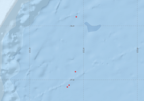
Voyage extents: 37° 08.0' S to 35° 50.0' S 151° 42.0' E to 151° 52.0' E
Marlin Metadata:-
Participants:- no records
Marine National Facility Reports - plans, summaries and data processing
- View the Survey plan - includes objectives, investigator details, proposed data collection, voyage track and equipment to be used.
- View the Survey Summary report - includes preliminary results, voyage narrative, types of data collected with C77/ROSCOP codes.
-

Search for publications, reports and datasets from this and other voyages
Data publishing
This is a list of online datasets hosted by CSIRO. Other processed datasets hosted by collaborating organisations may be found on the 'Metadata' or "Reports, Publications and Maps' tab.
Use the Get data link on the right to extract data using the NCMI Data Trawler.
| Data Stream | Data Summary | Get data | ||||||||||
|---|---|---|---|---|---|---|---|---|---|---|---|---|
| Hydrology |
|
Get Data from Trawler |
Deployments by start time:- Click on column header to sort. Use link on 'Deployment' to see full details. Use the CSV button at the bottom to export data (tab delimited).
Search for deployments from this voyage and others
| Deployment | Operation | Station | Cast | Gear | Project | Start and end times | Start Location | End Location | Depth range | Max Depth | Description | |||
|---|---|---|---|---|---|---|---|---|---|---|---|---|---|---|
| Hydrology Cast [details] | 1 | 81 | 1980-04-05 00:00 | 1980-04-05 00:00 | -36.8500 | 151.8500 | 296 | |||||||
| Hydrology Cast [details] | 1 | 81 | 1980-04-10 00:00 | 1980-04-10 00:00 | -37.1000 | 151.7333 | 100 | |||||||
| Hydrology Cast [details] | 1 | 81 | 1980-04-11 00:00 | 1980-04-11 00:00 | -37.1333 | 151.7000 | 200 | |||||||
| Hydrology Cast [details] | 1 | 81 | 1980-04-11 00:00 | 1980-04-11 00:00 | -35.8333 | 151.8667 | 155 | |||||||