Voyage details and related metadata, reports, events and data.
SE 01/2008
(alternative identifier: SE200801)
- is a Marine National Facility ![]() voyage
voyage
Period: 2008-10-02 00:00 to 2008-10-03 21:00 UTC
Duration: 1.88 days
From: Sydney To: Sydney
Region: New South Wales Coast
Ship: Southern Surveyor [details]
Description: A brief gear testing voyage off Sydney
Project: Southern Surveyor - general vessel operations, gear trials, etc. [details]
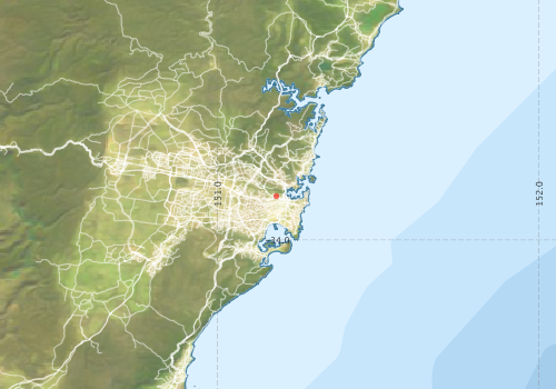
Voyage extents: 40° 00.0' S to 33° 42.0' S 151° 00.0' E to 152° 18.0' E
Marlin Metadata:-
Participants - on ship:-
| Name | Role | Organisation |
|---|---|---|
| Bernadette Heaney | Swath support | CSIRO Oceans & Atmosphere - Hobart |
| Don McKenzie | MNF Operations Manager | CSIRO Oceans & Atmosphere - Hobart |
| Drew Mills | Electronics support | CSIRO Oceans & Atmosphere - Hobart |
| John-Ove Feste Larsen | Swath calibration | CSIRO Oceans & Atmosphere - Hobart |
| Robert Lichter | Ship power systems contractor | CSIRO Oceans & Atmosphere - Hobart |
| Ron Plaschke | Wire re-spooling | CSIRO Oceans & Atmosphere - Hobart |
| Tony Veness | MNF Swath Support | CSIRO Oceans & Atmosphere - Hobart |
This list includes those that may have only been on part of the voyage. See voyage reports on 'Reports and Maps' tab for details.
Marine National Facility Reports - plans, summaries and data processing
-
SE200801 Voyage Plan
- includes objectives, investigator details, proposed data collection, voyage track and equipment to be used.
-

Search for publications, reports and datasets from this and other voyages
Data publishing
This is a list of online datasets hosted by CSIRO. Other processed datasets hosted by collaborating organisations may be found on the 'Metadata' or "Reports, Publications and Maps' tab.
Use the Get data link on the right to extract data using the NCMI Data Trawler.
| Data Stream | Data Summary | Get data | ||||||||||
|---|---|---|---|---|---|---|---|---|---|---|---|---|
| Multibeam echosounder |
|
Get Data from Trawler |
Deployments by start time:- Click on column header to sort. Use link on 'Deployment' to see full details. Use the CSV button at the bottom to export data (tab delimited).
Search for deployments from this voyage and others
| Deployment | Operation | Station | Cast | Gear | Project | Start and end times | Start Location | End Location | Depth range | Max Depth | Description | |||
|---|---|---|---|---|---|---|---|---|---|---|---|---|---|---|
| Multibeam echosounder [details] | EM300 Multibeam Echosounder | 2008-10-02 00:51 | 2008-10-03 18:02 | -33.8636 | 151.1836 | -34.0457 | 151.5431 | 6179.3 | ||||||