Survey details and related metadata, reports, events and data.
SAZ Southern Ocean Moorings (1997-8) (alternative identifier: M-SAZ97-8)
Period: 1997-09-17 00:00 to 1999-01-21 00:00 Local
Duration: 491.00 days
Mooring: SAZ Southern Ocean Moorings (1997-8) [details]
Description: The SAZ 1997 and 1998 moorings were deployed as part of the Sub-Antarctic Zone "SAZ" Project led by Tom Trull of the Antarctic CRC. Current meters were attached to moored sediment traps for recording associated information. The moorings were deployed on Aurora Australis voyage 1 1997/8, recovered and two redeployed on Aurora Australis voyage 6 1997/8, and the latter recovered on Voyage 5 1998/1999. The sites were along 140 deg E at 42, 47, 51 and 54 deg S, in water depths between 2280 and 5090 m.
Leader: T. Trull (Antarctic CRC)
Project: Sub-Antarctic Zone (SAZ) Project (Antarctic CRC) 1997-2008 [details]
Map extents: 50° 00.0' S to 0° 00.0' N 95° 00.0' E to 180° 00.0' E
Marlin Metadata:-
Participants:- no records
Marine National Facility Reports - plans, summaries and data processing
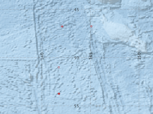
- There is no map for this survey.
Search for publications, reports and datasets from this and other voyages
Data publishing
This is a list of online datasets hosted by CSIRO. Other processed datasets hosted by collaborating organisations may be found on the 'Metadata' or "Reports, Publications and Maps' tab.
Use the Get data link on the right to extract data using the NCMI Data Trawler.
| Data Stream | Data Summary | Get data | ||||||||||||||
|---|---|---|---|---|---|---|---|---|---|---|---|---|---|---|---|---|
| Current Meter records from Moorings |
|
Get Data from Trawler Processing report for SAZ 1998-9 current meter data Processing report for SAZ 1997-8 current meter data |
Deployments by start time:- Click on column header to sort. Use link on 'Deployment' to see full details. Use the CSV button at the bottom to export data (tab delimited).
Search for deployments from this voyage and others
| Deployment | Operation | Station | Cast | Gear | Project | Start and end times | Start Location | End Location | Depth range | Max Depth | Description | |||
|---|---|---|---|---|---|---|---|---|---|---|---|---|---|---|
| Current Meter [details] | 1 | 1546 | 1997-09-17 00:00 | 1998-03-16 00:00 | -53.7473 | 141.7520 | 0 | 570 | ||||||
| Current Meter [details] | 1 | 1546 | 1997-09-17 00:00 | 1998-03-16 00:00 | -53.7473 | 141.7520 | 0 | 571 | ||||||
| Current Meter [details] | 1 | 1546 | 1997-09-17 00:00 | 1998-03-20 00:00 | -51.0013 | 141.7363 | 0 | 572 | ||||||
| Current Meter [details] | 1 | 1546 | 1997-09-19 00:00 | 1998-03-07 00:00 | -46.7660 | 142.0675 | 0 | 568 | ||||||
| Current Meter [details] | 1 | 1546 | 1997-09-19 00:00 | 1998-03-07 00:00 | -46.7660 | 142.0675 | 0 | 569 | ||||||
| Current Meter [details] | 1 | 1546 | 1998-03-11 00:00 | 1998-11-10 00:00 | -46.7583 | 142.0900 | 0 | 587 | ||||||
| Current Meter [details] | 1 | 1546 | 1998-03-11 00:00 | 1998-09-07 00:00 | -46.7583 | 145.0883 | 0 | 588 | ||||||
| Current Meter [details] | 1 | 1546 | 1998-03-11 00:00 | 1999-02-10 00:00 | -46.7583 | 145.0883 | 0 | 589 | ||||||
| Current Meter [details] | 1 | 1546 | 1998-03-22 00:00 | 1999-01-21 00:00 | -53.7483 | 141.7533 | 0 | 590 | ||||||
| Current Meter [details] | 1 | 1546 | 1998-03-22 00:00 | 1999-02-13 00:00 | -53.7483 | 141.7533 | 0 | 591 | ||||||