Survey details and related metadata, reports, events and data.
Devonport Moorings (1991/92) (alternative identifier: M-DEV91)
Period: 1991-07-16 00:00 to 1992-07-03 00:00 Local
Duration: 353.00 days
Mooring: Devonport Moorings (1991-2) [details]
Description: As part of a study of effluent dispersion on the north coast of Tasmania, current meters were deployed at five sites located between 1 and 4 km from the end of the Devonport sewage outfall, as a surrogate for effluent from a proposed pulp mill in the area, in water depths between 3 and 21 m. Data were collected from all 5 sites during July-October 1991, and again for sites 1, 2 and 5 during March-July 1992.
Leader: C. Fandry (CSIRO)
Project: Prediction of Tides and Currents for Offshore Resources 1989-1993 [details]
Map extents: 50° 00.0' S to 0° 00.0' N 95° 00.0' E to 180° 00.0' E
Marlin Metadata:-
Participants:- no records
Marine National Facility Reports - plans, summaries and data processing
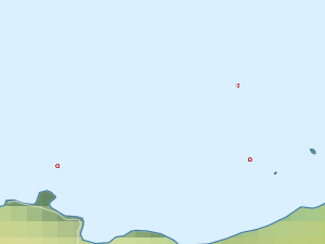
- There is no map for this survey.
Search for publications, reports and datasets from this and other voyages
Data publishing
This is a list of online datasets hosted by CSIRO. Other processed datasets hosted by collaborating organisations may be found on the 'Metadata' or "Reports, Publications and Maps' tab.
Use the Get data link on the right to extract data using the NCMI Data Trawler.
| Data Stream | Data Summary | Get data | ||||||||||||||
|---|---|---|---|---|---|---|---|---|---|---|---|---|---|---|---|---|
| Current Meter records from Moorings |
|
Get Data from Trawler |
Deployments by start time:- Click on column header to sort. Use link on 'Deployment' to see full details. Use the CSV button at the bottom to export data (tab delimited).
Search for deployments from this voyage and others
| Deployment | Operation | Station | Cast | Gear | Project | Start and end times | Start Location | End Location | Depth range | Max Depth | Description | |||
|---|---|---|---|---|---|---|---|---|---|---|---|---|---|---|
| Current Meter [details] | 1 | 1535 | 1992-03-17 00:00 | 1992-06-26 00:00 | -41.1500 | 146.4100 | 0 | 389 | ||||||
| Current Meter [details] | 1 | 1535 | 1992-03-17 00:00 | 1992-07-02 00:00 | -41.1517 | 146.3583 | 0 | 391 | ||||||
| Current Meter [details] | 2 | 1535 | 1992-03-17 00:00 | 1992-07-02 00:00 | -41.1517 | 146.3583 | 0 | 392 | ||||||
| Current Meter [details] | 2 | 1535 | 1992-03-17 00:00 | 1992-06-26 00:00 | -41.1500 | 146.4100 | 0 | 390 | ||||||
| Current Meter [details] | 1 | 1535 | 1992-03-18 00:00 | 1992-07-03 00:00 | -41.1300 | 146.4067 | 0 | 387 | ||||||
| Current Meter [details] | 2 | 1535 | 1992-03-18 00:00 | 1992-07-03 00:00 | -41.1300 | 146.4067 | 0 | 388 | ||||||