Voyage details and related metadata, reports, events and data.
IN2018_C01
- is a Marine National Facility ![]() voyage
voyage
Title: RAN Hydrographic Survey
Voyage details on MNF site: https://mnf.csiro.au/en/Voyages/IN2018_C01
Period: 2018-05-27 22:00 to 2018-06-07 23:45 UTC
Duration: 11.07 days
From: Hobart To: Hobart
Region: Tasmanian coast east and southeast; Bass Strait; Hogan Island; Victoria coast south
Ship: Investigator (RV) [details]
Description: RV Investigator research voyage in2018_c01, titled “RAN Hydrographic Survey.” Voyage objectives: To facilitate safe navigation for international and coastal shipping. This survey will also improve confidence for subsurface navigation in Bass Strait. The overall focus for this survey is to conduct a modern survey in the primary shipping route through Bass Strait. The MET and OC observations and data collection have three purposes, namely: a) To collect data from which a sonar or radar range prediction can be calculated (humidity, pressure, temperature, wind speed, ocean temperature and salinity profile, currents through depth, sediment type, sub-bottom classification (where possible); - Sub-bottom classification will incorporate sediment samples taken using the MNF Smith-McIntyre Grab. Samples will be kept and stored with Geoscience Australia (GA). b) To identify what observations can be conducted concurrently, and what observations have limiting factors that preclude concurrent operations/survey activity; c) To develop understanding of what types, accuracy and formats of data can be collected and how this might be of use to the scientific community and Defence. A full GSM Survey Procedure pertaining to the hydrographic surveying elements of the primary voyage are included in appendix 1 – GSM Hydrographic Survey Procedure.
Leader: LCDR Nigel Townsend (RAN)
Projects:
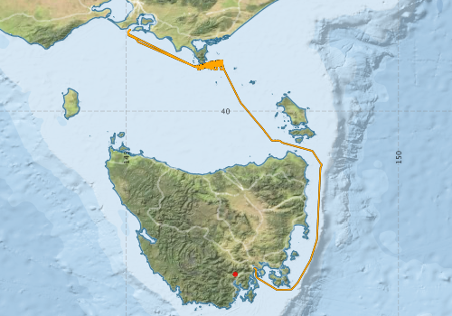
Voyage extents: 43° 17.3' S to 38° 29.2' S 145° 01.8' E to 148° 35.6' E Get voyage track shapefile Get CSV
Marlin Metadata:-
Cruise Summary Report at SeaDataNet:-
Participants - on ship:-
| Name | Role | Organisation | Project |
|---|---|---|---|
| Brett Muir | Voyage Manager | Marine National Facility | Voyage Management on RV Investigator |
| Eric Woehler | Researcher | Birdlife Australia | Spatial and temporal variability in the distribution and abundance of seabirds and marine mammals |
| Nigel Townsend | Chief Scientist | Royal Australian Navy | RAN Hydrographic Survey |
This list includes those that may have only been on part of the voyage. See voyage reports on 'Reports and Maps' tab for details.
Marine National Facility Reports - plans, summaries and data processing
-
IN2018_C01 Voyage Plan
- includes objectives, investigator details, proposed data collection, voyage track and equipment to be used.
-
IN2018_C01 Underway data Processing Report
- details of data processing steps, calibration information, instruments used and any issues with the data.
-
IN2018_C01 ADCP Processing Report
- details of data processing steps, calibration information, instruments used and any issues with the data.
- View Survey map
Publications, reports and datasets from this voyage.
Dataset
- Bakker, Dorothee C E; Pfeil, Benjamin (2020): SOCATv2019 metadata list with links to data in original SOCAT format and cruise documentation files. PANGAEA, 10.1594/PANGAEA.919935
Journal Article
- Daudt, Nicholas W.,Woehler, Eric J.,Schofield, Matthew R.,Smith, Robert O.,Bugoni, Leandro,Rayment, William J. (2024) Seabird assemblages are linked to the major western boundary current off eastern Australia. Progress in Oceanography 223 pp103215-. 10.1016/j.pocean.2024.103215
- Lucieer, Vanessa,Flukes, Emma,Monk, Jacquomo,Walsh, Peter (2024) Geomorphometric maps of Australia’s Marine Park estate and their role in improving the integrated monitoring and management of marine ecosystems. Frontiers in Marine Science 10 pp-. 10.3389/fmars.2023.1302108
Search for publications, reports and datasets from this and other voyages
Data publishing
This is a list of online datasets hosted by CSIRO. Other processed datasets hosted by collaborating organisations may be found on the 'Metadata' or "Reports, Publications and Maps' tab.
Use the Get data link on the right to extract data using the NCMI Data Trawler.
| Data Stream | Data Summary | Get data | ||||||||||||
|---|---|---|---|---|---|---|---|---|---|---|---|---|---|---|
| ADCP Data |
|
Get Data from Trawler 75KHz, 150KHz (normal and center beams) |
||||||||||||
| Gravity Measurements |
|
Get Data from Trawler Geophysical Survey and Mapping acquisition report |
||||||||||||
| Multibeam echosounder |
|
Get Data from Trawler |
||||||||||||
| pCO2 |
|
External link - download datafile at IMOS Data fields and units document (.pdf) |
||||||||||||
| Radon measurements |
|
Get Data from Trawler Download RV Investigator Radon dataset (XLSX) |
||||||||||||
| Sub-bottom profiler |
|
Get Data from Trawler Geophysical Survey and Mapping data acquisition and processing report |
||||||||||||
| Sea Surface Temperature |
|
Get Data from Trawler Download IN2018_C01 compressed dataset (2 Mb) |
||||||||||||
| Underway |
|
Get Data from Trawler Download the 10-second Underway data (CSV format) Download the 5 second Underway data (CSV format) Download the 5 minute Underway data (CSV format) Download the 1 minute Underway data (CSV format) Download the 5 second Underway data (NetCDF format) |
| ID | When (UTC) | Lat | Long | Instrument | Identifier | Action | Log | Subject / Comment |
|---|
Deployments by start time:- Click on column header to sort. Use link on 'Deployment' to see full details. Use the CSV button at the bottom to export data (tab delimited).
Search for deployments from this voyage and others
| Deployment | Operation | Station | Cast | Gear | Project | Start and end times | Start Location | End Location | Depth range | Max Depth | Description | |||
|---|---|---|---|---|---|---|---|---|---|---|---|---|---|---|
| ADCP Data [details] | Teledyne RDI ADCP 75 kHz | 2464 | 2018-05-28 05:51 | 2018-06-08 00:02 | -42.8864 | 147.3388 | 153.9 | |||||||
| Underway System [details] | Altimeter-163,Burket Flow meter,Burket Flow meter,CSIRO Hobart pCO2,CSIRO Hobart pCO2,CSIRO Hobart pCO2,CSIRO Hobart pCO2,CSIRO Hobart pCO2,CSIRO Hobart pCO2,CSIRO Hobart pCO2,CSIRO Hobart pCO2,CSIRO Hobart pCO2,CSIRO Hobart pCO2,CSIRO air sampling inlet,CSIRO air sampling inlet,Chelsea Tech Fluorometer,Gyrocompass,Humidity Sensor-HMT333,Humidity Sensor-HMT333,Humidity Sensor-HMT333,Humidity Sensor-HMT333,IMOS Port Pyranometer-SN 29125F3,IMOS Port Radiometer-SN 29140F3,IMOS Stbd Pyranometer-SN 29125F3,IMOS Stbd Radiometer-SN 29140F3,IMOS wind monitor,IMOS wind monitor,IMOS wind monitor,IMOS wind monitor,ISAR SST,Kobold MIK-C Flow meter,Kongsberg Maritime Skipper DL850 doppler log,Kongsberg Maritime Skipper DL850 doppler log,Kongsberg Maritime Skipper DL850 doppler log,Kongsberg Maritime Skipper DL850 doppler log,Kongsberg Maritime Skipper DL850 doppler log,Kongsberg Maritime Skipper DL850 doppler log,LI-COR LI-190 Quantum Sensor,LI-COR LI-190 Quantum Sensor,Multiangle Absorption Photometer (MAAP),Multiangle Absorption Photometer (MAAP),Ozone Monitor RVT1,Ozone Monitor RVT1,Ozone Monitor RVT2,Ozone Monitor RVT2,Picarro Greenhouse Gas Spectrometer CO2,CH4,H2o,Picarro Greenhouse Gas Spectrometer CO2,CH4,H2o,Picarro Greenhouse Gas Spectrometer CO2,CH4,H2o,Port drop keel sensor,RM Young 05106 wind monitor-SN 82705,RM Young Wind Sensor Type 05107,RM Young Wind Sensor Type 05107,RM Young Wind Sensor Type 05107,RM Young Wind Sensor Type 05107,RM Young Wind Sensor Type 05108,RM Young Wind Sensor Type 05108,RM Young Wind Sensor Type 05108,RM Young Wind Sensor Type 05108,Remote Temperature (T) - SN 671,Seapath 330+,Seapath 330+,Seapath 330+,Simrad EK60 multi-frequency split-beam echosounder,Starboard drop keel sensor,ThermoSalinoGraph (TSG)-SN 3439,ThermoSalinoGraph (TSG)-SS-SN 1777,Vaisala Ship's Barometer PTB330 | 2464 | 2018-05-28 06:04 | 2018-06-07 23:45 | -42.8864 | 147.3388 | ||||||||