Voyage details and related metadata, reports, events and data.
IN2014_E04
- is a Marine National Facility ![]() voyage
voyage
Title: Moorings equipment - testing and procedure development.
Period: 2014-11-25 21:00 to 2014-11-28 07:00 UTC
Duration: 2.42 days
From: Hobart To: Hobart
Region: River Derwent, Storm Bay.
Ship: Investigator (RV) [details]
Description: RV Investigator trial voyage IN2014_E04. Moorings equipment - testing and procedure development. This is a trial voyage which took place from Hobart to Hobart from the 26th November to 28th November 2014. The overall objectives are to safely develop optimal procedures for servicing of deep ocean moorings from RV Investigator. The voyage will include in both calm waters and rough waters: 1. Practice deploying and recovering of mock-SOTS float over the side with the crane and over the stern with the A-frame. 2. Practice deploying and retrieving of the mock-SAZ sediment trap over the stern in 3 ways, as per the deployment procedure. 3. Practice deploying and retrieving the Pulse and mock-RAS floats, as per the deployment procedure. 4. Lower an acoustic release and practice communication.(using different ship headings.)
Leader: T. Trull (CSIRO O&A, ACE CRC, IMOS)
Project: Investigator - general vessel operations, gear trials, etc. [details] Primary
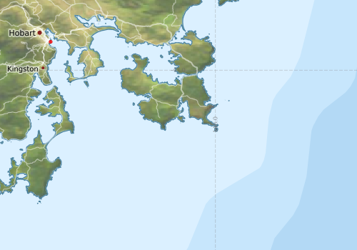
Voyage extents: 43° 34.9' S to 42° 53.2' S 147° 20.3' E to 148° 19.5' E
Marlin Metadata:-
Cruise Summary Report at SeaDataNet:-
Participants - on ship:-
| Name | Role | Organisation | Project |
|---|---|---|---|
| Aaron Tyndall | Seagoing Instrumentation Team Support | Marine National Facility | Seagoing Instrumentation Team |
| Anoosh Sarraf | Data Acquisition and Processing Computing Support | Marine National Facility | Data Acquisition and Processing |
| Bernadette Heaney | Geophysical Survey and Mapping Support | Marine National Facility | Geophysical Survey and Mapping |
| Dave Watts | Geophysical Survey and Mapping Support | Marine National Facility | Geophysical Survey and Mapping |
| Eric Schulz | Alternate Equipment Champion | Bureau of Meteorology | |
| Ian Hawkes | Data Acquisition and Processing Computing Support | Marine National Facility | Data Acquisition and Processing |
| Jamie Derrick | Mooring Specialist | CSIRO Oceans & Atmosphere - Hobart | |
| Jim LaDuke | Mooring Specialist | CSIRO Oceans & Atmosphere - Hobart | |
| Lisa Woodward | Deputy Voyage Manager | Marine National Facility | Voyage Management on RV Investigator |
| Mark Lewis | Seagoing Instrumentation Team Support | Marine National Facility | Seagoing Instrumentation Team |
| Max McGuire | Voyage Manager | Marine National Facility | Voyage Management on RV Investigator |
| Mikayla Keen | Communications Support | Marine National Facility | |
| Nicole Morgan | Seagoing Instrumentation Team Support | Marine National Facility | Seagoing Instrumentation Team |
| Peter Jansen | Australian Bluewater Observation System Project Manager | Integrated Marine Observing System | |
| Stephen Bray | Antarctic Cooperative Research Centre | ||
| Stephen Thomas | Seagoing Instrumentation Team Support | Marine National Facility | Seagoing Instrumentation Team |
| Steve van Graas | Data Acquisition and Processing Computing Support | Marine National Facility | Data Acquisition and Processing |
| Tara Martin | Geophysical Survey and Mapping Support | Marine National Facility | Geophysical Survey and Mapping |
| Tom Trull | Equipment Champion | CSIRO Oceans & Atmosphere - Hobart |
This list includes those that may have only been on part of the voyage. See voyage reports on 'Reports and Maps' tab for details.
Marine National Facility Reports - plans, summaries and data processing
- There is no map for this survey.
Search for publications, reports and datasets from this and other voyages
Data publishing
This is a list of online datasets hosted by CSIRO. Other processed datasets hosted by collaborating organisations may be found on the 'Metadata' or "Reports, Publications and Maps' tab.
Use the Get data link on the right to extract data using the NCMI Data Trawler.
| Data Stream | Data Summary | Get data | ||||||||
|---|---|---|---|---|---|---|---|---|---|---|
| Sea Surface Temperature |
|
Get Data from Trawler Download IN2014_E04 compressed dataset (28 Kb) |
Deployments by start time:- Click on column header to sort. Use link on 'Deployment' to see full details. Use the CSV button at the bottom to export data (tab delimited).
Search for deployments from this voyage and others
| Deployment | Operation | Station | Cast | Gear | Project | Start and end times | Start Location | End Location | Depth | Description | |||
|---|---|---|---|---|---|---|---|---|---|---|---|---|---|
| Gravity Meter [details] | 2423 | 2014-11-18 03:01 | 2014-11-22 20:17 | -42.8864 | 147.3388 | -42.9512 | 147.3940 | ||||||
| Multibeam echosounder [details] | 2423 | 2014-11-25 05:22 | 2014-11-27 14:12 | -42.8864 | 147.3388 | -43.4793 | 147.9503 | 2571.3 | |||||
| Underway System [details] | |||||||||||||