Voyage details and related metadata, reports, events and data.
FR 04/2002
(alternative identifier: FR200204)
- is a Marine National Facility ![]() voyage
voyage
Period: 2002-04-22 00:00 to 2002-04-26 00:00 Local
Duration: 4.00 days
From: Sydney To: Hobart
Region: New South Wales East coast, Tasman Sea, Bass Strait, Tasmania East coast.
Ship: Franklin [details]
Description: Advantage was taken of this TRANSIT from Sydney to Hobart to a) Test newly developed XBT interface electronics and software b) Do inter-comparison between different XBT systems and CTD in a variety of locations selected to give a wide range of temperature profiles. c) To test a new carbon dioxide sensor for use on research vessels.
Leader: Lindsay Pender (CMR)
Project: Franklin National Facility - general vessel operations, gear trials, etc. [details]
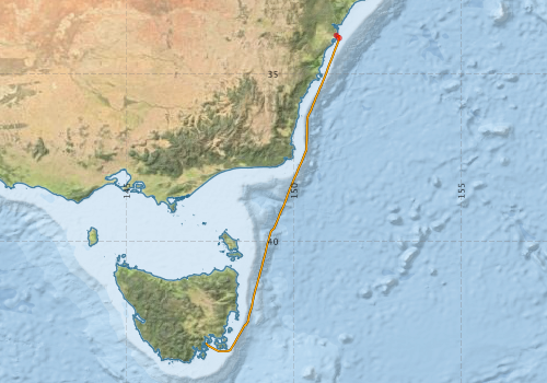
Voyage extents: 43° 17.2' S to 33° 49.6' S 147° 22.6' E to 151° 21.5' E Get voyage track shapefile Get CSV
Marlin Metadata:-
Participants - on ship:-
| Name | Role | Organisation |
|---|---|---|
| Alex Papji | XBT project | |
| Bronte Tilbrrok | CO2 sensor | |
| John Bennett | CO2 sensor | DAR |
| Lindsay Pender | Voyage leader | |
| Paul Sliogeris | XBT project | AODC |
| Ross Hibbins | XBT project | BOM |
| Scott Munting | XBT project |
This list includes those that may have only been on part of the voyage. See voyage reports on 'Reports and Maps' tab for details.
Marine National Facility Reports - plans, summaries and data processing

Search for publications, reports and datasets from this and other voyages
Data publishing
This is a list of online datasets hosted by CSIRO. Other processed datasets hosted by collaborating organisations may be found on the 'Metadata' or "Reports, Publications and Maps' tab.
Use the Get data link on the right to extract data using the NCMI Data Trawler.
| Data Stream | Data Summary | Get data | ||||||||||||||
|---|---|---|---|---|---|---|---|---|---|---|---|---|---|---|---|---|
| ADCP Data |
|
Get Data from Trawler Download NetCDF dataset fr0204adcpCDF.zip Download dataset 1.2 / 0.3 Mb Processing report for this dataset |
||||||||||||||
| Underway |
|
Get Data from Trawler |
Deployments by start time:- Click on column header to sort. Use link on 'Deployment' to see full details. Use the CSV button at the bottom to export data (tab delimited).
Search for deployments from this voyage and others
| Deployment | Operation | Station | Cast | Gear | Project | Start and end times | Start Location | End Location | Depth range | Max Depth | Description | |||
|---|---|---|---|---|---|---|---|---|---|---|---|---|---|---|
| Underway System [details] | Anemometer,Anemometer,Anemometer,Barometer,Gyro-MK 10,Humidity probe,Licor-UWQ 4653,RIMCO vane driving potentiometer,RIMCO vane driving potentiometer,Ships log,Simrad EA500 Echosounder,Temperature sensor-AD590J,ThermoSalinoGraph (TSG)-Franklin,ThermoSalinoGraph (TSG)-Franklin | 1197 | 2002-04-22 00:00 | 2002-04-25 23:59 | -33.8438 | 151.2690 | -43.0352 | 147.3760 | ||||||
| ADCP Data [details] | RDI Ocean Surveyor Acoustic Doppler current profiler | 1543 | 2002-04-22 07:20 | 2002-04-25 20:20 | -33.9230 | 151.3500 | -43.1100 | 147.4350 | 388 | |||||