Voyage details and related metadata, reports, events and data.
FR 15/98
(alternative identifier: FR199815)
- is a Marine National Facility ![]() voyage
voyage
Period: 1998-11-28 00:00 to 1998-12-15 00:00 Local
Duration: 17.00 days
From: Sydney To: Brisbane
Region: East Australian waters
Ship: Franklin [details]
Description:
Cainozoic marine stratigraphy and sedimentology of the central northern NSW and southern Queensland continental margin.
For more details see the Voyage Plan (see link above).
Leader: R. Boyd (University of Newcastle)
Project: National Facility External Users: R. Boyd (University of Newcastle) [details]
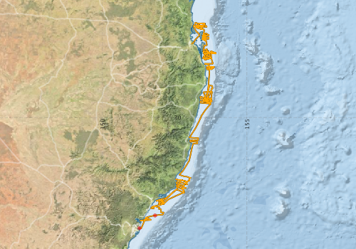
Voyage extents: 33° 50.5' S to 26° 43.0' S 151° 16.5' E to 153° 55.3' E Get voyage track shapefile Get CSV
Marlin Metadata:-
Participants - on ship:-
| Name | Role | Organisation |
|---|---|---|
| Not recorded | ? |
This list includes those that may have only been on part of the voyage. See voyage reports on 'Reports and Maps' tab for details.
Marine National Facility Reports - plans, summaries and data processing
-
RV Franklin FR15/98 Cruise Summary
- includes preliminary results, voyage narrative, types of data collected with C77/ROSCOP codes.
-
FR199815 Voyage Plan
- includes objectives, investigator details, proposed data collection, voyage track and equipment to be used.
-

Publications, reports and datasets from this voyage.
Journal Article
- Dela-Cruz, Jocelyn,Middleton, Jason H.,Suthers, Iain M. (2008) The influence of upwelling, coastal currents and water temperature on the distribution of the red tide dinoflagellate, Noctiluca scintillans, along the east coast of Australia. Hydrobiologia 598 pp59-75. 10.1007/s10750-007-9140-z
Search for publications, reports and datasets from this and other voyages
Data publishing
This is a list of online datasets hosted by CSIRO. Other processed datasets hosted by collaborating organisations may be found on the 'Metadata' or "Reports, Publications and Maps' tab.
Use the Get data link on the right to extract data using the NCMI Data Trawler.
| Data Stream | Data Summary | Get data | ||||||||||||||
|---|---|---|---|---|---|---|---|---|---|---|---|---|---|---|---|---|
| ADCP Data |
|
Get Data from Trawler Download ASCII dataset - fr9815adcp.zip Download NetCDF dataset fr9815adcp.zip Processing report for this dataset |
||||||||||||||
| Underway |
|
Get Data from Trawler |
Deployments by start time:- Click on column header to sort. Use link on 'Deployment' to see full details. Use the CSV button at the bottom to export data (tab delimited).
Search for deployments from this voyage and others
| Deployment | Operation | Station | Cast | Gear | Project | Start and end times | Start Location | End Location | Depth range | Max Depth | Description | |||
|---|---|---|---|---|---|---|---|---|---|---|---|---|---|---|
| Underway System [details] | Anemometer,Anemometer,Anemometer,Barometer,Gyro-MK 10,Humidity probe,Licor-UWQ 4653,RIMCO vane driving potentiometer,RIMCO vane driving potentiometer,Ships log,Simrad EA500 Echosounder,Temperature sensor-AD590J | 134 | 1998-11-28 01:30 | 1998-12-15 22:30 | -33.8335 | 151.2750 | -27.4463 | 153.0760 | ||||||
| ADCP Data [details] | RDI VM-150 Acoustic Doppler current profiler | 134 | 1998-11-29 03:20 | 1998-12-15 13:40 | -33.3930 | 151.8160 | -26.7220 | 153.2110 | 256.8 | |||||