Survey details and related metadata, reports, events and data.
DI 01/2009 (alternative identifier: DI200901)
Period: 2009-09-01 00:00 to 2009-10-07 00:00 Local
Duration: 36.00 days
From: Brisbane To: Hobart
Region: East coast of Australia
Ship: Diana [details]
Description: The survey was completed over 37 days and split over 2 legs with port time in Sydney mid survey. This period included sampling at Taupo Seamount with five days added to the vessel charter to cover this. Several days were lost to bad weather during leg 2 when shelter was sought in Disaster Bay and Eden with impending storm force wind warnings. The steaming distance covered (Brisbane to Hobart via Taupo Seamount) was considerable (~2800 kilometres) and steaming between sites following retrieval of the gears and processing of the catch, to arrive on site in time for the master to survey the site and fine-tune the location of the sets for the following morning. Throughout the survey 23 sites were sampled, usually 3 long-line sets and 4 BRUVS deployments.
Leader: Mark Green (Leg 1) Bruce Barker (Leg 2)
Project: Spatial closures in SESSF [details]
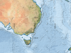
Voyage extents: 41° 00.0' S to 27° 00.0' S 147° 00.0' E to 156° 00.0' E
Marlin Metadata:-
Participants:- no records
Marine National Facility Reports - plans, summaries and data processing
- There is no map for this survey.
Search for publications, reports and datasets from this and other voyages
Data publishing - No datasets have been published
Deployments - None have been recorded in the Data Trawler.