Survey details and related metadata, reports, events and data.
DH 5/58 (alternative identifier: DH195805)
Period: 1958-03-12 00:00 to 1958-03-16 00:00 Local
Duration: 4.00 days
From: Sydney To: Sydney
Region: Austrailan East Coast
Ship: Derwent Hunter [details]
Description:
Derwent Hunter voyage DH 05/1958.
The purpose of this cruise was the same as that outlined
for Cruise DH3/58 which had to be cancelled,
This cruise was the fourth of the productivity series.
From the Cruise plan for DH3/58:
The purpose of this cruise was (1) to carry out routine measurements of the rate of photosynthetic uptake of CO in samples taken on a line of stations bearing 110 deg rom Port Hacking. (2) To measure the daily variation of C02 uptake at two stations 2O and 120 miles from the coast. (3) To determine the sampling error in C02 uptake measurements at a station 70 miles from the coast. (4) To determine the hydrological characteristics and the depth of light penetration at all stations.
Taken from Division of Fisheries and Oceanography Report 27 (1958)
Leader: N. Dyson (CSIRO)
Project: East Australian Current studies ("Derwent Hunter", "Gascoyne"), 1957-60 [details]
Voyage extents: 34° 18.0' S to 34° 07.0' S 151° 35.0' E to 152° 52.0' E
Marlin Metadata:-
Participants:- no records
Marine National Facility Reports - plans, summaries and data processing
- View the Survey Summary report - includes preliminary results, voyage narrative, types of data collected with C77/ROSCOP codes.
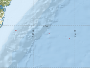
- There is no map for this survey.
Search for publications, reports and datasets from this and other voyages
Data publishing
This is a list of online datasets hosted by CSIRO. Other processed datasets hosted by collaborating organisations may be found on the 'Metadata' or "Reports, Publications and Maps' tab.
Use the Get data link on the right to extract data using the NCMI Data Trawler.
| Data Stream | Data Summary | Get data | ||||||||||
|---|---|---|---|---|---|---|---|---|---|---|---|---|
| Hydrology |
|
Get Data from Trawler |
Deployments by start time:- Click on column header to sort. Use link on 'Deployment' to see full details. Use the CSV button at the bottom to export data (tab delimited).
Search for deployments from this voyage and others
| Deployment | Operation | Station | Cast | Gear | Project | Start and end times | Start Location | End Location | Depth range | Max Depth | Description | |||
|---|---|---|---|---|---|---|---|---|---|---|---|---|---|---|
| Hydrology Cast [details] | 1 | 3 | 1958-03-12 00:00 | 1958-03-12 00:00 | -34.1167 | 151.5833 | 300 | |||||||
| Hydrology Cast [details] | 1 | 3 | 1958-03-13 00:00 | 1958-03-13 00:00 | -34.1833 | 152.3833 | 224 | |||||||
| Hydrology Cast [details] | 1 | 3 | 1958-03-14 00:00 | 1958-03-14 00:00 | -34.3000 | 152.8667 | 300 | |||||||