Survey details and related metadata, reports, events and data.
AB85/86 (alternative identifier: AB199285)
Period: 1992-03-28 00:00 to 1992-04-01 00:00 Local
Duration: 4.00 days
From: Weipa To: Weipa
Region: Gulf of Carpentaria
Ship: Jacqueline D [details]
Description:
Cruise Objectives
A study of seasonal and interannual variability of recruitment of commercially
important penaeid prawns is being undertaken in Albatross Bay, northeastern Gulf
of Carpentaria. The offshore component involves sampling of adults, spawning females,
larvae and recruiting subadults.
AB86 was the Twenty-sixth monthly survey cruise planned for the Albatross Bay
study area, for the period August 1989 to May 1992. This sampling is part of a
longer term study, for which 40 cruises have been completed during the period
March 1986 to May 1989. On this cruise, the set of 10 selected nearshore grids
were sampled twice, and the set of offshore grids were sampled once.
AB85 (Special Studies)
1. Sample inshore grids established during AB77 to examine possible tiger prawn
nursery areas.
2. Sample selected inshore grids for larval prawns.
AB86
1. Carry out a trawl survey of prawn species distribution, size composition, population
density and reproductive status in the study area.
2. Carry out sampling for larval prawns at selected stations.
3. Sample for phytoplankton species composition using a 37}i net. Filter samples
for chlorophyll a level analysis at selected stations at 2 depths with replication
during the cruise.
4. Record numbers and species of turtles collected in trawl samples.
5. Collect salinity and temperature profiles with the SDL at each plankton station.
6. Collect live P. semisulcatus and P. merguiensis for transport to the Cleveland
laboratory for maturation experiments.
7. Spawn selected P. merguiensis females on board to attempt transport of live
nauplii to Cleveland.
8. Collect water samples for nutrient analysis.
9. Collect samples of both immature and ripe P. semisulcatus for gut content analysis.
10. Collect samples for Isotope analysis of three species at three depths into
three size groups.
Leader: R.C Pendrey (CSIRO)
Project: Causes of declines in stocks of commercially important prawns in the northern prawn fishery (FIRDC project no. 89/13) 1989-1992 [details]
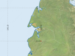
Map extents: 50° 00.0' S to 0° 00.0' N 95° 00.0' E to 180° 00.0' E
Metadata - No Marlin metadata records found or has not been linked to this survey or potentially the metadata catalogue is offline.
Participants:- no records
Marine National Facility Reports - plans, summaries and data processing
- View the Survey Summary report - includes preliminary results, voyage narrative, types of data collected with C77/ROSCOP codes.
- View Survey map
Search for publications, reports and datasets from this and other voyages
Data publishing - No datasets have been published
Deployments - None have been recorded in the Data Trawler.