Please login if you have access to particular applications.
Provider: All providers | |
Key Ecological Features | |
| Name: | Gulf of Carpentaria coastal zone - view region report showing all data |
| Region: | North |
| Area: | 43,131.86 km2 |
| Gear type: | CTD sensor
|
| Layers used: |
AODN Northern Territory satellite tagging Hawksbill turtle profile map
- link to layer metadata CMAR CTD Data Overview (1982 - present) - link to layer metadata RAN CTD data |
| Summary: | Records - 40 Deepest: db |
| Last updated: | 4-May-2024 10:25. |
| Buffer: | |
Time series plot (1930 to present) - Y axis is deployments as vertical profile or tows per year
Region data
Show data list
| Year | Total inside region |
| 1988 | 6 |
| 2003 | 16 |
| 2009 | 2 |
| 2010 | 38 |
| 2013 | 9 |
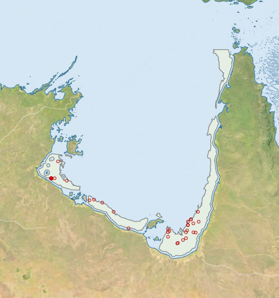
Region extents: 135° 27.2' E 17° 39.4' S to 142° 05.6' E 10° 48.0' S
Acknowledgements: Background map - Bright Earth e-Atlas Basemap v1.0 (AIMS, GBRMPA, JCU, DSITIA, GA, UCSD, NASA, OSM, ESRI) CC BY