Please login if you have access to particular applications.
Provider: All providers | |
Key Ecological Features | |
| Name: | Carbonate bank and terrace system of the Van Diemen Rise - view region report showing all data |
| Region: | North |
| Area: | 31,278.22 km2 |
| Gear type: | demersal trawl or sled
 |
| Layers used: |
CMAR Catch Operations Data overview (1965 to current) - link to layer metadata |
| Summary: | Records - 19 Deepest: db |
| Last updated: | 2-Dec-2025 13:44. |
| Buffer: | |
Time series plot (1930 to present) - Y axis is deployments per year
Region data
Show data list
| Year | Total inside region |
| 1967 | 1 |
| 1969 | 1 |
| 1970 | 2 |
| 1972 | 1 |
| 1973 | 2 |
| 1979 | 6 |
| 1980 | 5 |
| 1997 | 1 |
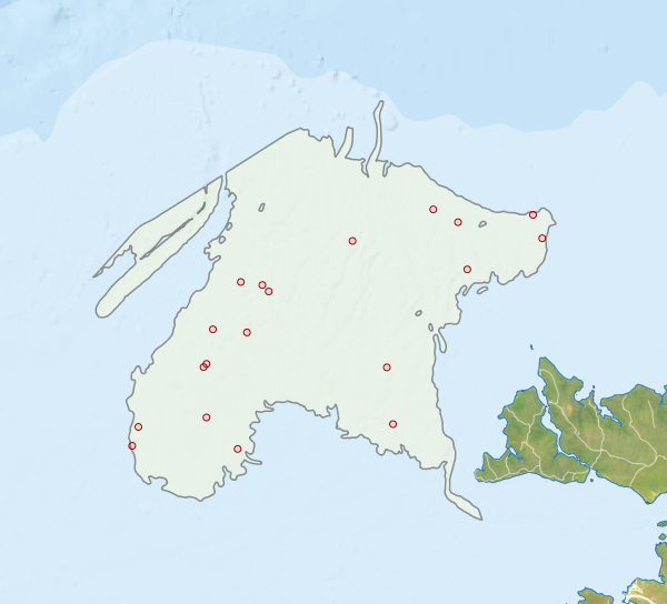
Region extents: 127° 58.3' E 12° 01.5' S to 130° 27.5' E 9° 48.5' S
Acknowledgements: Background map - Bright Earth e-Atlas Basemap v1.0 (AIMS, GBRMPA, JCU, DSITIA, GA, UCSD, NASA, OSM, ESRI) CC BY