CSIRO Marine and Atmospheric Research has access to data from three satellite reception antenna. The largest antenna the Tasmanian Earth Resources Satellite Station is on Hobart's eastern shore. We receive data from a number of environmental satellite instruments including MODIS, AVHRR and SeaWifs. These data, and datasets developed from processing and analysis of the individual images, are being made made available to the research community and public via a number of web services including OpenDap and LAS. As we redevelop these web pages more obvious links will be made to these points of access.
|
|

Tasmania Earth Resources Satellite Station
|
Recent MODIS passes are combined, and truecolour images down to 250m resolution are
viewed using the Google Earth application (requires version 4 or later). To install or
get more info on Google Earth, go to
http://earth.google.com (external link).
All Google Earth datasets at the Remote Sensing Group
A large archive of MODIS images, from Australian receiving stations and from tapes received from NASA, within the period February 2000 to the present.
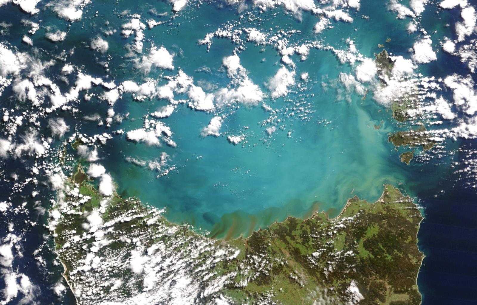
* Coccolithophorid blooms, Tasmania
A spectacular and detailed image off the North-West coast of Western Australia ( 1.3 Meg )
* North-West shelf chlorophyll
A spectacular and detailed image off the North-West coast of Western Australia ( 1.3 Meg )
* Northern Tasmania, after heavy rainfall
* Unusual cloud formation near Fraser Island
A composite Sea Surface Temperature (SST) image showing Australian waters for the last seven days is updated daily. Click on the image to retrieve the location and maximum SST value for the click point.
Fires!
The images on
these pages
show the massive extent of fires in VIC, NSW and the ACT.
Recent Bushfires..
The Sentinel system for
Bushfire monitoring by Geoscience Australia
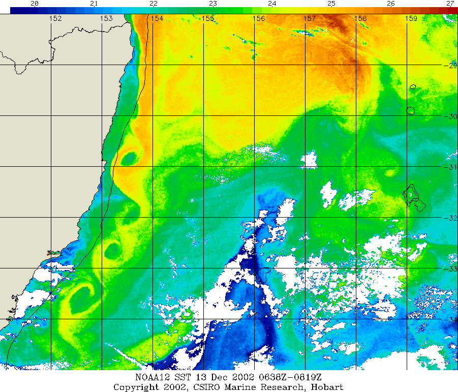
An unusual formation of eddies occured Friday 13 December 2002. See it
here
SST Calibration and Validation
Compares the measurements of water temperature using a thermometer, with the SST values derived by two methods which use satellite data: the McMillin and Crosby algorithm, and the NLSST (non-linear SST) algorithm. Plots show examples of all three methods for a day in summer and in winter, for a transect off Hillarys, W.A.
RADARSAT-SAR imagery
Canadian Space Agency/Agence spatiale canadienne RADARSAT Synthetic Aperture Radar (SAR) scenes acquired for ADRO Project #72 Cresswell and Tildesley (CSIRO AUSTRALIA)
AVHRR imagery of NSW bushfires.
Visible and thermal images processed from NOAA AVHRR data received on December 2nd, 1997
SeaWiFS & OCTS ocean colour satellite imagery
Samples of ocean colour images from the SeaWiFS instrument, which started in Sep 1997 and from the Japanese OCTS instrument for it's life from November 1996 to June 1997. These show great detail in the oceanic distribution of marine phytoplankton concentration and the underlying processes of current, mixing and coastal runoff.
MERIS truecolour browse images
of each scene held at Hobart Labs, from the European ocean colour satellite. Data commences from Jan 2004 onwards.


