Voyage details and related metadata, reports, events and data.
TAN2021_V01
- is a Marine National Facility ![]() voyage
voyage
Title: Macquarie Island voyage
Period: 2021-11-08 00:00 to 2021-12-03 00:00 UTC
Duration: 25.00 days
From: Wellington To: Wellington
Region: Macquarie Island
Ship: Tangaroa [details]
Description: RV Tangaroa sailed to the Macquarie Ridge under charter by Australia’s CSIRO Marine National Facility to recover 27 ocean bottom seismometers deployed on IN2020_V06 and acquire multibeam sonar and sub‐bottom profile data in the Macquarie Island region.
Leader: Kevin Mackay
Project: Probing the Australian-Pacific plate boundary: Macquarie Ridge in 3-D [details] Primary
Ship Logs
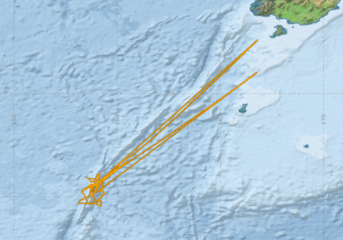
Voyage extents: 55° 28.7' S to 47° 23.9' S 158° 06.3' E to 166° 47.7' E Get voyage track shapefile Get CSV
Marlin Metadata:-
Participants:- no records
Marine National Facility Reports - plans, summaries and data processing
- View the Survey plan - includes objectives, investigator details, proposed data collection, voyage track and equipment to be used.
- There is no map for this survey. Create a map from underway data.
Publications, reports and datasets from this voyage.
Conference abstract
- Pham, T.-S., Tkalcic, H., Ma, X., Pickle, R., Muir, J., Duru, K., Winder, T., Rawlinson, N., Eakin, C., Coffin, M., and Stock, J. and the Macquarie Ridge 3D Team: Probabilistic ambient noise imaging of the Macquarie Ridge Complex using ocean-bottom and land-based seismometers, EGU General Assembly 2023, Vienna, Austria, 24–28 Apr 2023, EGU23-10662,
10.5194/egusphere-egu23-10662
Dataset
- Tkalčić, Hrvoje; Mountjoy, Joshu; MacKay, Kevin; Boyd, Matt; Vandenbossche, Phil; Navidad, Cisco; Taylor, Charlie; Plunkett, Tom (2022): TAN2021_V01 Macquarie Ridge Complex 5m - 210m Multi-resolution AusSeabed products. v1. CSIRO. Data Collection 10.25919/kn3g-x440
Journal Article
- Lucieer, Vanessa,Flukes, Emma,Monk, Jacquomo,Walsh, Peter (2024) Geomorphometric maps of Australia’s Marine Park estate and their role in improving the integrated monitoring and management of marine ecosystems. Frontiers in Marine Science 10 pp-. 10.3389/fmars.2023.1302108
Search for publications, reports and datasets from this and other voyages
Data publishing
This is a list of online datasets hosted by CSIRO. Other processed datasets hosted by collaborating organisations may be found on the 'Metadata' or "Reports, Publications and Maps' tab.
Use the Get data link on the right to extract data using the NCMI Data Trawler.
| Data Stream | Data Summary | Get data | ||||||||||
|---|---|---|---|---|---|---|---|---|---|---|---|---|
| Multibeam echosounder |
|
Get Data from Trawler |
Deployments - None have been recorded in the Data Trawler.