Voyage details and related metadata, reports, events and data.
ST 01/2008
(alternative identifier: ST200801)
- is a Marine National Facility ![]() voyage
voyage
Period: 2008-04-10 00:00 to 2008-04-14 00:00 UTC
Duration: 4.00 days
From: Hobart To: Sydney
Region: Tasman Sea
Ship: Southern Surveyor [details]
Description:
Scientific Objectives
As part of a national seabed mapping initiative map the upper-slope and mid-slope seabed focusing on the 200 m to 1500 m depth range and regions important for regional marine planning, biodiversity and conservation assessments and fisheries habitat mapping.
Objectives for the transit voyages:
1. Using transit time, map key areas as identified in gap analysis.
2. Develop methods of improving data quality and calibrating the EM300 backscatter data.
3. Develop and test new rapid methods of ground truthing acoustic backscatter maps with optical and physical sampling.
4. Process bathymetry and backscatter data and create maps suitable for ecological interpretation.
The objectives to be accomplished on this transit are to complete a swath survey line from Hobart to Sydney, predominately along the 400m contour, map and resample reference sites at 100, 200 and 400 m and deploy XBTs and the CTD in order to provide calibration data for the swath mapper.
Leader: Rudy Kloser (CMAR)
Project: Deepwater Assessment Group [details]
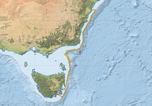
Voyage extents: 43° 32.1' S to 33° 46.1' S 147° 20.9' E to 151° 43.4' E Get voyage track shapefile Get CSV
Marlin Metadata:-
Participants - on ship:-
| Name | Role | Organisation |
|---|---|---|
| Dylan Colson | Undergrad Surveying and Spatial Sciences | University of Tasmania - Hobart |
| Fred Stein | OHS&E Audit | CSIRO Oceans & Atmosphere - Hobart |
| James Porteous | Media representative | ECOS magazine |
| Lindsay Pender | Computing support | CSIRO Oceans & Atmosphere - Hobart |
| Rick Smith | Swath mapping | CSIRO Oceans & Atmosphere - Hobart |
| Rohanne Young | OHS&E Audit | CSIRO Oceans & Atmosphere - Hobart |
| Rudy Kloser | Chief Investigator | CSIRO Oceans & Atmosphere - Hobart |
| Simon Torok | Observer | CSIRO Oceans & Atmosphere - Hobart |
| Stephen Thomas | Electronics support /Voyage Manager | CSIRO Oceans & Atmosphere - Hobart |
| Tim Lynch | Moorings | CSIRO Oceans & Atmosphere - Hobart |
| Vanessa Lucieer | TAFI/UTA | Post Doc Biodiversity CERF Hub |
This list includes those that may have only been on part of the voyage. See voyage reports on 'Reports and Maps' tab for details.
Marine National Facility Reports - plans, summaries and data processing
-
ST200801 Voyage Plan
- includes objectives, investigator details, proposed data collection, voyage track and equipment to be used.
-

Publications, reports and datasets from this voyage.
Dataset
- Bakker, Dorothee C E; Pfeil, Benjamin; Smith, Karl; Hankin, Steven; Olsen, Are; Alin, Simone R; Cosca, Catherine E; Harasawa, Sumiko; Kozyr, Alexander; Nojiri, Yukihiro; O'Brien, Kevin M; Schuster, Ute; Telszewski, Maciej; Tilbrook, Bronte; Wada, Chisato; Akl, John; Barbero, Leticia; Bates, Nicolas R; Boutin, Jacqueline; Bozec, Yann; Cai, Wei-Jun; Castle, Robert D; Chavez, Francisco P; Chen, Lei; Chierici, Melissa; Currie, Kim I; de Baar, Hein J W; Evans, Wiley; Feely, Richard A; Fransson, Agneta; Gao, Zhongyong; Hales, Burke; Hardman-Mountford, Nicolas J; Hoppema, Mario; Huang, Wei-Jen; Hunt, Christopher W; Huss, Betty; Ichikawa, Tadafumi; Johannessen, Truls; Jones, Elizabeth M; Jones, Steve D; Jutterstrøm, Sara; Kitidis, Vassilis; Körtzinger, Arne; Landschützer, Peter; Lauvset, Siv K; Lefèvre, Nathalie; Manke, Ansley; Mathis, Jeremy T; Merlivat, Liliane; Metzl, Nicolas; Murata, Akihiko; Newberger, Timothy; Omar, Abdirahman M; Ono, Tsuneo; Park, Geun-Ha; Paterson, Kristina; Pierrot, Denis; Ríos, Aida F; Sabine, Christopher L; Saito, Shu; Salisbury, Joe; Sarma, Vedula V S S; Schlitzer, Reiner; Sieger, Rainer; Skjelvan, Ingunn; Steinhoff, Tobias; Sullivan, Kevin; Sun, Heng; Sutton, Adrienne; Suzuki, Toru; Sweeney, Colm; Takahashi, Taro; Tjiputra, Jerry; Tsurushima, Nobuo; van Heuven, Steven; Vandemark, Doug; Vlahos, Penny; Wallace, Douglas WR; Wanninkhof, Rik; Watson, Andrew J (2014): Surface Ocean CO2 Atlas (SOCAT) V2. PANGAEA, 10.1594/PANGAEA.811776
- Smith, S. R.,Lopez, N.,Bourassa, M. A. (2016) SAMOS air‐sea fluxes: 2005–2014. Geoscience Data Journal 3 pp9-19. 10.1002/gdj3.34
Search for publications, reports and datasets from this and other voyages
Data publishing
This is a list of online datasets hosted by CSIRO. Other processed datasets hosted by collaborating organisations may be found on the 'Metadata' or "Reports, Publications and Maps' tab.
Use the Get data link on the right to extract data using the NCMI Data Trawler.
| Data Stream | Data Summary | Get data | ||||||||||||||
|---|---|---|---|---|---|---|---|---|---|---|---|---|---|---|---|---|
| ADCP Data |
|
Get Data from Trawler Download netCDF dataset st200801.zip ST200801_UWY_ADCP_Report.pdf |
||||||||||||||
| Multibeam echosounder |
|
Get Data from Trawler |
||||||||||||||
| pCO2 |
|
External link - download datafile at IMOS |
||||||||||||||
| Underway |
|
Get Data from Trawler |
Deployments by start time:- Click on column header to sort. Use link on 'Deployment' to see full details. Use the CSV button at the bottom to export data (tab delimited).
Search for deployments from this voyage and others
| Deployment | Operation | Station | Cast | Gear | Project | Start and end times | Start Location | End Location | Depth range | Max Depth | Description | |||
|---|---|---|---|---|---|---|---|---|---|---|---|---|---|---|
| Underway System [details] | Air Temperature Sensor-HMP233,Barometer,Fluorometer WS3S-443P,Gyro-Generic SS-NF,Humidity Sensor-HMP233,Licor-UWQ 3708,RM Young 05106 wind monitor-75621,RM Young 05106 wind monitor-75621,RM Young 05106 wind monitor-75621,RM Young Rain Gauge,Seapath 200,Seapath 200,Simrad EA500 Echosounder,ThermoSalinoGraph (TSG)-SS-SN 1777,ThermoSalinoGraph (TSG)-SS-SN 1777 | 1882 | 2008-04-09 23:16 | 2008-04-14 00:07 | -42.8908 | 147.3469 | -33.8255 | 151.2813 | ||||||
| Multibeam echosounder [details] | EM300 Multibeam Echosounder | 2008-04-09 23:19 | 2008-04-14 01:07 | -42.8950 | 147.3524 | -33.8627 | 151.1840 | 1563 | ||||||
| ADCP Data [details] | RDI Ocean Surveyor Acoustic Doppler current profiler | 1882 | 2008-04-10 01:17 | 2008-04-13 23:57 | -43.2102 | 147.5337 | -33.8294 | 151.3105 | 799 | |||||