Voyage details and related metadata, reports, events and data.
SS2012_T05
- is a Marine National Facility ![]() voyage
voyage
Period: 2012-07-30 08:00 to 2012-08-09 08:00 UTC
Duration: 10.00 days
From: Hobart To: Fremantle
Region: Australia's southern coast and continental shelf.
Ship: Southern Surveyor [details]
Description: MNF Southern Surveyor research voyage SS2012_t05. The benthic fauna of the Great Australian Bight. Scientific Objectives The focus of this program is to give students a taste of what it is like to live and work on an ocean going research vessel and to expose them to some of the different sampling methods and equipment that are used in oceanographic research. The students will have two (quasi) scientific aims, all of which will contribute to our knowledge about Australian waters, as follows: 1) to characterise the macro-fauna inhabiting the benthos at range of deep water (~500 m) sites along Australia's southern coast; 2) to investigate regional surface productivity (POM) along the southern shelf of Australia. For Kloser, the voyage provides an ongoing opportunity to use vessel transit time to complete a national mapping of the upper-mid slope seabed with multi-beam mapping and associated ecological interpretation. The upper-slope and mid-slope seabed 100 m to 1500 m depth range, are regions important for regional marine planning, biodiversity and conservation assessments and fisheries habitat mapping. The swath mapping will be integrated as a part of the student activities. Piggy-back Project- Distribution of plankton along the southern Australian seaboard. This is a part extract from voyage plan, please read plan for full details.
Leader: S. Holmes (U Western Sydney)
Project: National Facility External Users: S. Holmes (University of Sydney) [details]
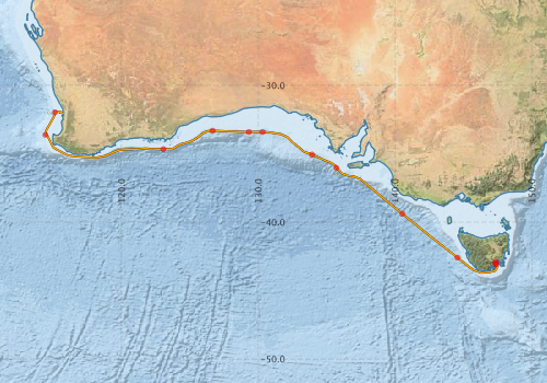
Voyage extents: 43° 42.1' S to 31° 56.3' S 114° 25.7' E to 147° 28.8' E Get voyage track shapefile Get CSV
Marlin Metadata:-
Participants - on ship:-
| Name | Role | Organisation |
|---|---|---|
| Amber-Louise Burberry | Undergraduate student | University of Technology, Sydney |
| Anoosh Sarraf | MNF Computing support | CSIRO Oceans & Atmosphere - Hobart |
| Cristin Sheehan | Undergraduate student | University of Technology, Sydney |
| Graeme Poleweski | Undergraduate student | University of Technology, Sydney |
| Januar Harinato | Ph.D. student | James Cook University |
| Jeff Cordell | MNF Electronics support | CSIRO Marine and Atmospheric Research |
| Kelly Buchanan | MSc student | University of New South Wales - Centre for Marine Science |
| Mark Rayner | MNF Hydrochemistry Support | CSIRO Oceans & Atmosphere - Hobart |
| Rod Palmer | MNF Voyage Manager | CSIRO Oceans & Atmosphere - Hobart |
| Sascha Frydman | MNF Swath support | CSIRO Oceans & Atmosphere - Hobart |
| Sebastian Holmes | Principal Investigator | University of Western Sydney |
| Tara Martin | MNF Swath support | CSIRO Marine and Atmospheric Research |
This list includes those that may have only been on part of the voyage. See voyage reports on 'Reports and Maps' tab for details.
Marine National Facility Reports - plans, summaries and data processing
-
SS2012_T05 Voyage Plan
- includes objectives, investigator details, proposed data collection, voyage track and equipment to be used.
-
SS2012_T05 Underway Data Processing Report
- details of data processing steps, calibration information, instruments used and any issues with the data.
-
SS2012_T05 Voyage Summary
- includes preliminary results, voyage narrative, types of data collected with C77/ROSCOP codes.
-
SS2012_T05 Scientific Highlight
- report of the key outputs
- There is no map for this survey. Create a map from underway data.
Publications, reports and datasets from this voyage.
Dataset
- Smith, S. R.,Lopez, N.,Bourassa, M. A. (2016) SAMOS air‐sea fluxes: 2005–2014. Geoscience Data Journal 3 pp9-19. 10.1002/gdj3.34
Search for publications, reports and datasets from this and other voyages
Data publishing
This is a list of online datasets hosted by CSIRO. Other processed datasets hosted by collaborating organisations may be found on the 'Metadata' or "Reports, Publications and Maps' tab.
Use the Get data link on the right to extract data using the NCMI Data Trawler.
| Data Stream | Data Summary | Get data | ||||||||||||||
|---|---|---|---|---|---|---|---|---|---|---|---|---|---|---|---|---|
| ADCP Data |
|
Get Data from Trawler Download NetCDFss2012_t05_ADCP_long_nc.zip Download Processing Report ss2012_t05ADCP.pdf Download NetCDFss2012_t05_ADCP_short_nc.zip Overview ADCP Dataset HTML |
||||||||||||||
| CTD profile |
|
Get Data from Trawler Processing report: ss2012_t05_CTD.pdf Download NetCDF data ss2012_t05_CTD_avg_nc.zip Download CTD plots ss2012_t05_CTD_plots_pdf.zip |
||||||||||||||
| Hydrology | No data | |||||||||||||||
| Multibeam echosounder |
|
Get Data from Trawler |
||||||||||||||
| Sediment sampling | No data | |||||||||||||||
| SOOP Bio-acoustics |
|
External link - datafile at IMOS NetCDF Data Format: Manual Download |
||||||||||||||
| Underway |
|
Get Data from Trawler Download 5 sec NetCDF dataset ss2012_t05UWYnc.zip |
||||||||||||||
| XBT Profile |
|
Get Data from Trawler Download xbt_ascii_ma_2007_2012.zip (MEDS ASCII format ) Download xbt_nc_ss2007_2012.zip (NetCDF format) |
Deployments by start time:- Click on column header to sort. Use link on 'Deployment' to see full details. Use the CSV button at the bottom to export data (tab delimited).
Search for deployments from this voyage and others
| Deployment | Operation | Station | Cast | Gear | Project | Start and end times | Start Location | End Location | Depth range | Max Depth | Description | |||
|---|---|---|---|---|---|---|---|---|---|---|---|---|---|---|
| Underway System [details] | Air Temperature Sensor-HMT333,Barometer,Doppler speed log,Fluorometer WS3S-443P,Gill Ultrasonic Wind Sensor,Gill Ultrasonic Wind Sensor,Humidity Sensor-HMT333,IMOS Port Pyranometer-SN 35122F3,IMOS Port Radiometer-SN 35111F3,IMOS Stbd Pyranometer-SN 35123F3,IMOS Stbd Radiometer-SN 35093F3,IMOS rain gauge,IMOS rain gauge,Licor - LI-190SL Q46071,RM Young 05106 wind monitor-75621,RM Young 05106 wind monitor-75621,RM Young 05106 wind monitor-75621,RM Young Rain Gauge,Seapath 200,Seapath 200,Seapath 200,Simrad EK60 echosounder,ThermoSalinoGraph (TSG)-SS-SN 1777,ThermoSalinoGraph (TSG)-SS-SN 1777 | 2369 | 2012-07-30 08:04 | 2012-08-09 07:37 | -42.8863 | 147.3386 | -32.0497 | 115.7448 | ||||||
| Multibeam echosounder [details] | EM300 Multibeam Echosounder | 2012-07-30 09:30 | 2012-08-09 05:27 | -43.0793 | 147.3921 | -31.9466 | 115.5324 | 4568.2 | ||||||
| XBT Cast [details] | Sippican Deep Blue | 2391 | 2012-07-31 03:11 | -42.5945 | 144.5703 | 1100.3 | ||||||||
| ADCP Data [details] | RDI Ocean Surveyor Acoustic Doppler current profiler | 2369 | 2012-07-31 08:07 | 2012-08-10 03:10 | -43.0182 | 147.3771 | -31.9417 | 115.3421 | 469.5 | |||||
| XBT Cast [details] | Sippican Deep Blue | 2391 | 2012-08-01 04:46 | -39.3920 | 140.5402 | 1100.3 | ||||||||
| CTD Cast [details] | 2 | Cast 2 | CTD 21,Conductivity CTD 21-SN 2312,Nitrate - CTD21 Satlantic ISUS V3-236,Oxygen CTD 21-SBE 43-SN 1794,Pressure CTD 21,Temperature CTD 21 - SN 4718 | 2369 | 2012-08-02 12:54 | 2012-08-02 13:26 | -36.0343 | 135.7183 | -36.0379 | 135.7189 | 384 | |||
| XBT Cast [details] | Sippican Deep Blue | 2391 | 2012-08-03 04:18 | -35.0692 | 133.9346 | 1100.3 | ||||||||
| XBT Cast [details] | Sippican Deep Blue | 2391 | 2012-08-04 04:41 | -33.4075 | 130.3228 | 1100.3 | ||||||||
| CTD Cast [details] | 3 | Cast 3 | CTD 21,Conductivity CTD 21-SN 2312,Nitrate - CTD21 Satlantic ISUS V3-236,Oxygen CTD 21-SBE 43-SN 1794,Pressure CTD 21,Temperature CTD 21 - SN 4718 | 2369 | 2012-08-04 11:10 | 2012-08-04 11:43 | -33.4073 | 129.3182 | -33.4096 | 129.3216 | 418 | |||
| XBT Cast [details] | Sippican Deep Blue | 2391 | 2012-08-05 04:35 | -33.3197 | 126.6704 | 1100.3 | ||||||||
| XBT Cast [details] | Sippican Deep Blue | 2391 | 2012-08-06 03:50 | -34.6711 | 123.0695 | 1100.3 | ||||||||
| CTD Cast [details] | 10 | Cast 10 | CTD 21,Conductivity CTD 21-SN 2312,Fluorometer-CTD 21 -Chelsea-06-5941-001,Licor - CTD 21 - SN 70111,Nitrate - CTD21 Satlantic ISUS V3-236,Oxygen CTD 21-SBE 43-SN 1794,Pressure CTD 21,Temperature CTD 21 - SN 4718,Transmissometer - CTD 22 -CST-1421DR | 2369 | 2012-08-08 13:26 | 2012-08-08 13:54 | -33.6171 | 114.4426 | -33.6166 | 114.4472 | 491 | |||
| CTD Cast [details] | 11 | Cast 11 | CTD 21,Conductivity CTD 21-SN 2312,Fluorometer-CTD 21 -Chelsea-06-5941-001,Licor - CTD 21 - SN 70111,Nitrate - CTD21 Satlantic ISUS V3-236,Oxygen CTD 21-SBE 43-SN 1794,Pressure CTD 21,Temperature CTD 21 - SN 4718,Transmissometer - CTD 22 -CST-1421DR | 2369 | 2012-08-09 02:16 | 2012-08-09 02:56 | -31.9693 | 115.1388 | -31.9688 | 115.1380 | 919 | |||