Survey details and related metadata, reports, events and data.
SOL2015_C01
Period: 2015-10-04 00:00 to 2015-10-31 00:00 Local
Duration: 27.00 days
From: Darwin To: Darwin
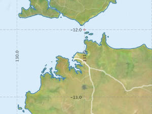
Region: Long term monitoring - Indonesian Throughflow: Timor Passage and Ombai Strait
Ship: Solander [details]
Description: This proposal will recover and redeploy deep ocean moorings in two key passages of the Indonesian Through Flow -Timor Passage and Ombai Strait. The moorings arrays, a component of the Australian Integrated Marine Observing System (IMOS, http://imos.org.au/), will monitor more than 80% of the total Indonesian Throughflow and collect ocean mixing observations at the mooring location and other key sills in the Ombai Strait and Timor Passage. In situ 'climate quality' observations from these moorings will provide the required spatial and temporal coverage to understand ocean dynamics, the ocean's role in climate variability and change, investigate forcing of the atmosphere and ocean and assess the realism of data-assimilation ocean models and coupled ocean-atmosphere models. The scientific objectives of this proposal are: * Determine the mean and intraseasonal, interannual and decadal variability of the Indonesian Throughflow; * Understanding the links between ENSO and IOD climate modes and the volume, heat and salt transport variability of the Indonesian Throughflow; * Improved understanding of the response of the northern and northwestern Australia continental margin shelf/slope boundary currents and Leeuwin Current System to Indonesian Throughflow variability. * Understand the variability of mixing and quantify the impact on water mass property changes between the inflow and outflow passage to the Indonesian Throughflow.
Leader: B. Sloyan (CSIRO)
Project: IMOS Sustained observations of the Timor Passage and Ombai Strait components of the Indonesian Throughflow [details]
Map extents: 50° 00.0' S to 0° 00.0' N 95° 00.0' E to 180° 00.0' E
Metadata - No Marlin metadata records found or has not been linked to this survey or potentially the metadata catalogue is offline.
Participants:- no records
Marine National Facility Reports - plans, summaries and data processing
- View the Survey plan - includes objectives, investigator details, proposed data collection, voyage track and equipment to be used.
- There is no map for this survey.
Search for publications, reports and datasets from this and other voyages
Data publishing - No datasets have been published
Deployments - None have been recorded in the Data Trawler.