Survey details and related metadata, reports, events and data.
NB 1/2011 (alternative identifier: NB201101)
Period: 2011-07-26 00:00 to 2011-07-28 00:00 Local
Duration: 2.00 days
Ship: Nelson Bay [details]
Description:
Project: Gulper shark line selectivity project [details]
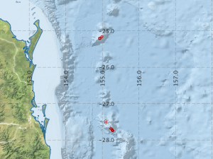
Voyage extents: 27° 44.7' S to 25° 09.6' S 154° 54.8' E to 155° 16.8' E
Metadata - No Marlin metadata records found or has not been linked to this survey or potentially the metadata catalogue is offline.
Participants:- no records
Marine National Facility Reports - plans, summaries and data processing
- There is no map for this survey.
Search for publications, reports and datasets from this and other voyages
Data publishing - No datasets have been published
Deployments by start time:- Click on column header to sort. Use link on 'Deployment' to see full details. Use the CSV button at the bottom to export data (tab delimited).
Search for deployments from this voyage and others
| Deployment | Operation | Station | Cast | Gear | Project | Start and end times | Start Location | End Location | Depth range | Max Depth | Description | |||
|---|---|---|---|---|---|---|---|---|---|---|---|---|---|---|
| Catch [details] | 1 | 2389 | 2011-07-25 21:25 | 2011-07-25 21:41 | -25.2133 | 154.9133 | 355 | Seamount: Recorder | ||||||
| Catch [details] | 2 | 2389 | 2011-07-25 22:58 | 2011-07-25 23:10 | -25.2050 | 154.9317 | 282 | Seamount: Recorder | ||||||
| Catch [details] | 3 | 2389 | 2011-07-26 00:05 | 2011-07-26 00:24 | -25.2050 | 154.9300 | 305 | Seamount: Recorder | ||||||
| Catch [details] | 4 | 2389 | 2011-07-26 03:00 | 2011-07-26 03:15 | -25.1617 | 154.9867 | 420 | Seamount: Recorder | ||||||
| Catch [details] | 5 | 2389 | 2011-07-26 04:25 | 2011-07-26 04:55 | -25.1600 | 154.9867 | 440 | Seamount: Recorder | ||||||
| Catch [details] | 6 | 2389 | 2011-07-26 06:42 | 2011-07-26 06:53 | -25.2100 | 154.9367 | 390 | Seamount: Recorder | ||||||
| Catch [details] | 7 | 2389 | 2011-07-26 07:21 | 2011-07-26 07:35 | -25.2050 | 154.9133 | 285 | Seamount: Recorder | ||||||
| Catch [details] | 8 | 2389 | 2011-07-26 22:51 | 2011-07-26 22:58 | -27.6750 | 155.2033 | 315 | Seamount: Queensland | ||||||
| Catch [details] | 9 | 2389 | 2011-07-26 23:59 | 2011-07-27 00:08 | -27.6883 | 155.2367 | 300 | Seamount: Queensland | ||||||
| Catch [details] | 10 | 2389 | 2011-07-27 01:50 | 2011-07-27 02:00 | -27.7233 | 155.2733 | 290 | Seamount: Queensland | ||||||
| Catch [details] | 11 | 2389 | 2011-07-27 03:00 | 2011-07-27 03:10 | -27.7267 | 155.2733 | 315 | Seamount: Queensland | ||||||
| Catch [details] | 12 | 2389 | 2011-07-27 05:51 | 2011-07-27 06:08 | -27.7417 | 155.2800 | 310 | Seamount: Queensland | ||||||
| Catch [details] | 13 | 2389 | 2011-07-27 06:45 | 2011-07-27 07:06 | -27.7433 | 155.2800 | 304 | Seamount: Queensland | ||||||
| Catch [details] | 14 | 2389 | 2011-07-27 07:40 | 2011-07-27 08:00 | -27.7450 | 155.2800 | 305 | Seamount: Queensland | ||||||
| Catch [details] | 15 | 2389 | 2011-07-27 20:43 | 2011-07-27 20:53 | -27.7300 | 155.2783 | 285 | Seamount: Queensland | ||||||
| Catch [details] | 16 | 2389 | 2011-07-27 21:50 | 2011-07-27 22:02 | -27.7233 | 155.2733 | 300 | Seamount: Queensland | ||||||
| Catch [details] | 17 | 2389 | 2011-07-27 23:05 | 2011-07-27 23:20 | -27.7250 | 155.2733 | 320 | Seamount: Queensland | ||||||
| Catch [details] | 18 | 2389 | 2011-07-28 00:45 | 2011-07-28 01:00 | -27.6983 | 155.2533 | 315 | Seamount: Queensland | ||||||
| Catch [details] | 19 | 2389 | 2011-07-28 03:00 | 2011-07-28 03:15 | -27.6867 | 155.2367 | 320 | Seamount: Queensland | ||||||
| Catch [details] | 20 | 2389 | 2011-07-28 05:48 | 2011-07-28 06:02 | -27.5283 | 155.0983 | 310 | Seamount: Queensland | ||||||
| Catch [details] | 21 | 2389 | 2011-07-28 07:10 | 2011-07-28 07:25 | -27.4800 | 155.0917 | 300 | Seamount: Queensland | ||||||