Survey details and related metadata, reports, events and data.
MES 1/90 (alternative identifier: MES199001)
Period: 1990-07-25 00:00 to 1990-07-30 00:00 Local
Duration: 5.00 days
From: Hobart To: Hobart
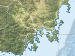
Region: Tasmania East Coast
Ship: Megisti Star [details]
Description: FV Megisti Star Orange Roughy research voyage MES 1/1990 took place off St Helens point, Eastern Tasmania during July 1990.
AIMS:
1. To conduct the second trawl survey of the orange roughy spawning ground
on the St Helens Hill to provide detailed catch composition (i.e. species by
weight) in order to ground truth the acoustic survey to be conducted by the
F.W.Tasmanian Enterprise.
2.To determine the size composition, sex composition and maturity of the spawning
stock of orange roughy over the St Helens Hill and offish in the surrounding
areas using midwater and demersal trawls; and to determine the presence of other
species of fish in the vicinity of the aggregation.
3. To fertilize and incubate orange roughy eggs to determine their rate of development.
Leader: C. Bullman (CSIRO)
Project: Analysis of stock structure of Orange Roughy 1996-1999 [details]

Voyage extents: 41° 48.9' S to 41° 13.4' S 148° 43.2' E to 148° 46.2' E
Metadata - No Marlin metadata records found or has not been linked to this survey or potentially the metadata catalogue is offline.
Metadata from OBIS Australia datasets:- biological data is published via the OBIS-AU IPT server and delivered to one or more of OBIS, ALA and GBIF
Download from OBIS Australia IPT View at - Ocean Biodiversity Information System (OBIS) Atlas of Living Australia (ALA) GBIF
Participants:- no records
Marine National Facility Reports - plans, summaries and data processing
- View the Survey Summary report - includes preliminary results, voyage narrative, types of data collected with C77/ROSCOP codes.
- There is no map for this survey.
Search for publications, reports and datasets from this and other voyages
Data publishing
This is a list of online datasets hosted by CSIRO. Other processed datasets hosted by collaborating organisations may be found on the 'Metadata' or "Reports, Publications and Maps' tab.
Use the Get data link on the right to extract data using the NCMI Data Trawler.
| Data Stream | Data Summary | Get data | ||||||
|---|---|---|---|---|---|---|---|---|
| Marine biodiversity observations and/or samples |
|
Get Data from Trawler |
Deployments by start time:- Click on column header to sort. Use link on 'Deployment' to see full details. Use the CSV button at the bottom to export data (tab delimited).
Search for deployments from this voyage and others
| Deployment | Operation | Station | Cast | Gear | Project | Start and end times | Start Location | End Location | Depth range | Max Depth | Description | |||
|---|---|---|---|---|---|---|---|---|---|---|---|---|---|---|
| Trawl [details] | 1 | Engel demersal high lift | 1168 | 1990-07-26 12:00 | -41.2382 | 148.7600 | -41.2400 | 148.7600 | Orange roughy demersal trawl | |||||
| Trawl [details] | 2 | Engel demersal high lift | 1168 | 1990-07-26 12:00 | -41.2230 | 148.7700 | -41.2200 | 148.7600 | Orange roughy demersal trawl | |||||
| Trawl [details] | 3 | Engel demersal high lift | 1168 | 1990-07-26 12:00 | -41.2375 | 148.7600 | -41.2400 | 148.7600 | Orange roughy demersal trawl | |||||
| Trawl [details] | 4 | Engel demersal high lift | 1168 | 1990-07-26 12:00 | -41.2315 | 148.7500 | -41.2400 | 148.7500 | Orange roughy demersal trawl | |||||
| Trawl [details] | 5 | Engel demersal high lift | 1168 | 1990-07-27 12:00 | -41.5903 | 148.7400 | -41.6000 | 148.6900 | Orange roughy demersal trawl | |||||
| Trawl [details] | 6 | Engel demersal high lift | 1168 | 1990-07-27 12:00 | -41.5485 | 148.7200 | -41.5400 | 148.7200 | Orange roughy demersal trawl | |||||
| Trawl [details] | 7 | Engel demersal high lift | 1168 | 1990-07-27 12:00 | -41.4520 | 148.7600 | -41.4500 | 148.7700 | Orange roughy demersal trawl | |||||
| Trawl [details] | 8 | Engel demersal high lift | 1168 | 1990-07-27 12:00 | -41.2697 | 148.7600 | -41.2500 | 148.7100 | Orange roughy demersal trawl | |||||
| Trawl [details] | 9 | Engel demersal high lift | 1168 | 1990-07-28 12:00 | -41.2322 | 148.7500 | -41.2400 | 140.7500 | Orange roughy demersal trawl | |||||
| Trawl [details] | 10 | Engel demersal high lift | 1168 | 1990-07-28 12:00 | -41.2308 | 148.7500 | -41.2200 | 148.7500 | Orange roughy demersal trawl | |||||
| Trawl [details] | 11 | Engel demersal high lift | 1168 | 1990-07-28 12:00 | -41.2323 | 148.7600 | -41.2400 | 148.7600 | Orange roughy demersal trawl | |||||
| Trawl [details] | 12 | Engel demersal high lift | 1168 | 1990-07-28 12:00 | -41.2322 | 148.7600 | -41.2400 | 148.7600 | Orange roughy demersal trawl | |||||
| Trawl [details] | 13 | Engel demersal high lift | 1168 | 1990-07-28 12:00 | -41.2332 | 148.7600 | -41.2300 | 148.7600 | Orange roughy demersal trawl | |||||
| Trawl [details] | 14 | Engel demersal high lift | 1168 | 1990-07-29 12:00 | -41.2317 | 148.7600 | -41.2400 | 148.7700 | Orange roughy demersal trawl | |||||
| Trawl [details] | 15 | Engel demersal high lift | 1168 | 1990-07-29 12:00 | -41.2342 | 148.7500 | -41.2400 | 148.7500 | Orange roughy demersal trawl | |||||
| Trawl [details] | 16 | Engel demersal high lift | 1168 | 1990-07-29 12:00 | -41.2238 | 148.7600 | -41.2200 | 148.7600 | Orange roughy demersal trawl | |||||
| Trawl [details] | 17 | Engel demersal high lift | 1168 | 1990-07-30 12:00 | -41.8148 | 145.7200 | -41.8200 | 148.7200 | Orange roughy demersal trawl | |||||