Survey details and related metadata, reports, events and data.
TOGA Equatorial Pacific Mooring (1990) (alternative identifier: M-TOGA90)
Period: 1990-02-15 00:00 to 1990-09-26 00:00 Local
Duration: 223.00 days
Mooring: TOGA Equatorial Pacific Mooring (1990) [details]
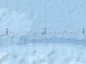
Description: For the TOGA project "Australia-Japan Equatorial Moored Instrument Array", a current meter mooring was deployed close to 147 deg E on the equator in the Pacific Ocean, in a water depth of 4600 m, between February and September 1990 (and possibly beyond). The mooring was deployed by a CSIRO Oceanography team aboard the Japanese RV Natsushima in February 1990, and serviced and redeployed during Franklin voyage FR 07/90. (details about any subsequent recovery have not been located at this time).
Leader: E. Lindstrom (CSIRO) & H. Inaba (Tokai University, Japan)
Project: Climate Program 1998-91 [details]
Map extents: 50° 00.0' S to 0° 00.0' N 95° 00.0' E to 180° 00.0' E
Marlin Metadata:-
Participants:- no records
Marine National Facility Reports - plans, summaries and data processing
- There is no map for this survey.
Search for publications, reports and datasets from this and other voyages
Data publishing
This is a list of online datasets hosted by CSIRO. Other processed datasets hosted by collaborating organisations may be found on the 'Metadata' or "Reports, Publications and Maps' tab.
Use the Get data link on the right to extract data using the NCMI Data Trawler.
| Data Stream | Data Summary | Get data | ||||||||||||||
|---|---|---|---|---|---|---|---|---|---|---|---|---|---|---|---|---|
| Current Meter records from Moorings |
|
Get Data from Trawler |
Deployments by start time:- Click on column header to sort. Use link on 'Deployment' to see full details. Use the CSV button at the bottom to export data (tab delimited).
Search for deployments from this voyage and others
| Deployment | Operation | Station | Cast | Gear | Project | Start and end times | Start Location | End Location | Depth range | Max Depth | Description | |||
|---|---|---|---|---|---|---|---|---|---|---|---|---|---|---|
| Current Meter [details] | 1 | 1547 | 1990-02-15 00:00 | 1990-06-06 00:00 | -0.0333 | 146.9433 | 0 | 296 | ||||||
| Current Meter [details] | 1 | 1547 | 1990-02-15 00:00 | 1990-09-26 00:00 | -0.0333 | 146.9400 | 0 | 292 | ||||||
| Current Meter [details] | 1 | 1547 | 1990-02-15 00:00 | 1990-09-22 00:00 | -0.0333 | 146.9400 | 0 | 294 | ||||||
| Current Meter [details] | 1 | 1547 | 1990-02-15 00:00 | 1990-09-26 00:00 | -0.0333 | 146.9400 | 0 | 290 | ||||||
| Current Meter [details] | 2 | 1547 | 1990-02-15 00:00 | 1990-09-22 00:00 | -0.0333 | 146.9400 | 0 | 295 | ||||||
| Current Meter [details] | 2 | 1547 | 1990-02-15 00:00 | 1990-06-06 00:00 | -0.0333 | 146.9433 | 0 | 297 | ||||||
| Current Meter [details] | 2 | 1547 | 1990-02-15 00:00 | 1990-09-26 00:00 | -0.0333 | 146.9400 | 0 | 291 | ||||||
| Current Meter [details] | 2 | 1547 | 1990-02-15 00:00 | 1990-09-26 00:00 | -0.0333 | 146.9400 | 0 | 293 | ||||||