Survey details and related metadata, reports, events and data.
Australian North West Shelf Moorings (1995) (alternative identifier: M-NWS95)
Period: 1995-01-13 00:00 to 1995-03-04 00:00 Local
Duration: 50.00 days
Mooring: North West Shelf Moorings (1995) [details]
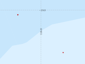
Description: 10 moorings were deployed at 6 sites (M1 to M6) across the Australian North West shelf off Dampier, in water depths ranging from 750 m (site M1, 240 km off Dampier) to 67 m (site M6), as part of a study "Internal tidal evolution of the North West Shelf". The moorings were deployed in January 1995 during Franklin voyage FR 01/95 and recovered in April 1995 during Franklin voyage FR 04/95.
Leader: P. Holloway (ADFA) & P. Craig (CSIRO)
Project: Hydrodynamic & Sediment Modelling 1993-1997 [details]
Map extents: 50° 00.0' S to 0° 00.0' N 95° 00.0' E to 180° 00.0' E
Marlin Metadata:-
Participants:- no records
Marine National Facility Reports - plans, summaries and data processing
- There is no map for this survey.
Search for publications, reports and datasets from this and other voyages
Data publishing
This is a list of online datasets hosted by CSIRO. Other processed datasets hosted by collaborating organisations may be found on the 'Metadata' or "Reports, Publications and Maps' tab.
Use the Get data link on the right to extract data using the NCMI Data Trawler.
| Data Stream | Data Summary | Get data | ||||||||||||||
|---|---|---|---|---|---|---|---|---|---|---|---|---|---|---|---|---|
| Current Meter records from Moorings |
|
Get Data from Trawler |
Deployments by start time:- Click on column header to sort. Use link on 'Deployment' to see full details. Use the CSV button at the bottom to export data (tab delimited).
Search for deployments from this voyage and others
| Deployment | Operation | Station | Cast | Gear | Project | Start and end times | Start Location | End Location | Depth range | Max Depth | Description | |||
|---|---|---|---|---|---|---|---|---|---|---|---|---|---|---|
| Current Meter [details] | 1 | 1346 | 1995-01-13 00:00 | 1995-02-13 00:00 | -19.0817 | 115.5967 | 0 | 479 | ||||||
| Current Meter [details] | 1 | 1346 | 1995-01-13 00:00 | 1995-02-15 00:00 | -19.0817 | 115.5967 | 0 | 485 | ||||||
| Current Meter [details] | 1 | 1346 | 1995-01-13 00:00 | 1995-02-18 00:00 | -19.0817 | 115.5967 | 0 | 483 | ||||||
| Current Meter [details] | 1 | 1346 | 1995-01-13 00:00 | 1995-02-15 00:00 | -19.0817 | 115.5967 | 0 | 481 | ||||||
| Current Meter [details] | 2 | 1346 | 1995-01-13 00:00 | 1995-02-13 00:00 | -19.0817 | 115.5967 | 0 | 480 | ||||||
| Current Meter [details] | 2 | 1346 | 1995-01-13 00:00 | 1995-02-18 00:00 | -19.0817 | 115.5967 | 0 | 484 | ||||||
| Current Meter [details] | 2 | 1346 | 1995-01-13 00:00 | 1995-02-15 00:00 | -19.0817 | 115.5967 | 0 | 482 | ||||||
| Current Meter [details] | 2 | 1346 | 1995-01-13 00:00 | 1995-02-15 00:00 | -19.0817 | 115.5967 | 0 | 486 | ||||||
| Current Meter [details] | 1 | 1346 | 1995-01-15 00:00 | 1995-02-19 00:00 | -19.7383 | 116.3850 | 0 | 491 | ||||||
| Current Meter [details] | 1 | 1346 | 1995-01-15 00:00 | 1995-03-04 00:00 | -19.7383 | 116.3850 | 0 | 487 | ||||||
| Current Meter [details] | 1 | 1346 | 1995-01-15 00:00 | 1995-02-19 00:00 | -19.7383 | 116.3850 | 0 | 489 | ||||||
| Current Meter [details] | 2 | 1346 | 1995-01-15 00:00 | 1995-02-19 00:00 | -19.7383 | 116.3850 | 0 | 492 | ||||||
| Current Meter [details] | 2 | 1346 | 1995-01-15 00:00 | 1995-02-19 00:00 | -19.7383 | 116.3850 | 0 | 490 | ||||||
| Current Meter [details] | 2 | 1346 | 1995-01-15 00:00 | 1995-03-04 00:00 | -19.7383 | 116.3850 | 0 | 488 | ||||||