Survey details and related metadata, reports, events and data.
Tasmania: Jarosite Dumpsite (EZ) Mooring (1988) (alternative identifier: M-EZ88)
Period: 1988-09-12 00:00 to 1988-10-19 00:00 Local
Duration: 37.00 days
Mooring: Tasmania: EZ Jarosite Mooring (1988) [details]
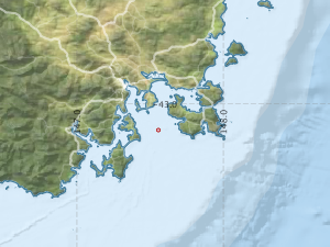
Description: An EZ current meter mooring at the EZ (Electrolytic Zinc) Company's deepwater jarosite dumpsite off SE Tasmania, was operational between September and October 1988 in approximately 2000m water depth. It was recovered by CSIRO Division of Fisheries during Soela voyage SO 6/88.
Leader: V. Lyne (CSIRO)
Project: EZ Company miscellaneous consulting - 1980s [details]
Map extents: 50° 00.0' S to 0° 00.0' N 95° 00.0' E to 180° 00.0' E
Marlin Metadata:-
Participants:- no records
Marine National Facility Reports - plans, summaries and data processing
- There is no map for this survey.
Search for publications, reports and datasets from this and other voyages
Data publishing
This is a list of online datasets hosted by CSIRO. Other processed datasets hosted by collaborating organisations may be found on the 'Metadata' or "Reports, Publications and Maps' tab.
Use the Get data link on the right to extract data using the NCMI Data Trawler.
| Data Stream | Data Summary | Get data | ||||||||||||||
|---|---|---|---|---|---|---|---|---|---|---|---|---|---|---|---|---|
| Current Meter records from Moorings |
|
Get Data from Trawler |
Deployments by start time:- Click on column header to sort. Use link on 'Deployment' to see full details. Use the CSV button at the bottom to export data (tab delimited).
Search for deployments from this voyage and others
| Deployment | Operation | Station | Cast | Gear | Project | Start and end times | Start Location | End Location | Depth range | Max Depth | Description | |||
|---|---|---|---|---|---|---|---|---|---|---|---|---|---|---|
| Current Meter [details] | 1 | 1548 | 1988-09-12 00:00 | 1988-10-19 00:00 | -43.1783 | 147.5567 | 0 | 230 | ||||||
| Current Meter [details] | 2 | 1548 | 1988-09-12 00:00 | 1988-10-19 00:00 | -43.1783 | 147.5567 | 0 | 231 | ||||||