Voyage details and related metadata, reports, events and data.
FR 07/96
(alternative identifier: FR199607)
- is a Marine National Facility ![]() voyage
voyage
Period: 1996-08-14 00:00 to 1996-09-11 00:00 Local
Duration: 28.00 days
From: Fremantle To: Fremantle
Region: Tropical Indian Ocean
Ship: Franklin [details]
Description: Cruise FR 07/96 was undertaken to study freshwater and heat budgets in the Tropical Indian Ocean. Primarily to measure the spatially inhomogeneous freshwater input. An instrumented drifting buoy was deployed at 2 degrees S, 93 degrees E and followed for several days. Radar images (3cm) were recorded at 10 minute intervals through the drift, for use in estimating the rainfall field away from the ship and buoy. Survey methods included boom and meteorological instrumentation, SeaSoar and silverfish deployments, ADCP, CTDs, radiometer measurements and TASCO infrared radiation thermometer tests, current meter recovery and underway instrumentation. Data analysis commenced on board and a draft paper on the results of the budget calculations has been prepared. On this occasion achieved heat budget closure to the desired level of 10 W/m2.
Leader: J.S. Godfrey (CSIRO) including other Pis
Project: Climate Variability 1989-1997 [details]
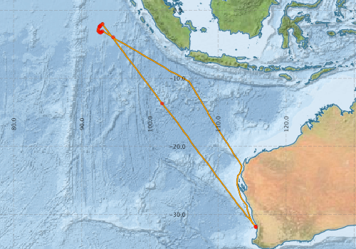
Voyage extents: 32° 03.3' S to 1° 49.7' S 92° 16.9' E to 115° 44.4' E Get voyage track shapefile Get CSV
Marlin Metadata:-
Participants - on ship:-
| Name | Role | Organisation |
|---|---|---|
| Chris Surman | Murdoch University | |
| Eric Schulz | CSIRO Division of Oceanography | |
| Erik Madsen | CSIRO ORV | |
| Frank Bradley | Chief Investigator | CSIRO CEM |
| Ian Helmond | CSIRO ORV | |
| Ivan Lebedev | FIAMS | |
| Lindsay Pender | CSIRO ORV | |
| Matthias Tomczak | FIAMS | |
| Stuart Godfrey | Cruise Manager | CSIRO Division of Oceanography |
| Val Latham | CSIRO ORV |
This list includes those that may have only been on part of the voyage. See voyage reports on 'Reports and Maps' tab for details.
Marine National Facility Reports - plans, summaries and data processing
-
FR199607 Voyage Summary
- includes preliminary results, voyage narrative, types of data collected with C77/ROSCOP codes.
-
FR199607 Voyage Plan
- includes objectives, investigator details, proposed data collection, voyage track and equipment to be used.
-

Publications, reports and datasets from this voyage.
Journal Article
- Surman, C. A.,Wooller, R. D. (2003) Comparative foraging ecology of five sympatric terns at a sub‐tropical island in the eastern Indian Ocean. Journal of Zoology 259 pp219-230. 10.1017/S0952836902003047
Search for publications, reports and datasets from this and other voyages
Data publishing
This is a list of online datasets hosted by CSIRO. Other processed datasets hosted by collaborating organisations may be found on the 'Metadata' or "Reports, Publications and Maps' tab.
Use the Get data link on the right to extract data using the NCMI Data Trawler.
| Data Stream | Data Summary | Get data | ||||||||||||||
|---|---|---|---|---|---|---|---|---|---|---|---|---|---|---|---|---|
| ADCP Data |
|
Get Data from Trawler Download ASCII dataset - fr9607adcp.zip Download NetCDF dataset fr9607adcp.zip |
||||||||||||||
| CTD profile |
|
Get Data from Trawler |
||||||||||||||
| Hydrology |
|
Get Data from Trawler |
||||||||||||||
| Towed CTD |
|
Get Data from Trawler |
||||||||||||||
| Underway |
|
Get Data from Trawler |
Deployments by start time:- Click on column header to sort. Use link on 'Deployment' to see full details. Use the CSV button at the bottom to export data (tab delimited).
Search for deployments from this voyage and others
| Deployment | Operation | Station | Cast | Gear | Project | Start and end times | Start Location | End Location | Depth range | Max Depth | Description | |||
|---|---|---|---|---|---|---|---|---|---|---|---|---|---|---|
| Underway System [details] | Anemometer,Anemometer,Anemometer,Barometer,Gyro-MK 10,Humidity probe,Licor-UWQ 4653,RIMCO vane driving potentiometer,RIMCO vane driving potentiometer,Ships log,Simrad EA500 Echosounder,Temperature sensor-AD590J,ThermoSalinoGraph (TSG),ThermoSalinoGraph (TSG) | 1532 | 1996-08-14 03:00 | 1996-09-10 23:30 | -31.8355 | 115.5510 | -32.0497 | 115.7450 | ||||||
| ADCP Data [details] | RDI VM-150 Acoustic Doppler current profiler | 1532 | 1996-08-14 06:00 | 1996-09-10 22:20 | -31.7980 | 115.5230 | -32.0490 | 115.7100 | 408.8 | |||||
| Towed CTD [details] | SeaSoar | 1532 | 1996-08-19 07:35 | 1996-08-19 08:46 | -13.7017 | 101.7917 | -13.5867 | 101.6982 | 153.5 | Leg: fr0796003 | ||||
| CTD Cast / Hydrology [details] | 1 | Cast 1 | 1532 | 1996-08-22 23:04 | 1996-08-22 23:37 | -2.0318 | 93.0515 | -2.0315 | 93.0488 | 0 | ||||
| CTD Cast / Hydrology [details] | 1 | Cast 2 | 1532 | 1996-08-24 02:05 | 1996-08-24 02:36 | -2.2285 | 92.7795 | -2.2307 | 92.7760 | 0 | ||||
| CTD Cast / Hydrology [details] | 1 | Cast 4 | 1532 | 1996-08-24 17:06 | 1996-08-24 17:32 | -2.3770 | 92.6522 | -2.3782 | 92.6513 | 0 | ||||
| CTD Cast / Hydrology [details] | 1 | Cast 5 | 1532 | 1996-08-24 19:29 | 1996-08-24 19:52 | -2.3933 | 92.6315 | -2.3955 | 92.6327 | 0 | ||||
| CTD Cast / Hydrology [details] | 1 | Cast 6 | 1532 | 1996-08-24 21:39 | 1996-08-24 22:03 | -2.4257 | 92.6267 | -2.4260 | 92.6235 | 0 | ||||
| CTD Cast / Hydrology [details] | 1 | Cast 7 | 1532 | 1996-08-25 23:13 | 1996-08-26 01:04 | -2.7732 | 92.4682 | -2.7700 | 92.4482 | 0 | ||||
| CTD Cast / Hydrology [details] | 1 | Cast 8 | 1532 | 1996-08-26 23:36 | 1996-08-27 00:01 | -3.0443 | 92.4297 | -3.0448 | 92.4328 | 0 | ||||
| CTD Cast / Hydrology [details] | 1 | Cast 9 | 1532 | 1996-08-28 02:56 | 1996-08-28 03:19 | -3.2503 | 92.6060 | -3.2517 | 92.6078 | 0 | ||||
| CTD Cast / Hydrology [details] | 1 | Cast 10 | 1532 | 1996-08-29 00:01 | 1996-08-29 00:24 | -3.3047 | 92.7518 | -3.3052 | 92.7518 | 0 | ||||
| CTD Cast / Hydrology [details] | 1 | Cast 11 | 1532 | 1996-08-30 03:31 | 1996-08-30 03:55 | -3.2232 | 92.8867 | -3.2217 | 92.8872 | 0 | ||||
| CTD Cast / Hydrology [details] | 1 | Cast 12 | 1532 | 1996-08-31 10:37 | 1996-08-31 11:09 | -3.0948 | 93.0247 | -3.0923 | 93.0327 | 0 | ||||
| CTD Cast / Hydrology [details] | 1 | Cast 13 | 1532 | 1996-09-01 01:27 | 1996-09-01 01:51 | -3.9783 | 94.6100 | -3.9788 | 94.6142 | 0 | ||||