Please login if you have access to particular applications.
Survey details and related metadata, reports, events and data.
BF2018_V01
Title: Hydrographic Survey of Boags Commonwealth Marine Reserve in Southwestern Bass Strait
Period: 2018-06-27 00:00 to 2018-07-04 00:00 Local
Duration: 7.00 days
From: Stanley To: Beauty Point
Region: Boags Commonwealth Marine Reserve. Bass Strait
Ship: Bluefin [details]
Description:
Leader: Neville Barrett (UTAS)
Project: none linked to this survey.
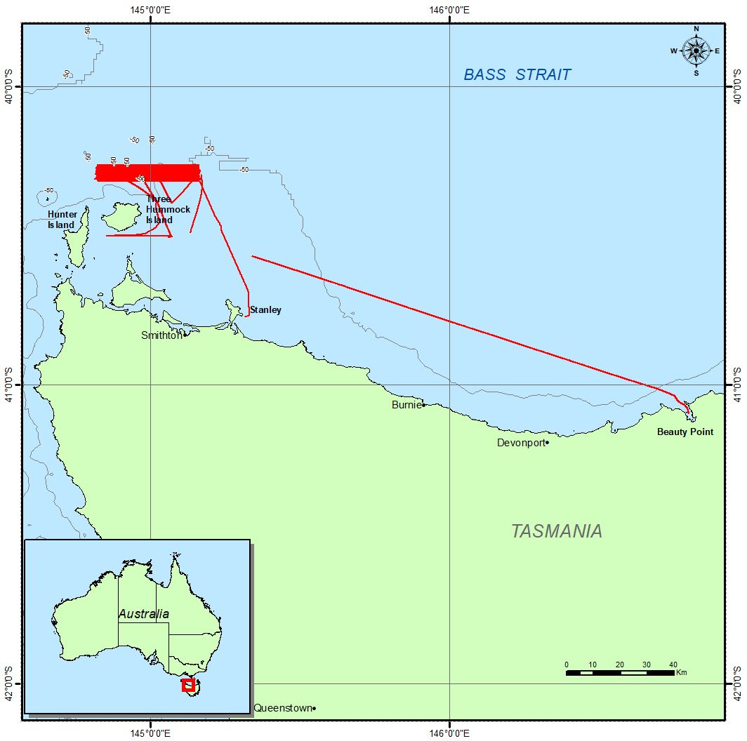
Voyage extents: 40° 33.9' S to 40° 28.2' S 144° 47.7' E to 145° 10.2' E
Marlin Metadata:-
Participants:- no records
Marine National Facility Reports - plans, summaries and data processing
- There is no map for this survey.
Publications, reports and datasets from this voyage.
Dataset
- Barrett, Neville; Vandenbossche, Phil; Davey, Craig; Navidad, Cisco (2020): BF2018_V01 Boags Commonwealth Marine Reserve Bathymetry 1m resolution Floating Point Geotiff . CSIRO. Data Collection. 10.25919/j58v-4a28
- Barrett, Neville; Vandenbossche, Phil; Davey, Craig; Navidad, Cisco (2020): BF2018_V01 Hope Channel Bathymetry 1m resolution Floating Point Geotiff. v3. CSIRO. Data Collection. 10.25919/5f7e3a6d61bef
- Barrett, Neville; Vandenbossche, Phil; Davey, Craig; Navidad, Cisco (2020): BF2018_V01 South East of Three Hummock Island Bathymetry 1m resolution Floating Point Geotiff. v1. CSIRO. Data Collection. 10.25919/3qat-4g60
Journal Article
- Lucieer, Vanessa,Flukes, Emma,Monk, Jacquomo,Walsh, Peter (2024) Geomorphometric maps of Australia’s Marine Park estate and their role in improving the integrated monitoring and management of marine ecosystems. Frontiers in Marine Science 10 pp-. 10.3389/fmars.2023.1302108
Search for publications, reports and datasets from this and other voyages
Data publishing - No datasets have been published
Deployments - None have been recorded in the Data Trawler.