Survey details and related metadata, reports, events and data.
BF2014_V01
Period: 2014-07-04 00:00 to 2014-07-08 00:00 Local
Duration: 4.00 days
From: Hobart To: Hobart
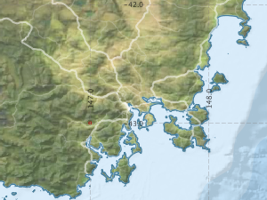
Region: Maatsuyker island
Ship: Bluefin [details]
Description: The Shallow Swath Internal facility (O&A) will be working with UTAS/IMAS on the vessel Bluefin on Benthic Habitat mapping around Maatsuyker island Tasmania.
Leader: N. Barrett (IMAS/UTAS)
Project: Shallow Swath Internal Facility [details]
Map extents: 50° 00.0' S to 0° 00.0' N 95° 00.0' E to 180° 00.0' E
Metadata - No Marlin metadata records found or has not been linked to this survey or potentially the metadata catalogue is offline.
Participants:- no records
Marine National Facility Reports - plans, summaries and data processing
- There is no map for this survey.
Search for publications, reports and datasets from this and other voyages
Data publishing - No datasets have been published
Deployments - None have been recorded in the Data Trawler.