Please login if you have access to particular applications.
Provider: All providers | |
Key Ecological Features | |
| Name: | Reefs, cays and herbivorous fish of the Marion Plateau |
| Region: | Coral Sea |
| Area: | 2,689.48 km2 |
| Data aggregated on 2025-11-22 08:18 | |
The following is the list of gear types used within this region. Click on 'gear type' for a detailed report of that gear.
| Gear Type | Code | Map colour | Layers used | Summary |
|---|---|---|---|---|
| ocean based acoustic current meter | OB_ACM | ■ |
CSIRO NCMI Acoustic Doppler Current Profiler data - link to layer metadata NOAA drifting buoys (map) |
Records - 1 Deepest: db,Records - 27 Deepest: db |
| Water quality and chemistry | WQ_C | ■ |
CMAR Hydrology - link to layer metadata |
Records - 1 Deepest: db |
| CTD sensor | CTD | ■ |
CMAR CTD Data Overview (1982 - present) - link to layer metadata ARGO profile map - link to layer metadata |
Records - 1 Deepest: db,Records - 3 Deepest: db |
| diver visual | DV | ■ |
Reef Life Survey (RLS) Sites (http://reeflifesurvey.com) - link to layer metadata |
Records - 27 Deepest: db |
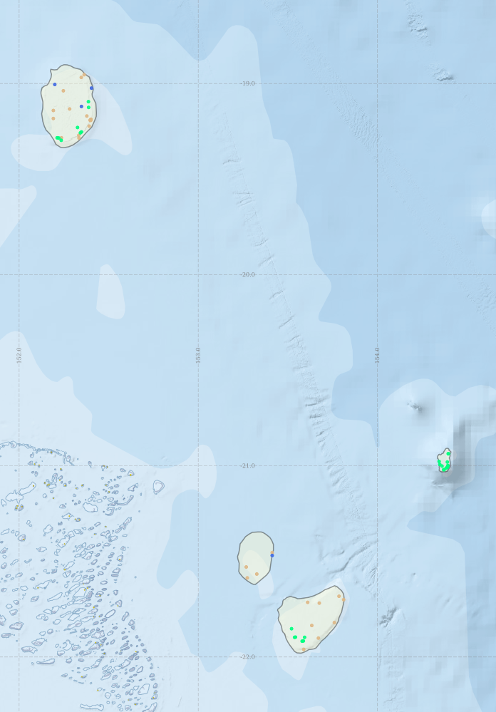
Region extents: 152° 07.3' E 21° 58.8' S to 154° 24.6' E 18° 54.1' S Refresh map
Acknowledgements: Background map - Bright Earth e-Atlas Basemap v1.0 (AIMS, GBRMPA, JCU, DSITIA, GA, UCSD, NASA, OSM, ESRI) CC BY
Time series plot (1930 to present) - Y axis is per year
Region data
Show data list
| Year | CTD | DV | OB_ACM | WQ_C |
| 1991 | 1 | 1 | 1 | |
| 1996 | 6 | |||
| 2000 | 2 | |||
| 2006 | 12 | |||
| 2008 | 7 | |||
| 2011 | 3 | |||
| 2012 | 8 | |||
| 2013 | 19 |