Please login if you have access to particular applications.
Provider: All providers | |
Key Ecological Features | |
| Name: | Commonwealth marine environment within and adjacent to Geographe Bay |
| Region: | South-west |
| Area: | 574.20 km2 |
| Data aggregated on 2025-11-17 12:27 | |
The following is the list of gear types used within this region. Click on 'gear type' for a detailed report of that gear.
| Gear Type | Code | Map colour | Layers used | Summary |
|---|---|---|---|---|
| ocean based acoustic current meter | OB_ACM | ■ |
CSIRO NCMI Acoustic Doppler Current Profiler data - link to layer metadata |
Records - 6 Deepest: db |
| Water quality and chemistry | WQ_C | ■ |
CMAR Hydrology - link to layer metadata |
Records - 5 Deepest: db |
| sediment grab and core samples | SG | ■ | Seabed sediments sampling | Records - 5 Deepest: db |
| CTD sensor | CTD | ■ |
CMAR CTD Data Overview (1982 - present) - link to layer metadata |
Records - 2 Deepest: db |
| diver visual | DV | ■ |
Reef Life Survey (RLS) Sites (http://reeflifesurvey.com) - link to layer metadata |
Records - 1 Deepest: db |
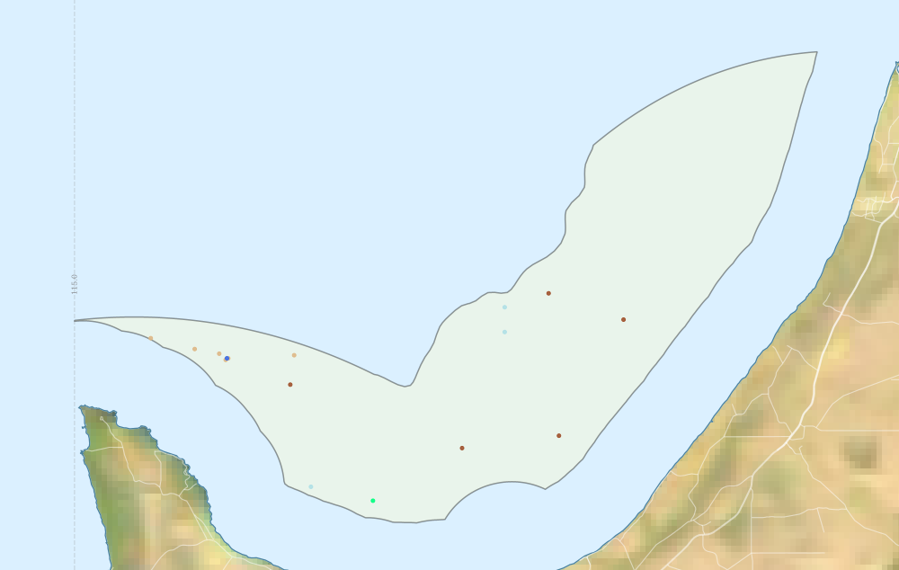
Region extents: 115° 00.0' E 33° 36.4' S to 115° 34.5' E 33° 18.1' S Refresh map
Acknowledgements: Background map - Bright Earth e-Atlas Basemap v1.0 (AIMS, GBRMPA, JCU, DSITIA, GA, UCSD, NASA, OSM, ESRI) CC BY
Time series plot (1930 to present) - Y axis is per year
Region data
Show data list
| Year | CTD | DV | OB_ACM | WQ_C |
| 1963 | 3 | |||
| 2003 | 1 | 3 | 1 | |
| 2009 | 1 | |||
| 2010 | 1 | 3 | 1 |