Please login if you have access to particular applications.
Provider: All providers | |
IMCRA version 4.0 | |
| Name: | Abrolhos Islands - view region report showing all data |
| Region: | |
| Comments: | http://www.environment.gov.au/node/18075 |
| Area: | 6,627.79 km2 |
| Gear type: | CTD sensor
|
| Layers used: |
CMAR CTD Data Overview (1982 - present)
- link to layer metadata CMAR Towed CTD - link to layer metadata ARGO profile map - link to layer metadata RAN CTD data |
| Summary: | Records - 41 Deepest: db |
| Last updated: | 28-Apr-2024 00:30. |
| Buffer: | |
Time series plot (1930 to present) - Y axis is deployments as vertical profile or tows per year
Region data
Show data list
| Year | Total inside region |
| 1987 | 9 |
| 1995 | 1 |
| 1996 | 15 |
| 2003 | 9 |
| 2005 | 1 |
| 2007 | 1 |
| 2010 | 1 |
| 2011 | 4 |
| 2014 | 1 |
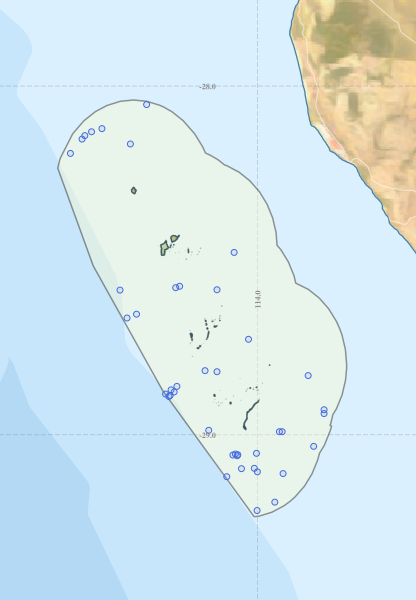
Region extents: 113° 20.9' E 29° 14.1' S to 114° 17.5' E 28° 02.4' S
Acknowledgements: Background map - Bright Earth e-Atlas Basemap v1.0 (AIMS, GBRMPA, JCU, DSITIA, GA, UCSD, NASA, OSM, ESRI) CC BY