Please login if you have access to particular applications.
Provider: All providers | |
IMCRA version 4.0 | |
| Name: | Tiwi - view region report showing all data |
| Region: | |
| Comments: | http://www.environment.gov.au/node/18075 |
| Area: | 5,102.39 km2 |
| Gear type: | demersal trawl or sled
|
| Layers used: |
CMAR Catch Operations Data overview (1965 to current)
- link to layer metadata |
| Summary: | Records - 17 Deepest: db |
| Last updated: | 18-Mar-2024 03:20. |
| Buffer: | |
Time series plot (1930 to present) - Y axis is deployments per year
Region data
Show data list
| Year | Total inside region |
| 1980 | 1 |
| 1984 | 7 |
| 1997 | 9 |
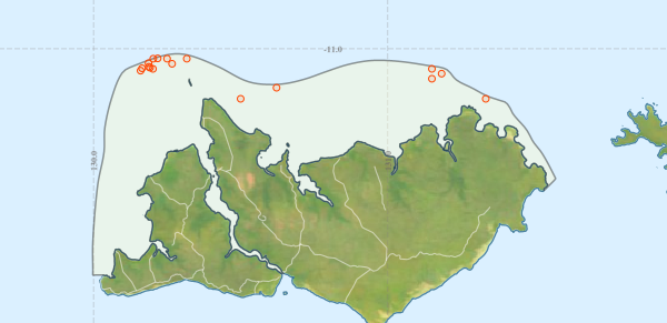
Region extents: 129° 59.8' E 11° 46.0' S to 131° 34.3' E 11° 01.0' S
Acknowledgements: Background map - Bright Earth e-Atlas Basemap v1.0 (AIMS, GBRMPA, JCU, DSITIA, GA, UCSD, NASA, OSM, ESRI) CC BY