Please login if you have access to particular applications.
Provider: All providers | |
Coastal Shelfs 0-200m | |
| Name: | 0-40 m South Australia, Victoria and Tasmania - view region report showing all data |
| Region: | South-east |
| Area: | not set |
| Gear type: | satellite tag
|
| Layers used: |
New Zealand Fur Seal CTD Profiles
- link to layer metadata Australian Fur Seal CTD Profiles - link to layer metadata Australian Sea Lion CTD Profiles - link to layer metadata AATAMS - Satellite tracking of shearwaters - link to layer metadata |
| Summary: | Records - 482 Deepest: db |
| Last updated: | 2-Apr-2024 15:58. |
| Buffer: | |
Time series plot (1930 to present) - Y axis is dive locations or haulout sites per year
Region data
Show data list
| Year | Total inside region |
| 2010 | 3 |
| 2011 | 477 |
| 2012 | 2 |
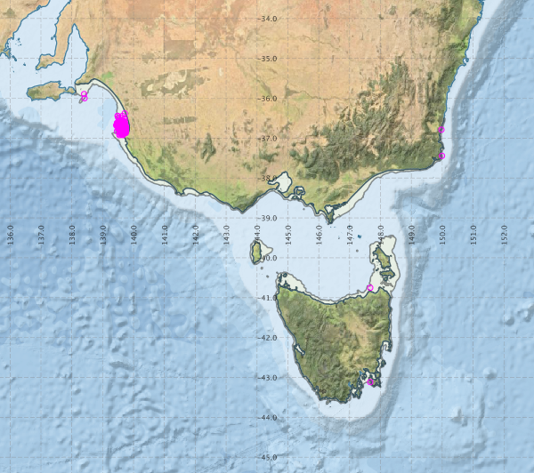
Region extents: 138° 04.6' E 43° 45.0' S to 150° 05.4' E 35° 30.8' S
Acknowledgements: Background map - Bright Earth e-Atlas Basemap v1.0 (AIMS, GBRMPA, JCU, DSITIA, GA, UCSD, NASA, OSM, ESRI) CC BY