Please login if you have access to particular applications.
Provider: All providers | |
Coastal Shelfs 0-200m | |
| Name: | 0-40 m South Australia, Victoria and Tasmania - view region report showing all data |
| Region: | South-east |
| Area: | not set |
| Gear type: | diver visual
|
| Layers used: |
Long Term Temperate Reef Monitoring Program Site Surveys
Reef Life Survey (RLS) Sites (http://reeflifesurvey.com) - link to layer metadata |
| Summary: | Records - 1106 Deepest: db |
| Last updated: | 2-Apr-2024 15:58. |
| Buffer: | |
Time series plot (1930 to present) - Y axis is surveys per year
Region data
Show data list
| Year | Total inside region |
| 1992 | 59 |
| 1993 | 41 |
| 1994 | 94 |
| 1995 | 38 |
| 1996 | 21 |
| 1997 | 25 |
| 1998 | 26 |
| 1999 | 99 |
| 2000 | 60 |
| 2001 | 23 |
| 2002 | 25 |
| 2004 | 42 |
| 2005 | 56 |
| 2006 | 149 |
| 2007 | 132 |
| 2008 | 46 |
| 2008 | 74 |
| 2009 | 46 |
| 2009 | 55 |
| 2010 | 24 |
| 2010 | 40 |
| 2011 | 30 |
| 2011 | 57 |
| 2012 | 24 |
| 2012 | 43 |
| 2013 | 30 |
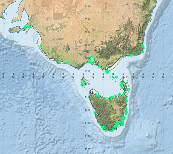
Region extents: 138° 04.6' E 43° 45.0' S to 150° 05.4' E 35° 30.8' S
Acknowledgements: Background map - Bright Earth e-Atlas Basemap v1.0 (AIMS, GBRMPA, JCU, DSITIA, GA, UCSD, NASA, OSM, ESRI) CC BY