Please login if you have access to particular applications.
Provider: All providers | |
Australian Marine Parks | |
| Name: | West Cape York Marine National Park Zone (IUCN II) - view region report showing all data |
| Region: | North |
| Comments: | This reserve was originally proclaimed on 17 November 2012. There are NO CHANGES ON THE WATER until the North Australian Marine Parks Network Management Plan comes into effect. Australia's network of Australian Marine Parks (revised 2014-03-28) http://www.environment.gov.au/fed/catalog/search/resource/details.page?uuid=%7B2E8DD19C-1B93-4D90-BD1C-128DDC4A2998%7D |
| Area: | 7,957.38 km2 |
| Gear type: | CTD sensor
|
| Layers used: |
RAN CTD data
CMAR CTD Data Overview (1982 - present) - link to layer metadata |
| Summary: | Records - 14 Deepest: db |
| Last updated: | 24-Mar-2024 20:28. |
| Buffer: | |
Time series plot (1930 to present) - Y axis is deployments as vertical profile or tows per year
Region data
Show data list
| Year | Total inside region |
| 2004 | 1 |
| 2012 | 1 |
| 2013 | 13 |
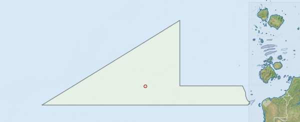
Region extents: 139° 59.7' E 10° 59.0' S to 142° 00.9' E 10° 10.4' S
Acknowledgements: Background map - Bright Earth e-Atlas Basemap v1.0 (AIMS, GBRMPA, JCU, DSITIA, GA, UCSD, NASA, OSM, ESRI) CC BY