Please login if you have access to particular applications.
Provider: All providers | |
Coastal Shelfs 0-200m | |
| Name: | 40-200 m North-West shelf - view region report showing all data |
| Region: | North-west |
| Area: | not set |
| Gear type: | Water quality and chemistry
|
| Layers used: |
CMAR Hydrology
- link to layer metadata MMP Locations Depth Weighted Avg SRS Bio Optical DataBase - link to layer metadata |
| Summary: | Records - 1054 Deepest: db |
| Last updated: | 24-Mar-2024 04:13. |
| Buffer: | |
Time series plot (1930 to present) - Y axis is deployments per year
Region data
Show data list
| Year | Total inside region |
| 1960 | 11 |
| 1961 | 18 |
| 1962 | 7 |
| 1963 | 5 |
| 1964 | 30 |
| 1965 | 4 |
| 1966 | 5 |
| 1967 | 5 |
| 1971 | 10 |
| 1973 | 7 |
| 1976 | 21 |
| 1977 | 2 |
| 1978 | 46 |
| 1979 | 39 |
| 1980 | 33 |
| 1982 | 73 |
| 1983 | 41 |
| 1984 | 4 |
| 1986 | 9 |
| 1987 | 76 |
| 1992 | 5 |
| 1993 | 24 |
| 1994 | 1 |
| 1995 | 36 |
| 1995 | 372 |
| 1996 | 31 |
| 1997 | 8 |
| 1998 | 10 |
| 1999 | 1 |
| 1999 | 10 |
| 1999 | 73 |
| 2000 | 48 |
| 2003 | 2 |
| 2005 | 5 |
| 2005 | 7 |
| 2010 | 64 |
| 2011 | 3 |
| 2012 | 2 |
| 2013 | 2 |
| 2013 | 5 |
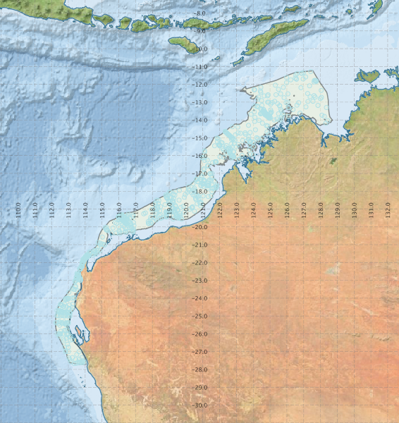
Region extents: 112° 13.7' E 27° 42.6' S to 128° 42.9' E 11° 13.4' S
Acknowledgements: Background map - Bright Earth e-Atlas Basemap v1.0 (AIMS, GBRMPA, JCU, DSITIA, GA, UCSD, NASA, OSM, ESRI) CC BY